THE WEATHER BEAT · OCT 17
Outer Banks watches become Coastal Flood Warnings: 2 to 4 feet expected on Hatteras and Ocracoke through Tuesday as a nor'easter forms
Friday's watches are now warnings: 2 to 4 feet of water expected on Hatteras and Ocracoke from this evening to Tuesday, with ferry disruptions likely.

.jpg)
Key points
- Overnight, NWS Newport/Morehead City turned Friday's Coastal Flood Watches for Hatteras Island and Ocracoke Island into Coastal Flood Warnings. They call for 2 to 4 feet of water above ground in low-lying areas from 5 p.m. EDT Saturday to 8 a.m. EDT Tuesday.
- Both warnings say people could be stranded on the islands for several days. They tell residents to expect ferry disruptions from this evening into at least part of next week.
- Storm Warnings now cover the offshore waters from Oregon Inlet to Cape Lookout. A Wind Advisory with gusts up to 50 mph replaced the Outer Banks High Wind Watch. Farther north, NWS Wakefield added Coastal Flood Watches for the Maryland beaches, the Eastern Shore of Virginia and eastern Currituck County.

The nor'easter is now a forecast, not a possibility
Last night this column covered a storm that had not formed yet, and the watches that went with it. By Saturday morning the forecasters were more sure of it. At 4:24 a.m. EDT, NWS Newport/Morehead City's discussion put the change in four short lines: "Nor'easter expected to develop off of the NC coast this evening. Confidence is HIGH on minor to moderate coastal impacts with vulnerable areas seeing the potential for more significant impacts." It went on: "Coastal Flood Watches upgraded to Warnings. High Wind Watch upgraded to Wind Advisory."
The part still unknown is how strong the storm gets and how long it stays. The forecaster wrote that "Confidence is increasing the nor'easter lingering offshore for multiple days, but strength is still uncertain." The same discussion also said models may be underestimating it: "with access to the warm gulf stream waters for multiple days, it is possible models are downplaying the eventual strength of the low."
Hatteras and Ocracoke
The two warnings went out at 5:02 a.m. EDT and use the same words. They expect 2 to 4 feet of inundation above ground level near shorelines and tidal waterways, from 5 p.m. this afternoon to 8 a.m. Tuesday. Last night's Hatteras Island watch contradicted itself, giving "up to one foot" in one line and 2 to 4 feet in another. This morning's warning says 2 to 4 feet in both places.
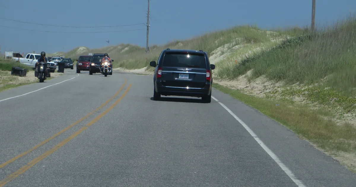
Both products expect water to spread inland from the waterfront and reach some homes and businesses, and they warn that vulnerable stretches of NC-12 may flood around high tide. They describe "a long duration event" with ocean overwash "through multiple high tide cycles into next week". They tell people to prepare for being stranded on the islands for multiple days and for ferry disruptions starting this evening.
Wind and the waters offshore
The office chose a Wind Advisory over a High Wind Warning for the Outer Banks, and its discussion explained why. The islands handle wind alone better than most places. The forecaster wrote that the nor'easter a couple of weeks ago caused no wind damage of its own, "like trees down or widespread power outages", and that the odds of gusts over 58 mph are "generally below 20%." The advisory for Hatteras Island, Ocracoke Island and the Northern Outer Banks calls for north winds of 30 to 40 mph with gusts up to 50 mph, from noon today to 8 p.m. Monday, and says it will likely run longer.
Offshore, the 1:11 p.m. EDT Storm Warning for the waters 20 to 60 nautical miles out, from Oregon Inlet past Cape Hatteras to Cape Lookout, expects north winds of 35 to 40 knots, gusts to 50 knots and seas of 13 to 18 feet, from 5 p.m. today to 5 a.m. Sunday. Friday's watch for some of the same waters said seas of 17 to 23 feet were possible. The warning does not explain the lower figure, so we report both. NWS Wilmington's warning for Surf City to Little River Inlet starts as a Gale Warning at noon today and becomes a Storm Warning from 8 a.m. Sunday to 2 a.m. Monday.
Hampton Roads and the Eastern Shore
NWS Wakefield's 11:49 a.m. EDT update did what its Friday discussion said was likely: it added watches. New Coastal Flood Watches cover the Maryland beaches, inland Worcester County, Accomack and Northampton counties, and eastern Currituck County, each for one to two feet of inundation. Wakefield's watches for Norfolk, Portsmouth, Chesapeake, Suffolk, Virginia Beach and the lower James River now begin Monday afternoon, not Sunday afternoon as Friday's version said, and still run through Tuesday morning. Until then, Coastal Flood Advisories cover Virginia Beach, Hampton, Poquoson, Norfolk, Portsmouth, Chesapeake and Suffolk for up to a foot of water from noon to 6 p.m. today.
This is a summary of official products, not emergency information. For live warnings see weather.gov and your local officials.
The products, for the record
| Product | Office, issued (EDT, Sat Oct 17) | Where | What it says | When |
|---|---|---|---|---|
| Coastal Flood Warning | Newport/Morehead City, 5:02 a.m. | Hatteras Island | 2 to 4 ft inundation; surf 8 to 14 ft | 5 p.m. Sat to 8 a.m. Tue |
| Coastal Flood Warning | Newport/Morehead City, 5:02 a.m. | Ocracoke Island | 2 to 4 ft inundation; surf 6 to 12 ft | 5 p.m. Sat to 8 a.m. Tue |
| Coastal Flood Advisory | Newport/Morehead City, 5:02 a.m. | Northern Outer Banks | 1 to 3 ft; surf 8 to 15 ft | 5 p.m. Sat to 8 a.m. Tue |
| Coastal Flood Advisory | Newport/Morehead City, 5:02 a.m. | East Carteret | 2 to 3 ft; surf 7 to 10 ft | 5 p.m. Sat to 8 p.m. Mon |
| Coastal Flood Advisory | Newport/Morehead City, 5:02 a.m. | Pamlico, Southern Craven (Pamlico Sound, Neuse, Trent, Bay rivers) | 1 to 3 ft | 8 p.m. Sat to 5 p.m. Mon |
| Coastal Flood Advisory | Newport/Morehead City, 5:02 a.m. | West Carteret, Coastal Onslow (Bogue Banks, North Topsail Beach) | 1 to 2 ft | 6 a.m. Sun to 11 a.m. Mon |
| Wind Advisory | Newport/Morehead City, 3:02 a.m. | Hatteras Island, Ocracoke Island, Northern Outer Banks | N 30 to 40 mph, gusts to 50 mph | noon Sat to 8 p.m. Mon |
| Wind Advisory | Newport/Morehead City, 3:02 a.m. | Mainland Dare, Mainland Hyde, West Carteret | N 15 to 25 mph, gusts to 45 mph | 2 p.m. Sat to 8 p.m. Mon |
| Storm Warning | Newport/Morehead City, 1:11 p.m. | Oregon Inlet to Cape Lookout, 20 to 60 nm | N 35 to 40 kt, gusts 50 kt, seas 13 to 18 ft | 5 p.m. Sat to 5 a.m. Sun |
| Storm Warning | Wilmington, 2:25 a.m. | Surf City to Little River Inlet, 20 to 60 nm | N 30 to 40 kt, gusts 50 kt, seas 10 to 15 ft | 8 a.m. Sun to 2 a.m. Mon (gale from noon Sat) |
| Coastal Flood Watch | Wakefield, 11:49 a.m. | Maryland Beaches, Inland Worcester, Accomack, Northampton, Eastern Currituck | 1 to 2 ft possible | Mon afternoon to Tue morning |
| Coastal Flood Watch | Wakefield, 11:49 a.m. | Norfolk, Portsmouth, Chesapeake, Suffolk, Virginia Beach, Surry, James City, Newport News, Isle of Wight | 1 to 2 ft possible | Mon afternoon to Tue morning |
| Coastal Flood Advisory | Wakefield, 11:49 a.m. | Virginia Beach, Hampton/Poquoson, Chesapeake, Suffolk, Norfolk, Portsmouth | up to 1 ft | noon to 6 p.m. Sat |
Sources: NWS alerts via api.weather.gov, read at about 18:00Z Saturday; NWS Newport/Morehead City Area Forecast Discussion, 4:24 a.m. EDT Saturday October 17. Products as issued; any later product replaces them.
This is a summary of official products, not emergency information. For live warnings see weather.gov and your local officials. https://www.weather.gov/mhx/ and https://www.weather.gov/akq/
The rock's live forecast for the places in this story
More from the Journal
 THE WEATHER BEAT
Typhoon Watch for Guam, Rota, Tinian and Saipan as Tropical Depression Champi heads toward the Marianas
OCT 15
THE WEATHER BEAT
Typhoon Watch for Guam, Rota, Tinian and Saipan as Tropical Depression Champi heads toward the Marianas
OCT 15
 THE WEATHER BEAT
East wind reaches Arizona: Tucson High Wind Warning for gusts to 75 mph, Albuquerque and Guadalupe Pass watches now warnings
OCT 15
THE WEATHER BEAT
East wind reaches Arizona: Tucson High Wind Warning for gusts to 75 mph, Albuquerque and Guadalupe Pass watches now warnings
OCT 15
 EXPLAINERS
Why Is the Sky Blue?
AUG 20
EXPLAINERS
Why Is the Sky Blue?
AUG 20
Follow the Journal: RSS · get it by email