EXPLAINERS · AUG 17
Lake-Effect Snow: How a Lake Builds a Blizzard
Lake-effect snow explained: cold wind, warm open water, the forecasters' 13 degree rule, and how one shore gets buried while the sun shines ten miles away.

Grounded in National Weather Service definitions; suitable for classrooms and other curious humans.
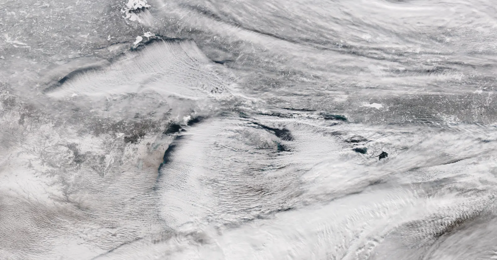
Lake-effect snow happens when very cold air blows across a relatively warm, unfrozen lake. The lake heats and moistens the bottom of the cold air, that air rises, and the moisture comes down as snow in narrow bands parked downwind of the shore. The classic forecasters' rule of thumb wants the lake surface about 13 degrees Celsius, roughly 23 degrees Fahrenheit, warmer than the air about a mile up. The longer the stretch of open water the wind crosses, called the fetch, the harder the machine runs, and the wind direction decides exactly which neighborhood gets buried.
A machine with two ingredients
Most snowstorms need a whole storm system. needs only a temperature argument: frigid air on the move, and a large body of water that has not frozen and still remembers autumn. Cross the second with the first and the lake runs like a snow machine, no storm system required, often under a sky that is of cloud. Full sun.">clear a county away.
It works because water gives up its heat slowly. Deep water that spent all summer warming is still comparatively warm in December, while the air arriving from the interior of a continent can be brutally cold. The mismatch is the fuel.
The recipe, step by step
Cold air slides over the open water. The lake immediately goes to work on the lowest layer of it, warming it and loading it with evaporated moisture. Warm moist air under cold air is exactly the unstable arrangement that convection loves: the heated layer rises in columns, the columns build clouds, and the clouds organize into long narrow bands lined up with the wind.
While the air is over water, the bands just gather strength. When they cross the downwind shore, the land slows the wind, the air piles into itself and gets an extra upward shove, and the bands unload. Snowfall inside a well built band can come down at rates that bury a town in a day, with thunder in the heaviest cases, while the sky ten miles either side of the band stays blue. Lake-effect snow is less like a storm than like a firehose: narrow, aimed, and indifferent to everyone it misses.
The 13 degree rule
Forecasters carry a classic rule of thumb for whether the machine turns on: the lake surface should be about 13 degrees Celsius warmer than the air at roughly a mile up, which is about a 23 degree Fahrenheit gap. Less contrast than that and the lake merely steams politely; more, and the rising columns get vigorous enough to organize serious bands. The rule is a threshold for , the same ingredient every convective forecast is checking, just measured across a lake instead of an afternoon.
Fetch: the length of the runway
The second dial is , the distance of open water the wind crosses. A short hop across a narrow lake collects only a little heat and moisture. A long diagonal run down the full length of a great lake gives the air tens of extra miles to load up, and the band that comes ashore at the far end is a different animal. This is why the geometry of the wind matters as much as its temperature: shift the wind a few dozen degrees and the same lake points its firehose at a completely different town, or, aligned just right down the long axis, builds the single fattest band it can.
Who gets it, and when
The season has a shape. Lake-effect snow peaks in early winter, when the water is still warm from summer and the first truly arctic air arrives: the contrast is never better. As winter grinds on, the lake spends its stored heat, the gap narrows, and if the lake over, the machine loses its fuel supply and shuts down. Ice is the off switch.
Geography writes the rest. The famous snowbelts sit downwind of the Great Lakes for the prevailing cold-season winds, which is why the eastern and southern shores collect what the northern and western shores merely watch. Hills just inland make it worse for themselves: the Tug Hill Plateau, rising east of Lake Ontario, adds its own uphill shove to arriving bands and is one of the snowiest inhabited places in the eastern United States because of it.
Reading a lake-effect day
The forecast tell is specificity. A synoptic storm gets forecast for a region; lake-effect gets forecast for a shore, a corridor, sometimes a set of neighborhoods, with the honest admission that a small wind shift moves the whole prediction. If you live downwind of big water, the numbers to watch are the wind direction, the water temperature, and how cold the air above is about to be. The rock does not live near a great lake, which it considers the lake's loss, but it has reviewed the physics and finds the whole arrangement fair: the lake spends all summer collecting warmth, and all December giving it back with interest.
Words in this lesson
Every marked word above is here in full, because a definition that only appears on hover is no use to somebody reading on a phone, printing the page, or listening to it.
- Clear
- Zero to one okta of cloud. Full sun.
- Fetch
- The stretch of open water a wind crosses. The longer the fetch, the more heat and moisture the air collects on the trip, which is what turns a cold wind over a lake into a snow machine.
- Freeze
- Air at or below 32 F.
- Instability
- The condition where air, once nudged upward, keeps rising on its own because it stays warmer than its surroundings. It is one of the three ingredients every thunderstorm needs.
- Lake-effect snow
- Cold air over warm lakes builds narrow intense snow bands.
- Okta
- One eighth of the sky. Sky cover is counted in oktas, from zero for clear to eight for overcast, which is why the familiar sky words are really just bands of a number.
This is a Working lesson
It belongs to the Weather School, which is free and always will be: twenty lessons from toddler to adult, every one with a printable worksheet and answer key that any classroom may copy. No account, no cost, no catch.
Another one at this level: feels like.
For teachers and every lesson.
Definitions in this explainer follow the National Weather Service. The rock checked twice. The rock always checks twice.