THE WEATHER BEAT · OCT 14
Up to 8 inches of rain fell overnight in western and central Oklahoma, and the Canadian River near Bridgeport is at its 2004 crest
Norman's warnings put 3 to 8 inches down around El Reno and Watonga by 8 a.m., with the Canadian River near Bridgeport forecast to match its 2004 crest.

Key points
- Western and central Oklahoma got a night of heavy rain. As of the National Weather Service in Norman's 8:08 a.m. CDT warning, radar estimated 3 to 8 inches had fallen around El Reno, Watonga and Kingfisher, with flash flood warnings stretching from Elk City to Oklahoma City and Norman.
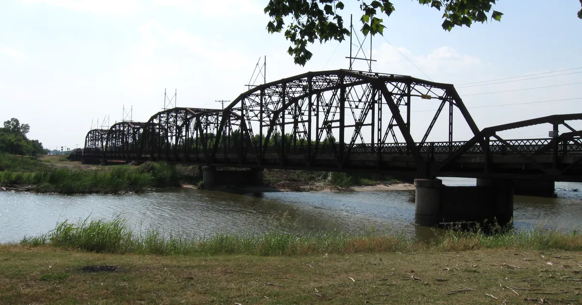
- The Canadian River near Bridgeport was in moderate flood at 16.1 feet at 7:45 a.m. CDT. It was forecast to crest at 16.2 feet this afternoon, the same height as the crest of March 5, 2004.
- As of the 7:39 a.m. CDT Storm Prediction Center outlook, parts of the southern Plains are under a Slight Risk of severe storms this afternoon and evening. Flood Watches cover most of western and central Oklahoma through Thursday afternoon.
Overnight in Oklahoma
The storms came in waves and kept falling on the same ground. By 6:13 a.m. CDT, Norman had a Flash Flood Warning out for Oklahoma County and the towns around it: Oklahoma City, Edmond, Moore, Yukon, Mustang and Guthrie, with 1 to 3 inches already down. An hour later, at 7:21 a.m. CDT, a second warning went out for western Oklahoma, from Elk City and Sayre east to Weatherford, Clinton and Cordell. That one was based on radar and gauge reports, and it said 2 to 7 inches had fallen.
The 8:08 a.m. CDT warning held the biggest number of the morning. It extended the warning for southern Blaine, southern Kingfisher, northwestern Canadian and northwestern Caddo counties, where radar estimated 3 to 8 inches had fallen. It named El Reno, Watonga, Kingfisher, Piedmont, Hinton and Geary. A separate 7:49 a.m. CDT warning covered Norman, Chickasha, Tuttle and Minco, where 1 to 3 inches had fallen and the warning expected 2 to 3 more.
Just across the line in the Texas Panhandle, the National Weather Service in Amarillo warned Wellington and Collingsworth County at 5:58 a.m. CDT. It said 2 to 3 inches had fallen there, at rates of 1 to 2 inches an hour.
| Warning (NWS) | Issued (CDT) | Rain fallen, per the warning | Towns named |
|---|---|---|---|
| Norman, Canadian, Kingfisher, Logan, Oklahoma, Cleveland | 6:13 a.m. | 1 to 3 in, up to 2 in more | Oklahoma City, Edmond, Moore, Yukon, Mustang, Guthrie |
| Norman, Beckham, Custer, Washita, Roger Mills, Greer, Harmon, Kiowa | 7:21 a.m. | 2 to 7 in, up to 2 in more | Elk City, Weatherford, Clinton, Sayre, Cordell |
| Norman, Cleveland, Grady, McClain | 7:49 a.m. | 1 to 3 in, 2 to 3 in more | Norman, Chickasha, Tuttle, Minco |
| Norman, Blaine, Kingfisher, Canadian, Caddo (extended) | 8:08 a.m. | 3 to 8 in, up to 2 in more | El Reno, Watonga, Kingfisher, Piedmont, Hinton |
| Amarillo, Collingsworth, Donley, Wheeler TX | 5:58 a.m. | 2 to 3 in, 1 to 3 in more | Wellington, Samnorwood |
*Source: NWS Norman and NWS Amarillo Flash Flood Warnings, October 14, 2026. Rainfall figures are radar and gauge estimates as stated in each warning.*
The rivers
Small creeks rise first. The rivers follow over the next day or two, and Norman's river statements laid out that schedule this morning. The Canadian River near Bridgeport was already above its 14-foot flood stage at 16.1 feet at 7:45 a.m. CDT. Norman raised the forecast from minor to moderate flooding, with a crest of 16.2 feet this afternoon and the river falling back below flood stage late Thursday evening. The warning's own flood history line says 16.2 feet matches the crest of March 5, 2004.
Downstream, the Canadian near Mustang and the North Canadian near Watonga and Yukon are forecast to rise to just under flood stage by Thursday and Friday. That means shallow water in low pastures and on local roads, according to Norman's advisories.
| River point | Stage at 7:15 to 7:45 a.m. CDT | Forecast crest | Flood stage | Product |
|---|---|---|---|---|
| Canadian River near Bridgeport | 16.1 ft | 16.2 ft this afternoon | 14.0 ft | Flood Warning, moderate |
| Canadian River near Mustang | 10.2 ft | 21.9 ft early Friday | 22.0 ft | Flood Advisory |
| North Canadian River near Watonga | 9.3 ft | 13.6 ft Thursday morning | 15.0 ft | Flood Advisory |
| North Canadian River near Yukon | 2.9 ft | 11.6 ft Thursday afternoon | 14.0 ft | Flood Advisory |
*Source: NWS Norman Flood Warning and Flood Advisories, issued 7:57 to 7:59 a.m. CDT, October 14, 2026.*
Today, officially
As of the 7:39 a.m. CDT Day 1 outlook, the Storm Prediction Center has a Slight Risk of severe thunderstorms across parts of the southern Plains and the southern High Plains. It expects severe wind gusts this afternoon and evening, plus a low tornado risk this evening, mainly across southwest into south-central Oklahoma. The outlook also notes a marginal wind-damage threat from the Ohio Valley into the Mid-Atlantic.
The rain isn't finished either. Norman's Flood Watch, issued at 11:26 p.m. CDT Tuesday, covers 31 Oklahoma counties and 5 in north Texas through Thursday afternoon. It calls for widespread totals of 1 to 3 inches and a few places as high as 5. Tulsa's watch covers Tulsa County and northeast Oklahoma on the same terms. In West Texas, the National Weather Service in Midland has a Flood Watch through Friday morning that says "Moisture from Hurricane Simon will stream over West Texas the next several days." Flood Watches from Wichita, Kansas City and Springfield continue through Thursday for the Kansas and Missouri counties this page covered yesterday.
| Product | Office | Issued | In effect through |
|---|---|---|---|
| Day 1 Outlook, Slight Risk | SPC | 7:39 a.m. CDT Wed | 7 a.m. CDT Thu |
| Flood Watch, 31 OK and 5 TX counties | NWS Norman | 11:26 p.m. CDT Tue | Thu 1 p.m. CDT |
| Flood Watch, northeast OK | NWS Tulsa | 11:12 p.m. CDT Tue | Thu 1 p.m. CDT |
| Flood Watch, Panhandle | NWS Amarillo | 5:59 a.m. CDT Wed | Thu 1 a.m. CDT |
| Flood Watch, West Texas and Big Bend | NWS Midland | 5:19 a.m. CDT Wed | Fri 7 a.m. CDT |
*Sources: SPC Day 1 Convective Outlook (SPC AC 141239); NWS alerts via api.weather.gov, read 13:15Z October 14, 2026.*
This is a morning summary, not emergency information. For live warnings see weather.gov and your local officials.
The rock's live forecast for the places in this story
More from the Journal



Follow the Journal: RSS · get it by email