THE WEATHER BEAT · OCT 13
Kansas and Missouri under Flood Watches from four offices tonight, with a Slight Risk of severe storms along a stalled front
Storms are expected along a stalled front tonight, with rain rates near 2 inches an hour and totals up to 4 inches in parts of eastern Kansas and western.

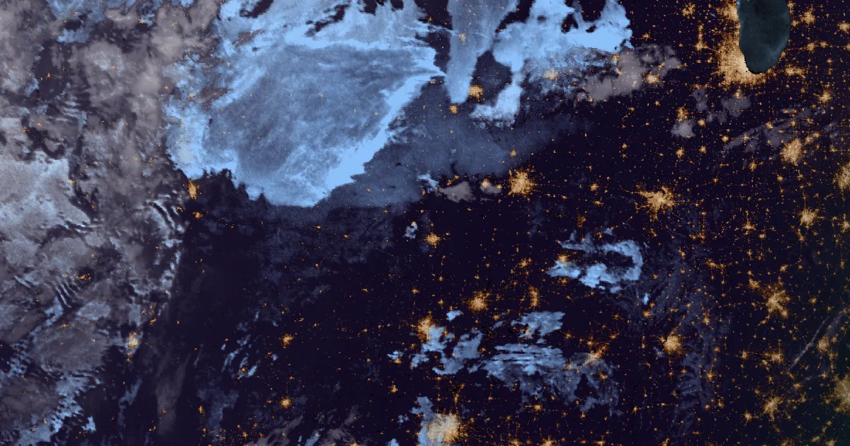
Key points
- The Storm Prediction Center has a Slight Risk of severe storms from parts of Kansas and northwest Missouri down into the southern High Plains for this afternoon and tonight. Large hail and damaging gusts are the main threats, and a tornado or two is possible near a stalled front.
- Four National Weather Service offices have Flood Watches out for eastern Kansas and western Missouri from this afternoon or evening through Wednesday morning. Topeka expects rain rates around 2 inches per hour, and Springfield's watch gives storm totals up to 2 to 4 inches.
- In the West the cold mornings and early snow continue. Freeze Warnings ran this morning from the Columbia Basin to the Snake River Plain, and Winter Weather Advisories cover the Wasatch, the Uintas, the Ruby Mountains and the Wind River Range.
Today, officially: storms on a stalled front, then heavy rain
A front has stalled across Kansas into northern Missouri, and tonight's storms are expected to form along it. The Storm Prediction Center's 12:22 a.m. CDT outlook expects scattered storms near the front by late afternoon, with "moderate to locally strong buoyancy" south of it and enough wind shear for supercells early on. It names strong to severe gusts and large hail as the main hazards. It adds that "some increase in low-level shear/SRH by early evening could result in a tornado or two near the front and surface trough." Later tonight the storms may merge into larger clusters across Kansas, Missouri and western and southern Illinois. The outlook says it is not clear how long they stay severe once the air near the ground cools after dark.
The same storms are why four offices issued Flood Watches overnight. They will move over the same ground for hours. NWS Wichita's watch, covering Sedgwick, Reno, Harvey, McPherson, Butler and six more counties, says the storms "are expected to move east to northeast across the same areas late this afternoon through tonight." NWS Topeka expects storms to "develop in a very moist environment by this evening," with rain rates around 2 inches per hour. It says the watch may need to run into Thursday if more rounds of heavy rain show up. NWS Springfield's watch, for Bourbon County in Kansas and four counties in western Missouri, forecasts totals up to 2 to 4 inches. NWS Kansas City's watch takes the area east into Cass, Johnson, Henry and Pettis counties in Missouri. That puts Wichita, Hutchinson, Emporia, Topeka, Lawrence, Fort Scott, Warrensburg and Sedalia inside the watched counties tonight.
A watch means flooding is possible, not that it is happening. The offices will upgrade it to warnings for specific places if the rain arrives as forecast.
| Product | Office | Counties | Window | Detail in the text |
|---|---|---|---|---|
| Flood Watch | NWS Wichita KS (2:15 a.m. CDT) | Marion, McPherson, Chase, Butler, Harvey, Kingman, Reno, Sedgwick, Allen, Greenwood, Woodson KS | Late this afternoon to mid-morning Wednesday | High rainfall rates, storms over the same areas |
| Flood Watch | NWS Topeka KS (1:31 a.m. CDT) | Anderson, Coffey, Douglas, Franklin, Lyon, Morris, Osage, Shawnee, Wabaunsee KS | This afternoon to Wednesday morning | Rain rates around 2 in per hour; may extend into Thursday |
| Flood Watch | NWS Kansas City/Pleasant Hill MO (2:05 a.m. CDT) | Linn, Miami KS; Bates, Cass, Henry, Johnson, Pettis MO | This evening to Wednesday morning | Heavy rainfall possible this evening into Wednesday morning |
| Flood Watch | NWS Springfield MO (1:49 a.m. CDT) | Bourbon KS; Benton, Morgan, St. Clair, Vernon MO | This evening to Wednesday morning | Totals up to 2 to 4 in |
| Day 1 Convective Outlook | Storm Prediction Center (12:22 a.m. CDT) | Parts of KS and northwest MO into the southern High Plains, Slight Risk | 7 a.m. CDT Tuesday to 7 a.m. CDT Wednesday | Hail, damaging gusts, a tornado or two possible; isolated severe storms also possible in western and central New York |
*Sources: NWS Flood Watches from Wichita, Topeka, Kansas City/Pleasant Hill and Springfield, issued early Tuesday; SPC Day 1 Convective Outlook, 1222 AM CDT Tue Oct 13 2026. All are forecasts, and later issuances may change them.*
In the West: a cold morning and the first mountain snow
The cold mornings in the interior West held for another day. Freeze Warnings ran until 8 to 10 a.m. local time this morning from Pendleton, Spokane, Portland, Eureka, Las Vegas and Pocatello. The coldest number in any of them was 21 degrees, forecast for the Grande Ronde Valley in Oregon. Wallowa County was forecast to reach 25. NWS Las Vegas has another Freeze Warning for the northern Owens Valley for early Wednesday morning. Pueblo and Albuquerque have Freeze Watches for the San Luis Valley and the upper Rio Grande Valley for late Wednesday night into Thursday morning. The Pueblo text says "a killing freeze will be possible which could bring an end to the growing season across the San Luis Valley."
Higher up, the snow has started. NWS Salt Lake City's advisory for the western Uinta Mountains calls for another 8 to 14 inches, mostly above 9,000 feet, through 6 a.m. MDT Wednesday. It also warns that "seasonal roads such as Bald Mountain Pass remain open at this time and may pose a significant risk to under-prepared travelers."
| Product | Office | Where | Number in the text | Until |
|---|---|---|---|---|
| Freeze Warning | NWS Pendleton OR | Grande Ronde Valley | Low as 21 F | 9 a.m. PDT today |
| Freeze Warning | NWS Pendleton OR | Wallowa County | Low as 25 F | 9 a.m. PDT today |
| Freeze Warning | NWS Spokane WA | Moses Lake, Okanogan Valley, Lewiston areas | 29 to 32 F, locally 27 near Moses Lake | 9 a.m. PDT today |
| Freeze Warning | NWS Las Vegas NV | Northern Owens Valley | 28 to 32 F | 8 a.m. PDT Wednesday |
| Winter Weather Advisory | NWS Salt Lake City UT | Western Uinta Mountains | Additional 8 to 14 in | 6 a.m. MDT Wednesday |
| Winter Weather Advisory | NWS Salt Lake City UT | Wasatch Mountains south of I-80 | 3 to 6 in in upper Little and Big Cottonwood | 6 a.m. MDT Wednesday |
| Winter Weather Advisory | NWS Elko NV | Ruby Mountains, East Humboldt Range | Additional 5 to 10 in | 5 p.m. PDT today |
| Winter Weather Advisory | NWS Riverton WY | Wind River Mountains | 3 to 12 in at 9,000 ft and above | 6 a.m. MDT Wednesday |
*Sources: NWS Freeze Warnings, Freeze Watches and Winter Weather Advisories as listed, issued Monday night and early Tuesday. Temperatures and snow amounts are forecasts.*
This is a morning summary, not emergency information. For live warnings see weather.gov and your local officials. NWS Wichita: https://www.weather.gov/ict/ NWS Topeka: https://www.weather.gov/top/ NWS Kansas City/Pleasant Hill: https://www.weather.gov/eax/ NWS Springfield: https://www.weather.gov/sgf/ Storm Prediction Center: https://www.spc.noaa.gov/
The rock's live forecast for the places in this story
More from the Journal
 THE WEATHER BEAT
Frost advisories from Puget Sound to Portland and freeze watches east of the Cascades: the first cold nights of fall, and the shirt for them
OCT 11
THE WEATHER BEAT
Frost advisories from Puget Sound to Portland and freeze watches east of the Cascades: the first cold nights of fall, and the shirt for them
OCT 11
 THE WEATHER BEAT
Rachel's remnants bring flash flooding to Zion and the Forsyth burn scar, and Flood Advisories to Salt Lake City
OCT 11
THE WEATHER BEAT
Rachel's remnants bring flash flooding to Zion and the Forsyth burn scar, and Flood Advisories to Salt Lake City
OCT 11
 EXPLAINERS
Why Is the Sky Blue?
AUG 20
EXPLAINERS
Why Is the Sky Blue?
AUG 20
Follow the Journal: RSS · get it by email