THE WEATHER BEAT · OCT 11
Isaias's remnants bring 3 to 7 inches of rain and Flash Flood Warnings to western North Carolina, from Lake Lure to Linville Falls
Overnight, 3 to 7 inches of rain fell on the North Carolina mountains, and the Broad River was forecast to crest just above its 2010 mark.

Key points
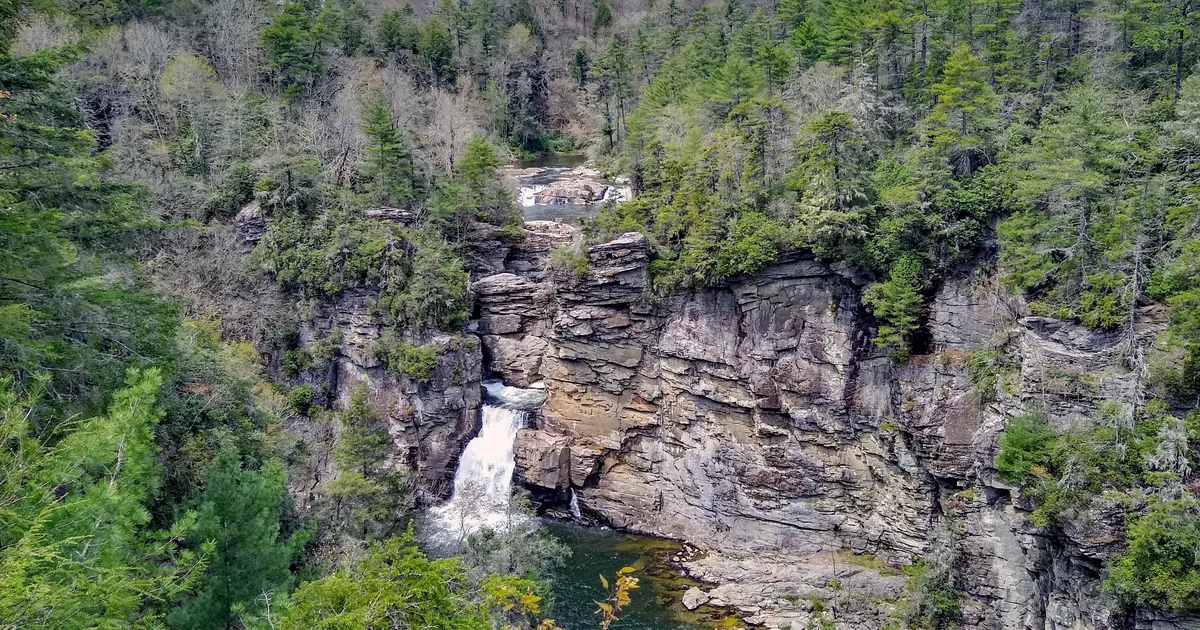
- Overnight, the remnants of Isaias brought 3 to 7 inches of rain to the mountains of western North Carolina, by the National Weather Service's own figures. By early Sunday morning the Greenville-Spartanburg and Blacksburg offices had Flash Flood Warnings out from Lake Lure and Chimney Rock north to Spruce Pine and Linville Falls, and east to Roanoke, Virginia.
- The rivers rise after the rain stops. As of the early Sunday warnings, the Broad River near Boiling Springs was forecast to crest at 13.5 feet this evening, just above its January 2010 crest of 13.4 feet. The French Broad River at Blantyre was forecast to crest at 16.5 to 17 feet.
- As of the Weather Prediction Center's 4 a.m. CDT advisory, Post-Tropical Cyclone Isaias was 65 miles southeast of Nashville with 25 mph winds, moving northeast at 23 mph. Flood Watches run through this afternoon or tonight from northeast Georgia to the Virginia Blue Ridge.
A long night in the Blue Ridge
Isaias came ashore near Destin on Friday night as a hurricane. By Saturday night it was a weak low over Tennessee, but it was still carrying a lot of tropical water, and the mountains of western North Carolina wrung it out. The Blacksburg office reported that 4 to 7 inches had fallen since Saturday morning around Boone, Blowing Rock and the creeks of Watauga County. Greenville-Spartanburg reported 3 to 6 inches across Burke County and across Henderson and Transylvania counties, and 3 to 5 inches in Rutherford County.
Then, before dawn, lines of storms began to train, one cell following another over the same ground. Greenville-Spartanburg's 5:11 a.m. EDT warning traced one such line from Glassy Mountain and Gowansville to Tryon, Saluda, Bat Cave, Chimney Rock and Lake Lure, capable of 1 to 2 inches in less than an hour. At 6:05 a.m. another ran from Old Fort to Marion, Little Switzerland and Spruce Pine. At 6:29 a.m. a third was entering northwestern Burke and southeastern Avery counties, toward the Linville River from Grandfather Mountain to Linville and Pineola. All three warnings described the threat as "life threatening flash flooding" on soils that were already saturated, and each said evacuations may be needed.
In Hendersonville, the 5:17 a.m. warning said Mud Creek was in minor flood and still rising. It put the water 2 to 4 feet deep in low parts of William H. King Memorial Park and the Oklawaha Greenway. In Morganton, Hunting Creek was in minor flood and was expected to crest close to its moderate flood stage of 10 feet. In Virginia, the Blacksburg office's 6:13 a.m. warning said 1.5 to 3 inches had fallen over Roanoke, Salem and Franklin County.
| Warning (NWS office, issue time EDT Sun) | Area | Rain reported fallen | Valid until |
|---|---|---|---|
| Flood Warning (Blacksburg, 5:47 a.m.) | Watauga, south-central Ashe, southwestern Wilkes NC: Boone, Blowing Rock, Deep Gap | 4 to locally 7 in since Saturday morning | 8 a.m. |
| Flash Flood Warning (Greenville-Spartanburg, 5:11 a.m.) | Polk, eastern Henderson, SE Buncombe, NW Rutherford NC; NE Greenville, NW Spartanburg SC: Tryon, Saluda, Chimney Rock, Lake Lure | rates of 1 to 2 in per hour | 11 a.m. |
| Flood Warning (Greenville-Spartanburg, 5:24 a.m.) | Henderson and eastern Transylvania NC: Hendersonville, Brevard | 3 to 6 in | 11:15 a.m. |
| Flash Flood Warning (Greenville-Spartanburg, 6:05 a.m.) | McDowell, SW Avery, SE Mitchell, SE Yancey NC: Marion, Old Fort, Spruce Pine | rates of 1 to 2.5 in per hour | 9 a.m. |
| Flood Warning (Greenville-Spartanburg, 6:10 a.m.) | Southern Burke NC: Morganton, Valdese, Glen Alpine | 3 to 6 in | noon |
| Flash Flood Warning (Blacksburg, 6:13 a.m.) | Franklin, SE Roanoke counties, cities of Roanoke and Salem VA | 1.5 to 3 in | 11:15 a.m. |
| Flash Flood Warning (Greenville-Spartanburg, 6:29 a.m.) | SE Avery, NW Burke, west-central Caldwell NC: Linville Falls, Crossnore, Jonas Ridge | rates of 1 to 2 in per hour | 1 p.m. |
| Flash Flood Warning (Greenville-Spartanburg, 6:40 a.m.) | Rutherford NC: Rutherfordton, Forest City, Spindale | 3 to 5 in | 8:45 a.m. |
*Sources: the NWS warnings named in the table, as issued. Rain figures are the offices' radar and gauge estimates, not official storm totals.*
The rivers, today
The rain is moving out, but the water in the rivers still has to come down from the mountains. Greenville-Spartanburg's 5:46 a.m. warning for the Broad River said "runoff from widespread 4 to 6 inches of storm total rainfall" would push the river above flood stage near Boiling Springs late this morning, to a crest of 13.5 feet this evening. The warning's own history line compares that with a crest of 13.4 feet on January 25, 2010. It asks people as far upstream as Bat Cave to watch the river. On the French Broad at Blantyre the stage was 16.0 feet at 6:30 a.m. and rising, with a crest of 16.5 to 17 feet expected this evening.
| River gauge | Stage, Sunday morning | Flood stage | Forecast crest | Compare |
|---|---|---|---|---|
| Broad River above Sandy Run Creek, 3 SSW Boiling Springs NC | 11.6 ft at 5:30 a.m. EDT | 12.0 ft (moderate 14.0) | 13.5 ft this evening | 13.4 ft on 01/25/2010 |
| French Broad River at Grove Bridge Rd, Blantyre NC | 16.0 ft at 6:30 a.m. EDT, rising | 16.0 ft | 16.5 to 17.0 ft this evening | |
| Hunting Creek, Morganton NC | minor flood, rising (6:06 a.m. EDT) | close to the 10 ft moderate stage |
*Sources: NWS Greenville-Spartanburg Flood Warnings for the Broad River (5:46 a.m. EDT), the French Broad River (7:01 a.m. EDT) and southern Burke County (6:10 a.m. EDT). Crests are forecasts.*
Where Isaias is now
The Weather Prediction Center has issued Isaias's advisories since the Hurricane Center's last one on Saturday morning. Between its 10 p.m. CDT Saturday advisory and its 4 a.m. CDT Sunday advisory, the Center lowered its rain numbers. The Saturday night advisory gave 2 to 5 inches more, locally 10, for the southern Appalachians from the western Carolinas into western Virginia. The Sunday morning advisory gives 1 to 3 inches, locally 5, from the central Appalachians into the Mid-Atlantic, and 1 inch along the North Carolina coast. It expects the river flooding in the western Florida Panhandle, covered in Saturday's landfall story, to crest on Sunday.
Flood Watches from four offices follow the moisture. Greenville-Spartanburg's runs until 2 p.m. EDT across northeast Georgia, western North Carolina and the Upstate. Blacksburg's covers Boone, Wilkes and Surry in North Carolina and Grayson, Carroll, Floyd and Patrick in Virginia through this evening, and its text names "the remnants of Isaias." Sterling's covers the Virginia Blue Ridge and the Piedmont from Nelson and Albemarle to Fauquier through late tonight, with storm totals of 2 to 3 inches and 4 to 5 along the eastern slopes. On the coast, the Newport/Morehead City office has a watch until 2 p.m. EDT from Onslow to the Outer Banks, and Wilmington had one until 11 a.m. EDT from the Cape Fear area to Georgetown, South Carolina.
| Item | Advisory 18 (10 p.m. CDT Sat) | Advisory 19 (4 a.m. CDT Sun) |
|---|---|---|
| Center | 35.0N 86.7W, 75 mi S of Nashville | 35.4N 85.9W, 65 mi SE of Nashville |
| Max sustained winds | 25 mph | 25 mph |
| Pressure | 1009 mb | 1010 mb |
| Movement | NE, 16 mph | NE, 23 mph |
| Rain line | 2 to 5 in, locally 10, southern Appalachians | 1 to 3 in, locally 5, central Appalachians to Mid-Atlantic |
*Sources: NWS Weather Prediction Center Post-Tropical Cyclone Isaias Advisories 18 and 19, and the NWS Flood Watches from Greenville-Spartanburg (6:13 a.m. EDT), Blacksburg (6:44 a.m. EDT), Sterling (6:32 a.m. EDT), Newport/Morehead City (2:21 a.m. EDT) and Wilmington (2:02 a.m. EDT). Positions and rain amounts are forecasts and estimates.*
Saturday's story on the landfall and the first inland flooding is at /journal/beat/isaias-landfall-destin-inland-flooding-atlanta-2026-10-10/.
This is a morning summary, not emergency information. For live warnings see weather.gov and your local officials. NWS Greenville-Spartanburg: https://www.weather.gov/gsp/ NWS Blacksburg: https://www.weather.gov/rnk/ Weather Prediction Center: https://www.wpc.ncep.noaa.gov/
The rock's live forecast for the places in this story
More from the Journal

.jpg)
Follow the Journal: RSS · get it by email