THE WEATHER BEAT · NOV 12
Winter Storm Warnings for the Sierra Nevada: up to 2 feet of heavy wet snow and 90 mph ridge gusts Friday near Lake Tahoe and Mono
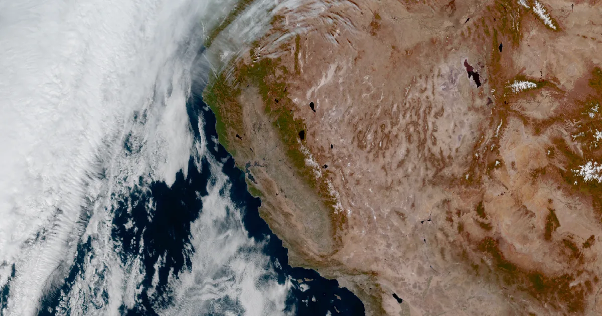
Three NWS offices posted Winter Storm Warnings for the Sierra Nevada overnight, for heavy wet snow from Friday morning into Saturday and more snow next.

Key points
- As of early Thursday, three National Weather Service offices (Reno, Sacramento and Las Vegas) had Winter Storm Warnings up for the Sierra Nevada, running from Friday morning to Saturday. NWS Hanford has a Winter Storm Watch farther south, for Yosemite, Kings Canyon and Sequoia.
- NWS Reno calls for heavy wet snow near Lake Tahoe and Truckee. Its warning gives up to 20 inches along the crest west of the lake, 1 to 2 feet above 7000 feet in Mono County, and ridge gusts of 70 to 90 mph.
- In its overnight discussion, Reno expects the heaviest snow late Friday night into early Saturday. It names the Friday evening commute as the hard part, and it sees a weaker storm on Monday and possibly another on Wednesday.
Thursday is the calm before it. In its 12:58 a.m. PST discussion, the Reno forecast office called today "one last day of mild weather" before a storm brings wind and snow to the whole region on Friday.
The warnings went out just after midnight. NWS Sacramento issued its warning at 12:05 a.m. PST for the northern Sierra above 6000 feet, covering Interstate 80, Highway 50 and State Routes 4 and 108, plus the southern Cascades around Lassen Volcanic National Park. At 12:33 a.m., NWS Reno turned its watch into warnings for the Greater Lake Tahoe Area and Mono County. NWS Las Vegas had already posted one for the Eastern Sierra slopes of Inyo County at 11:43 p.m. PST Wednesday.
Reno describes this snow as heavy and wet, the kind the office calls "Sierra cement," and warns that it and the wind "could cause damage to trees and power lines." Wind comes first. The office expects gusts over 45 mph Friday ahead of the snow, and says travel will be hard for tall vehicles along US-395 and I-580. In the Truckee and Lake Tahoe towns the warning gives gusts of 35 to 45 mph, with waves of 2 to 4 feet on the lake.
The snow level will fall quickly, so where the line sits matters. Reno has it starting around 7000 to 8000 feet at Tahoe and Mono and dropping below 6000 to 7000 feet by midnight. Below 6000 feet it expects mostly rain, up to a quarter inch. Above the line, it says the heaviest rates late Friday night into early Saturday could top 2 inches an hour. Reno's advice is plain: if you are planning a Sierra trip, think about waiting until the bulk of the storm has passed.
Farther south, the Hanford watch runs from Friday afternoon through late Monday night. It covers the Sierra above 6000 feet in Yosemite outside the valley, Kings Canyon and Sequoia, and says it could affect weekend travel.
This is not the only storm. Sacramento expects a lull Saturday afternoon through Sunday, then more snow Sunday night into Monday. Reno says that second system has been trending weaker, with crest totals near 5 inches as of now. It is also watching a third system for Wednesday into Thursday that comes from off the coast of Alaska and has lower snow levels. Reno's line on that one: "This doesn't mean we'll see snow down in Reno just yet."
| Product | Office | Area | Runs (PST) | Snow | Wind |
|---|---|---|---|---|---|
| Winter Storm Warning | NWS Reno | Greater Lake Tahoe Area | 10 a.m. Fri to 10 a.m. Sat | near 12 in above 7000 ft; up to 6 in below; up to 20 in on the crest west of the lake | ridges 70 to 90 mph; Truckee and Tahoe towns 35 to 45 mph |
| Winter Storm Warning | NWS Reno | Mono County | 1 p.m. Fri to 10 a.m. Sat | 1 to 2 ft above 7000 ft; up to 6 in from 6000 to 7000 ft | ridges 60 to 80 mph; Highway 395 45 to 55 mph |
| Winter Storm Warning | NWS Sacramento | Northern Sierra above 5000 ft, Lassen Volcanic NP | 10 a.m. Fri to 10 a.m. Sat | up to 1 ft above 6000 ft; up to 2 ft on the highest peaks | gusts to 60 mph |
| Winter Storm Warning | NWS Las Vegas | Eastern Sierra Slopes of Inyo County | 1 p.m. Fri to 4 p.m. Sat | 5 to 10 in above 7000 ft; up to 1 ft near the crest | not given |
| Winter Storm Watch | NWS Hanford | Sierra above 6000 ft, Yosemite, Kings Canyon, Sequoia | Fri afternoon to late Mon night | 6 to 12 in above 6000 ft | gusts to 50 mph |
Sources: the five NWS products above, issued 11:43 p.m. PST Wednesday to 2:33 a.m. PST Thursday, November 12, 2026, and the NWS Reno Area Forecast Discussion issued at 12:58 a.m. PST Thursday. Figures are forecasts as of those issue times. They are not measurements, and later products may change them.
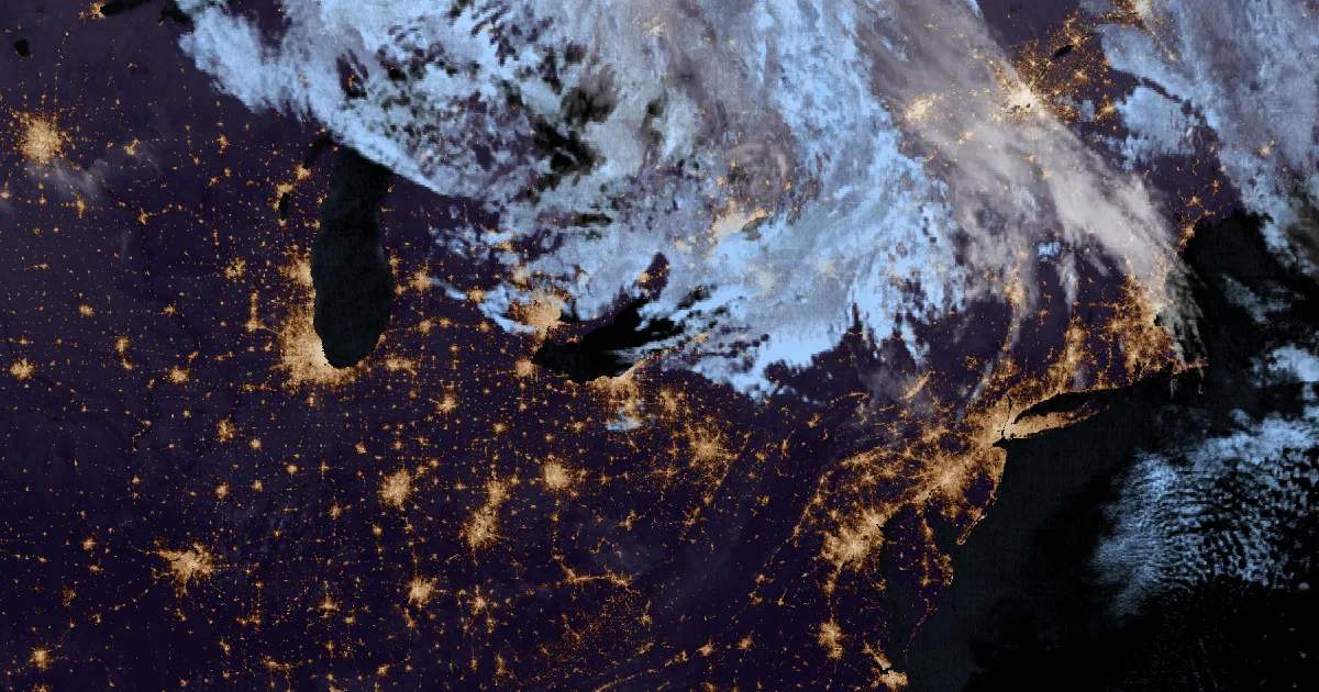
Elsewhere, the Storm Prediction Center's Day 1 outlook carries a marginal risk: it says a couple of strong thunderstorms may reach parts of the northern Mid Atlantic this afternoon. Tropical Depression Pena is still in the central Pacific at 30 mph as of the 9:00 a.m. UTC advisory.
For road conditions, the offices point to Caltrans QuickMap (quickmap.dot.ca.gov), NVRoads, or 511.
This is a morning summary, not emergency information. For live warnings see weather.gov and your local officials. NWS Reno's winter page: https://www.weather.gov/rev/winter
The rock's live forecast for the places in this story
More from the Weather Beat
More from the Journal
Follow the Journal: RSS · get it by email