THE WEATHER BEAT · OCT 14
Flash flood warnings covered Charleston, Parkersburg and Clarksburg, West Virginia, on Wednesday evening
Three Charleston NWS warnings in 90 minutes put up to 2.25 inches on the Kanawha and Ohio valleys, with flooding reported in Malden; Texas saw up to 5.

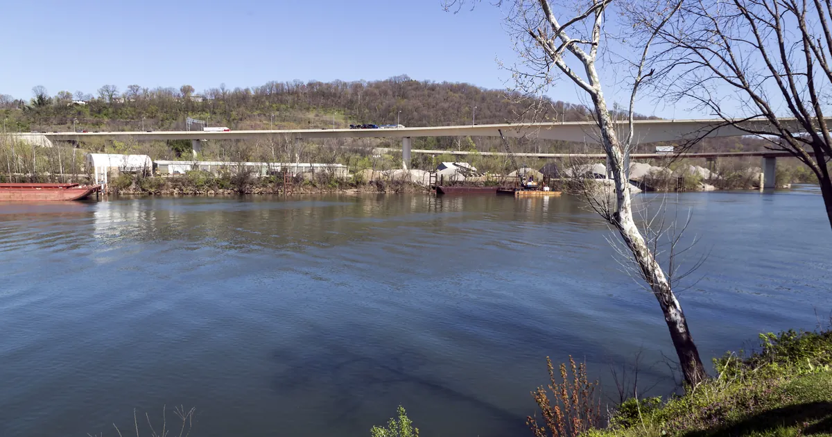

Key points
- On Wednesday evening the National Weather Service in Charleston, West Virginia, issued flash flood warnings covering Charleston, Parkersburg, Marietta and Clarksburg. The 8:28 p.m. EDT warning said flash flooding was already under way in Malden.
- Radar estimates in those warnings put 0.5 to 2.25 inches of rain on parts of West Virginia and southeast Ohio between late afternoon and evening.
- In the Texas Rolling Plains, Lubbock's warnings said up to 5 inches had fallen around Spur, Dickens, Paducah and Matador. San Angelo's Flood Watch names moisture from Hurricane Simon as the reason for heavier rain Thursday afternoon into Friday morning.
West Virginia, Wednesday evening
Rain is usually not news in the Kanawha Valley in October. On Wednesday evening, though, thunderstorms set off three flash flood warnings from the Charleston office in a little over 90 minutes.
The first warning came at 6:59 p.m. EDT for the hill country around Clarksburg and Salem. Radar showed 1 to 1.5 inches had already fallen there, with up to another inch possible. At 7:51 p.m. EDT a second warning covered the Ohio River towns of Parkersburg, Vienna, Williamstown and St. Marys, and Marietta across the river. Between 1 and 2.25 inches had fallen there. The third, at 8:28 p.m. EDT, covered Charleston itself. It estimated 0.5 to 1.5 inches and said flash flooding was already occurring in Malden, just up the Kanawha River from the capital.
The Charleston warning also listed the roads. They were Interstate 77 between mile markers 96 and 99, the West Virginia Turnpike between mile markers 88 and 95, and Route 119 between mile markers 67 and 79. The Parkersburg warning listed Interstate 77 near the Ohio line and Route 50 between mile markers 25 and 52.
| Warning (NWS Charleston WV) | Issued | Until | Rain fallen, per the warning | Towns named |
|---|---|---|---|---|
| Doddridge, Gilmer, Harrison, Lewis, Ritchie WV | 6:59 p.m. EDT | 10:00 p.m. EDT | 1 to 1.5 in, up to 1 in more possible | Clarksburg, Salem, Jackson Mill, West Milford |
| Washington OH; Doddridge, Pleasants, Ritchie, Wood WV | 7:51 p.m. EDT | 9:15 p.m. EDT | 1 to 2.25 in, up to 0.25 in more possible | Parkersburg, Marietta, Vienna, Williamstown, St. Marys, Harrisville |
| Boone, Kanawha, Lincoln WV | 8:28 p.m. EDT | 11:30 p.m. EDT | 0.5 to 1.5 in; flooding occurring in Malden | Charleston, South Charleston, Marmet, Belle, Chesapeake |
*Amounts are radar estimates quoted from the NWS warnings themselves, not gauge totals.*
The Texas Rolling Plains
To the southwest, the same unsettled pattern that flooded Oklahoma on Wednesday morning produced slow storms over the open country east of Lubbock. Between 6:58 and 7:20 p.m. CDT, NWS Lubbock extended or reissued flash flood warnings for Crosby, Dickens, Garza, Kent, King, Cottle and Motley counties. Each one said the heaviest rain had ended but flash flooding was still occurring. The Cottle and Motley warning, covering Paducah and Matador, and the Dickens and King warning, covering Guthrie, both said up to 5 inches had fallen. Lubbock's Flood Watch for those counties runs until 1 a.m. CDT Thursday.
| Warning (NWS Lubbock TX) | Issued | Until | Rain fallen, per the warning | Towns named |
|---|---|---|---|---|
| Crosby, Dickens, Garza, Kent | 6:58 p.m. CDT | 8:45 p.m. CDT | 2 to 5 in | White River Lake, Kalgary |
| Dickens, Garza, Kent | 7:17 p.m. CDT | 8:45 p.m. CDT | 2 to 4 in | Spur, Dickens, Clairemont, Justiceburg |
| Dickens, King | 7:18 p.m. CDT | 9:15 p.m. CDT | up to 5 in | Guthrie, Finney, Dumont |
| Cottle, Motley | 7:20 p.m. CDT | 9:30 p.m. CDT | up to 5 in | Paducah, Matador, Cee Vee |
Thursday, officially
At 1:46 p.m. CDT, NWS San Angelo issued a Flood Watch for 18 counties of west central Texas, including Abilene's Taylor County and San Angelo's Tom Green County. It runs from Thursday afternoon through Friday morning. The watch text reads: "moisture from Hurricane Simon will bring highly efficient rain showers and thunderstorms to the area." It adds that flash flooding is likely and considerable flash flooding is possible. At 1:47 p.m. CDT, NWS Austin/San Antonio issued a watch for Val Verde County for the same window. It calls for 1 to 3 inches, with isolated amounts of 6 inches possible.
This is an evening summary, not emergency information. For live warnings see weather.gov and your local officials. The Charleston office's page is weather.gov/rlx.
The rock's live forecast for the places in this story
More from the Journal
 THE WEATHER BEAT
Snow on the high peaks and frost in the valleys: October in the West, in the Weather Service's own words, and the shirt for it
OCT 13
THE WEATHER BEAT
Snow on the high peaks and frost in the valleys: October in the West, in the Weather Service's own words, and the shirt for it
OCT 13
 THE WEATHER BEAT
A flash flood on a schedule: how Sunday's storms sent a flood wave down the Paria River toward Lees Ferry
OCT 12
THE WEATHER BEAT
A flash flood on a schedule: how Sunday's storms sent a flood wave down the Paria River toward Lees Ferry
OCT 12
 EXPLAINERS
Why Is the Sky Blue?
AUG 20
EXPLAINERS
Why Is the Sky Blue?
AUG 20
Follow the Journal: RSS · get it by email