THE WEATHER BEAT · SEP 18
Wildfire burn scars trigger flash flood warnings across Idaho and Montana
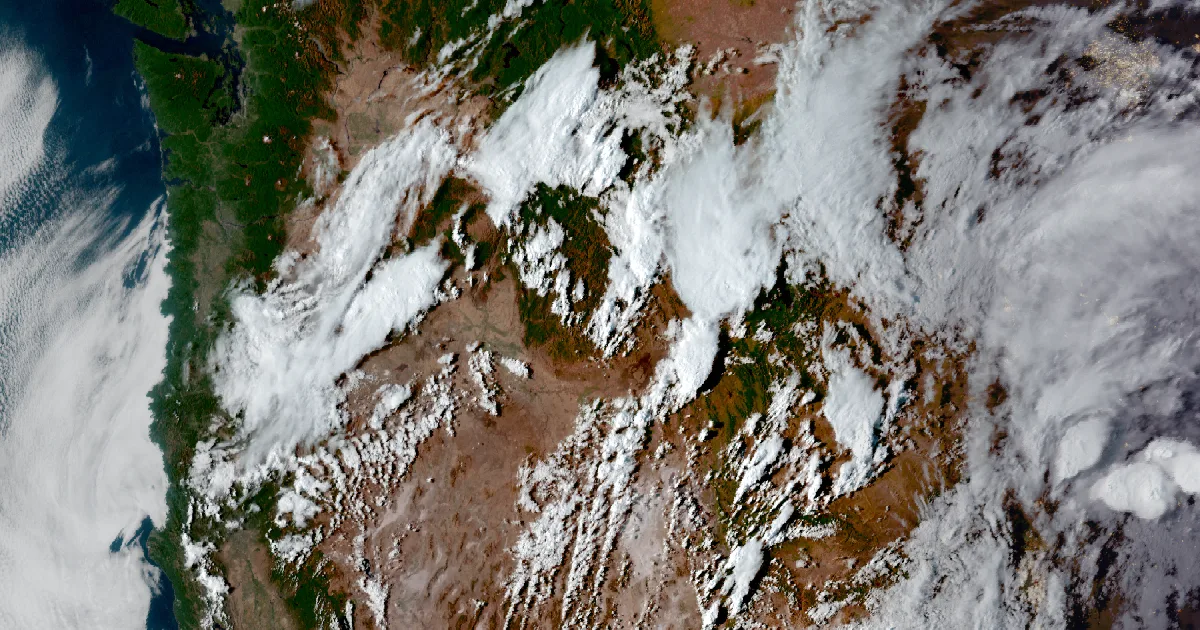
Thunderstorms over five 2026 wildfire burn scars in Idaho and Montana prompted flash flood warnings and watches for debris flows on Friday.

Key points
- The National Weather Service issued three Flash Flood Warnings Friday morning for thunderstorms over three separate 2026 wildfire burn scars in Idaho, warning of debris flows of rock, mud and vegetation.
- A Flash Flood Watch covers six areas of south central and southwest Idaho through Friday evening for the Wapiti, Crooked and Buckhorn burn scars, naming more than a dozen communities that could see flash flooding.
- Two more Flash Flood Watches cover parts of southwest and central Montana into Saturday, for the Sand Creek, Bobcat Lakes and Horse Gulch burn scars and other ground burned this summer.
Burn scars, not open ground
Friday's flash flood threat in Idaho and Montana is not ordinary heavy rain on ordinary ground. Every warning and watch the National Weather Service issued Friday morning names a specific wildfire burn scar, land stripped of the vegetation that would normally slow runoff, where the same rain that would soak into a hillside elsewhere instead sheets off fast enough to carry rock, mud and vegetation downslope.
The National Weather Service's Pocatello office issued two of the warnings. One, issued at 10:44 a.m. MDT and running until 1:45 p.m., covered the Big Rock Burn Scar in southeastern Jefferson and south central Madison Counties, naming Heise as a location that would experience flash flooding. Radar indicated thunderstorms producing heavy rain with an expected rate of 0.5 to 1 inch per hour, and the warning called the hazard "life threatening flash flooding." A second Pocatello warning, extended at 11:50 a.m. MDT to run until 2:15 p.m., covered the Ohio Burn Scar in northwestern Blaine County, where radar had already measured between 0.5 and 1 inch of rain with another 0.5 to 1 inch per hour expected.
The National Weather Service's Boise office issued the third warning at 11:49 a.m. MDT, running until 2:00 p.m., for the MM115 Highway 20 Burn Scar in central Elmore County, with an expected rainfall rate of 0.25 to 0.75 inches per hour. Boise also issued a Flash Flood Watch at 10:50 a.m. MDT, running through Friday evening, covering the Wapiti, Crooked and Buckhorn burn scars across the West Central Mountains, Boise Mountains, Camas Prairie, Lower and Upper Treasure Valley and Western Magic Valley. That watch named Idaho City, Fairfield, Lowman, Horseshoe Bend, Pine, Prairie, Atlanta, Anderson Dam, Corral, Centerville, Pioneerville, Garden Valley, Banks and Gardena as places that could see flash flooding.
In Montana, the National Weather Service's Great Falls office issued two Flash Flood Watches at 10:39 a.m. MDT. One runs from 3 p.m. Friday through Saturday afternoon for the Sand Creek and Bobcat Lakes burn scars in northwest Beaverhead County. The other runs from 6 p.m. Friday through Saturday evening for the Horse Gulch area and burn scars from the summer of 2026, across the Little Belt and Highwood Mountains, the Big Belt, Bridger and Castle Mountains, and the Elkhorn and Boulder Mountains. Both watches warn that heavy rainfall over the burn scars could trigger flash flooding of low-lying areas, street flooding, and debris flows.
The warnings and watches, for the nerds
| location | event | burn scar | issued (MDT) | until | office |
|---|---|---|---|---|---|
| Jefferson/Madison Co., ID | Flash Flood Warning | Big Rock | Fri 10:44 AM | Fri 1:45 PM | NWS Pocatello |
| Blaine Co., ID | Flash Flood Warning (extended) | Ohio | Fri 11:50 AM | Fri 2:15 PM | NWS Pocatello |
| Elmore Co., ID | Flash Flood Warning | MM115 Hwy 20 | Fri 11:49 AM | Fri 2:00 PM | NWS Boise |
| SW/SC Idaho, 6 zones | Flash Flood Watch | Wapiti, Crooked, Buckhorn | Fri 10:50 AM | Fri midnight | NWS Boise |
| NW Beaverhead Co., MT | Flash Flood Watch | Sand Creek, Bobcat Lakes | Fri 10:39 AM | Sat evening | NWS Great Falls |
| Central MT, 3 mountain zones | Flash Flood Watch | Horse Gulch, summer 2026 scars | Fri 10:39 AM | Sat evening | NWS Great Falls |
Source: National Weather Service active alerts API, fetched 2026-09-18 18:04Z. Every location, time and rainfall rate above is quoted from the alert text itself.
This is a summary of official warnings, not emergency information. For live warnings see weather.gov and your local officials.
The rock's live forecast for the places in this story: Idaho City ID | Fairfield ID | Lowman ID | Horseshoe Bend ID | Pine ID | Prairie ID | Atlanta ID | Corral ID | Centerville ID | Pioneerville ID | Garden Valley ID | Banks ID | Heise ID
The rock's live forecast for the places in this story
More from the Journal


Follow the Journal: RSS · get it by email