THE WEATHER BEAT · OCT 2
The Plains rain reaches the Missouri River: Glasgow forecast for moderate flooding Monday as Nebraska crests come down
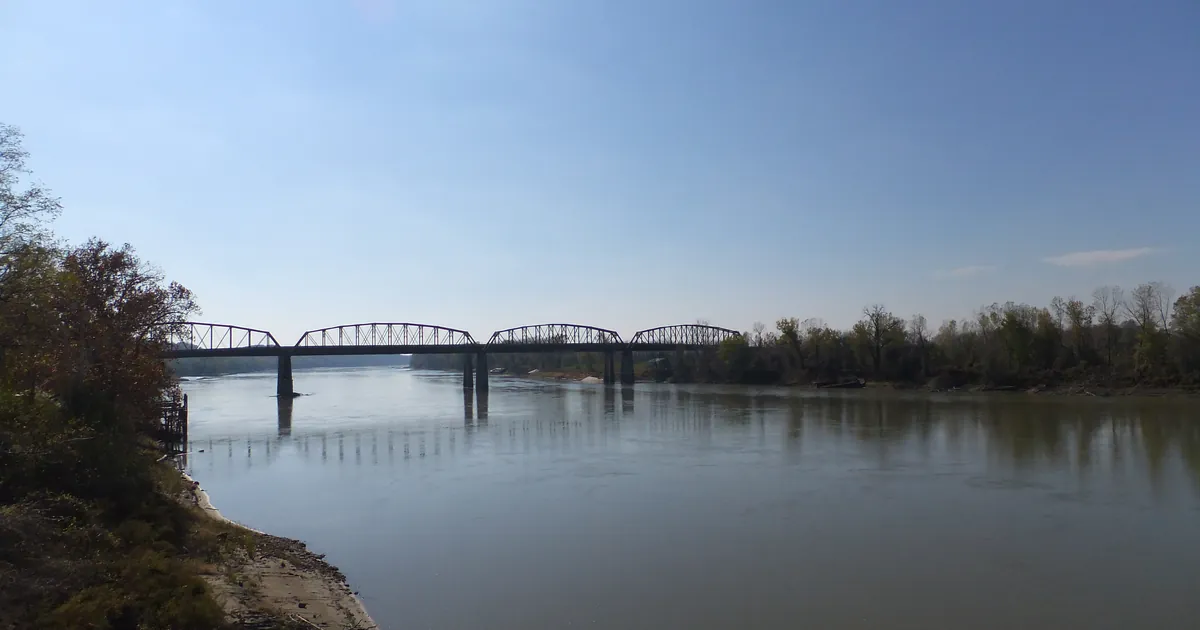
Wednesday's rain has moved on to the Missouri. Six gages from Leavenworth to Boonville are forecast to flood, and Glasgow is due at 31.1 feet Monday.

Key points
- The water from Wednesday's Kansas and Nebraska rain has moved onto the Missouri River. At 10:15 a.m. CDT on Friday, NWS Kansas City forecast six Missouri River gages from Leavenworth to Boonville to rise to or above flood stage. Glasgow, Mo., is forecast to reach moderate flooding, with a crest of 31.1 feet early Monday morning.
- Upstream in Nebraska the forecasts came down. The Big Blue River at Beatrice is now forecast to crest at 24.6 feet Saturday evening. On Thursday the forecast was 26.8 feet. Salt Creek near Ashland peaked at 21.1 feet and stayed under the 21.5 feet of May 2015 that its warning cites.
- At 12:29 p.m. CDT Friday there were 77 Flood Warnings in force from 18 National Weather Service offices, down from the 102 this desk counted at midday Thursday. Kansas City issued 17 of them and Omaha 14.
Yesterday into today: the crests move downstream
A river flood is the slow end of a storm. The rain that fell behind Wednesday's tornadoes in north central Kansas and south central Nebraska spent Thursday filling the creeks. On Friday morning the warnings showed it moving down the map, from the Big Blue and Salt Creek into the Platte, the Grand and the Missouri.
The Nebraska forecasts improved overnight. On Thursday the Omaha office expected the Big Blue at Beatrice to reach 26.8 feet, above the 26.3 feet of September 1941. Friday morning's warning says the crest will come earlier and lower, 24.6 feet tomorrow evening. That is still well over the 18-foot flood stage, and the office now compares it with a crest of 24.6 feet on June 25, 1963. Upstream at Crete, the Big Blue stood at 26.6 feet at 7:45 a.m. and was expected to crest at 26.7 feet this afternoon, just under the 27.0 feet of March 1949 the warning cites. Salt Creek near Ashland reached 21.1 feet in the 24 hours to 7:45 a.m. and was expected to fall below flood stage this afternoon. The warning says that at 21 feet, local levees are threatened with overtopping and "substantial damages are occurring at the campground near Highway 6."
In Missouri the Grand River is still rising. Near Sumner it stood at 32.9 feet at 8:45 a.m., almost seven feet over flood stage. It is forecast to crest at 34.1 feet tomorrow morning, higher than the 33.3 feet Thursday's forecast gave. Near Chillicothe the Grand was cresting at about 29.2 feet this afternoon. Downstream at Brunswick it was at 15.4 feet and is forecast to pass its 19-foot flood stage this evening and crest at 24.7 feet Sunday evening.
Stranger Creek at Easton, Kan., came up almost exactly as forecast. Thursday's warning gave a crest of 20.1 feet. At 9:30 a.m. Friday it read 20.5 feet and was cresting, which is the level where the warning says Highway 192 just east of town closes because of swift water over the road.
| River gage | Stage Friday (CDT) | Flood stage | Forecast crest | Thursday's forecast |
|---|---|---|---|---|
| Big Blue River at Beatrice, Neb. | 16.0 ft (7:45 a.m.) | 18.0 ft | 24.6 ft Sat. evening | 26.8 ft |
| Big Blue River near Crete, Neb. | 26.6 ft (7:45 a.m.) | 21.0 ft | 26.7 ft Fri. afternoon | not in Thursday's story |
| Salt Creek near Ashland, Neb. | 21.0 ft (7:45 a.m.), peak 21.1 ft | 20.0 ft | falling, below flood stage Fri. afternoon | 21.3 ft |
| Grand River near Sumner, Mo. | 32.9 ft (8:45 a.m.) | 26.0 ft | 34.1 ft Sat. morning | 33.3 ft |
| Grand River near Chillicothe, Mo. | 29.1 ft (8:45 a.m.) | 24.0 ft | 29.2 ft Fri. afternoon | not in Thursday's story |
| Grand River near Brunswick, Mo. | 15.4 ft (7:20 a.m.) | 19.0 ft | 24.7 ft Sun. evening | not in Thursday's story |
| Stranger Creek at Easton, Kan. | 20.5 ft (9:30 a.m.) | 17.0 ft | cresting near 20.5 ft | 20.1 ft |
| Platte River near Agency, Mo. | 27.0 ft (8:30 a.m.) | 20.0 ft | cresting near 27 ft Fri. morning | not in Thursday's story |
*Source: NWS Flood Warnings from Omaha/Valley (8:30 to 8:53 a.m. CDT) and Kansas City/Pleasant Hill (8:55 to 10:47 a.m. CDT), Oct. 2, 2026, as read from api.weather.gov at 12:29 p.m. CDT. Thursday's figures are from this desk's Oct. 1 story. Past crests are the comparisons each warning cites. They are not record claims. River forecasts change with each issuance.*
Today, officially: the Missouri River
The Kansas City office's 10:15 a.m. warning covers six gages on the Missouri, from Leavenworth to Boonville, and the crests reach each one in turn. Leavenworth is forecast to touch its 20-foot flood stage just after midnight tonight. Napoleon is forecast to crest at 24.5 feet early Sunday morning, Waverly at 27.0 feet Sunday morning, and Miami at 26.6 feet Sunday evening. Glasgow and Boonville crest on Monday.
Glasgow is the one gage forecast to reach moderate flooding. It stood at 19.5 feet at 9:30 a.m. and is forecast to pass its 25-foot flood stage late tomorrow morning and crest at 31.1 feet early Monday morning. The warning says that at 27 feet, many agricultural levees are overtopped and "secondary roads and homes behind levees may be inundated." The crest is forecast to stay under 32 feet, the level where State Highway 240 west of Glasgow goes under water and the city park begins to flood. At Boonville the forecast crest is 27.2 feet early Monday afternoon, six feet over flood stage. The warning says that at 25 feet numerous farm levees are overtopped and backwater on Perche Creek floods McBaine.
Upstream, the Kansas City office raised the forecast at St. Joseph from minor to moderate. The river there was at 20.3 feet at 9 a.m. and is forecast to crest at 21.2 feet this evening, the level just past which the warning says Riverfront Park begins to flood. The Storm Prediction Center's day 1 outlook says "Severe thunderstorm potential should remain low through tonight."
| Missouri River gage | Stage Friday (CDT) | Flood stage | Forecast crest | Severity forecast |
|---|---|---|---|---|
| St. Joseph, Mo. | 20.3 ft (9:00 a.m.) | 17.0 ft | 21.2 ft Fri. evening | Moderate |
| Leavenworth, Kan. | 17.0 ft (9:45 a.m.) | 20.0 ft | 20.0 ft after midnight | Minor |
| Napoleon, Mo. | 17.1 ft (10:00 a.m.) | 17.0 ft | 24.5 ft early Sun. | Minor |
| Waverly, Mo. | 17.7 ft (9:00 a.m.) | 20.0 ft | 27.0 ft Sun. morning | Minor |
| Miami, Mo. | no current reading | 18.0 ft | 26.6 ft Sun. evening | Minor |
| Glasgow, Mo. | 19.5 ft (9:30 a.m.) | 25.0 ft | 31.1 ft early Mon. | Moderate |
| Boonville, Mo. | 13.2 ft (9:04 a.m.) | 21.0 ft | 27.2 ft Mon. afternoon | Minor |
- Flood Warnings in force at 12:29 p.m. CDT: 77, from 18 offices. Kansas City 17, Omaha 14, Quad Cities 10, Des Moines 7, St. Louis 6, Topeka 5, Hastings 4, the rest 14.
*Source: NWS Kansas City/Pleasant Hill Flood Warnings for the Missouri River (10:09 and 10:15 a.m. CDT, Oct. 2, 2026), SPC day 1 outlook, active alerts count from api.weather.gov at 12:29 p.m. CDT.*
This is a summary, not emergency information. For live warnings see weather.gov and your local officials, and for river forecasts see water.noaa.gov.
The rock's live forecast for the places in this story
More from the Journal

.jpg)
Follow the Journal: RSS · get it by email