THE WEATHER BEAT · OCT 5
The Missouri falls out of flood as eastern Iowa rivers keep rising; Wapsipinicon near DeWitt crests Thursday
Jefferson City and Hermann warnings were cancelled Monday. In eastern Iowa the Wapsipinicon near DeWitt is forecast to crest at 12.8 feet Thursday.


Key points
- The Missouri River is falling out of flood in central Missouri. NWS St. Louis cancelled its warnings for Jefferson City and Hermann at 9:46 a.m. CDT Monday. Glasgow, Boonville and Waverly were all forecast to drop below flood stage by Monday evening.
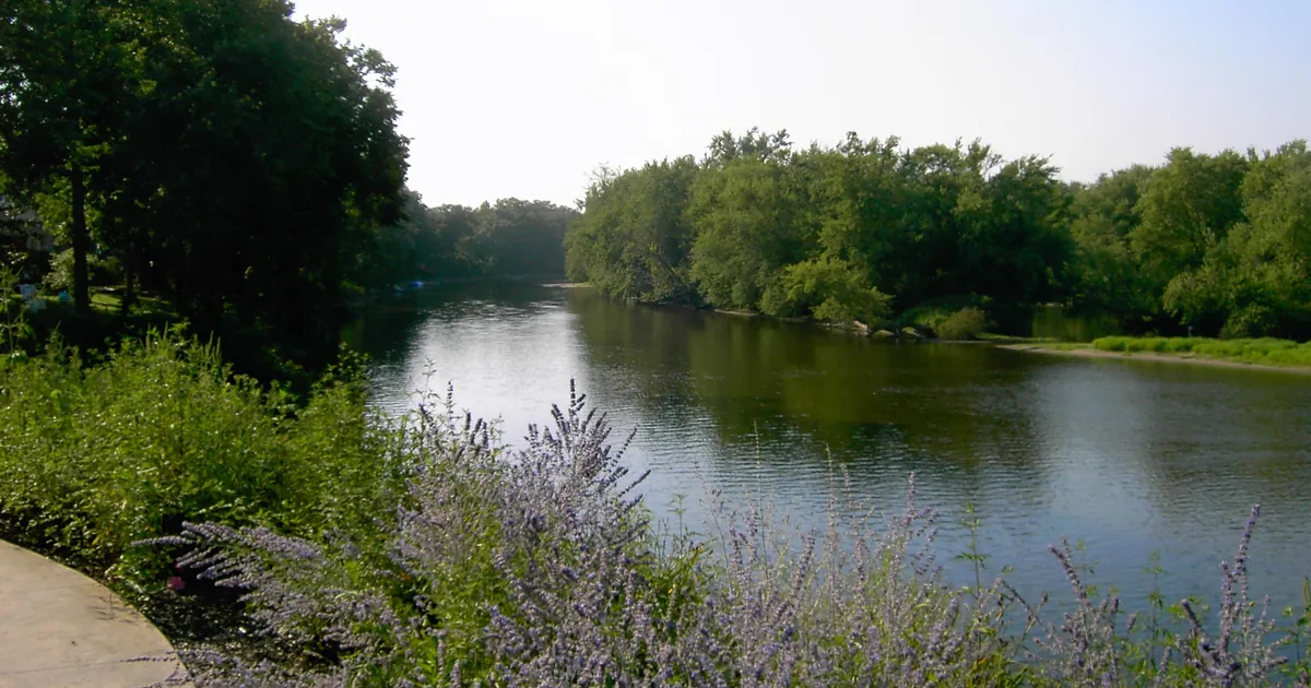
- In eastern Iowa the rivers are still rising. NWS Quad Cities says moderate flooding is occurring on the Wapsipinicon River near DeWitt and that major flooding is forecast, with a crest of 12.8 feet early Thursday afternoon. Old U.S. Highway 61 near the river is affected from 12.5 feet.
- The Iowa River at Marengo is forecast to crest at 16.8 feet early Friday morning. The Cedar River near Conesville is forecast to crest at 13.9 feet early Wednesday morning. At Conesville the warning lists yards, campgrounds and a park in Moscow among the places affected.
.jpg)
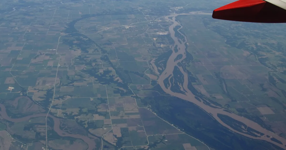
The Missouri lets go
This desk has followed the Missouri River crest downstream since Friday. On Monday morning that story ended. At 9:46 a.m. CDT, NWS St. Louis cancelled the Flood Warnings for the Missouri at Jefferson City and at Hermann. The only gage it still had in flood on that stretch was Chamois, which read 17.0 feet at 7 a.m., right at flood stage. It was forecast to crest at 17.1 feet Monday afternoon and to fall below flood stage by evening. The cancellation does not give the observed crest at Jefferson City, so this story does not give one either.
Upstream, NWS Kansas City's 9:34 a.m. CDT warnings showed the river still above flood stage Monday morning but on the way down. Glasgow read 26.9 feet at 8:30 a.m. That is just under the 27-foot mark where the warning says many agricultural levees are overtopped. All three Kansas City gages were forecast to drop below flood stage that evening.
| Gage | Stage in the warning (CDT) | Flood stage | Forecast |
|---|---|---|---|
| Missouri River at Glasgow, Mo. | 26.9 ft (8:30 a.m. Mon.) | 25.0 ft | below flood stage Mon. evening, 14.7 ft Sat. morning |
| Missouri River at Boonville, Mo. | 22.6 ft (9:04 a.m. Mon.) | 21.0 ft | below flood stage late Mon. evening, 11.0 ft Sat. morning |
| Missouri River at Waverly, Mo. | 22.1 ft (9:00 a.m. Mon.) | 20.0 ft | below flood stage late Mon. evening, 13.4 ft Mon., Oct. 12 |
| Missouri River near Chamois, Mo. | 17.0 ft (7:00 a.m. Mon.) | 17.0 ft | crest 17.1 ft Mon. afternoon, below flood stage Mon. evening |
| Missouri River at Jefferson City and Hermann, Mo. | warnings cancelled 9:46 a.m. Mon. |
*Source: NWS Kansas City/Pleasant Hill Flood Warnings issued 9:34 a.m. CDT Oct. 5, 2026, and NWS St. Louis Flood Warnings issued 9:46 a.m. CDT Oct. 5, 2026. River forecasts change with each issuance, and newer ones may have replaced these by the time you read this.*
Eastern Iowa, still climbing
The rivers in eastern Iowa run slower. NWS Quad Cities' 9:27 a.m. CDT Monday warnings cover seven gages. Several are forecast to rise for days before they turn.
The Wapsipinicon near DeWitt matters most. It read 12.1 feet at 8:30 a.m. Monday, a foot above its 11-foot flood stage. It is forecast to keep rising to a crest of 12.8 feet early Thursday afternoon and to stay above flood stage until early Sunday afternoon. The warning's headline reads: "Moderate flooding is occurring and major flooding is forecast." The impact it lists is old U.S. Highway 61 near the river, at 12.5 feet. Upstream near Anamosa, the same river was forecast to crest Monday afternoon at 14.5 feet, exactly its flood stage. That is the height where Lead Mine Road is completely covered.
The Iowa River is also slow. At Marengo it read 15.6 feet and is forecast to crest at 16.8 feet early Friday morning, which will put water several feet deep on farmland in places. Farther down, the river was already over flood stage at Oakville, where River Road is under water from 11.5 feet, and at Wapello, where water reaches homes near the U.S. Highway 61 bridge from 22 feet. The Cedar River near Conesville sat at 13.5 feet, the height where the warning says water reaches yards and access roads along Iowa Highway 22, campgrounds north of Interstate 80 and the lowest parts of Jack Shuger Memorial Park in Moscow. It is forecast to crest at 13.9 feet early Wednesday morning.
Out on the plains it is a different story. NWS Omaha said moderate flooding was occurring on Turkey Creek near De Witt, Nebraska, at 25.2 feet Monday morning. The office notes that this ties a previous crest of 25.2 feet on May 30, 2013. The creek and the Big Blue River at Beatrice were forecast to fall below flood stage Tuesday afternoon.
| Gage | Stage in the warning (CDT, Mon.) | Flood stage | Forecast | Listed impact |
|---|---|---|---|---|
| Wapsipinicon River near DeWitt 4S, Iowa | 12.1 ft (8:30 a.m.) | 11.0 ft | crest 12.8 ft early Thu. afternoon, below flood stage early Sun. afternoon | 12.5 ft: old U.S. Highway 61 near the river |
| Wapsipinicon River near Anamosa, Iowa | 14.3 ft (8:15 a.m.) | 14.5 ft | crest 14.5 ft Mon. afternoon | 14.5 ft: Lead Mine Road completely covered |
| Iowa River at Marengo, Iowa | 15.6 ft (9:00 a.m.) | 15.0 ft | crest 16.8 ft early Fri. morning, below flood stage Sat. morning | 16.0 ft: farmland along the river, water several feet deep in places |
| Cedar River near Conesville, Iowa | 13.5 ft (9:00 a.m.) | crest 13.9 ft early Wed. morning | 13.5 ft: yards and access roads along Iowa 22, campgrounds north of I-80, Jack Shuger Memorial Park in Moscow | |
| Iowa River at Oakville, Iowa | 11.8 ft (9:00 a.m.) | 11.0 ft | below flood stage early Thu. afternoon | 11.5 ft: River Road under water |
| Iowa River at Wapello, Iowa | 22.1 ft (9:00 a.m.) | 21.0 ft | below flood stage early Fri. morning | 22.0 ft: residences near the U.S. Highway 61 bridge |
| Turkey Creek near De Witt, Neb. | 25.2 ft (8:45 a.m.) | 23.5 ft | below flood stage early Tue. afternoon | 25.0 ft: water begins to overtop Blueridge Drive |
| Big Blue River at Beatrice, Neb. | 21.1 ft (8:45 a.m.) | 18.0 ft | below flood stage early Tue. afternoon | 21.0 ft: West Scott baseball fields begin to flood |
*Source: NWS Quad Cities Flood Warnings issued 9:27 a.m. CDT Oct. 5, 2026, and NWS Omaha/Valley Flood Warnings issued 9:42 and 9:45 a.m. CDT Oct. 5, 2026. The Conesville warning text the desk received was cut off before its flood stage line, so that cell is left blank.*
This is a summary, not emergency information. For live warnings see weather.gov and your local officials, and for river forecasts see water.noaa.gov.
The rock's live forecast for the places in this story
More from the Journal
 THE WEATHER BEAT
California's heat spreads north and east: Central Valley and Bay Area advisories, a Death Valley warning and an Imperial Valley watch
OCT 4
THE WEATHER BEAT
California's heat spreads north and east: Central Valley and Bay Area advisories, a Death Valley warning and an Imperial Valley watch
OCT 4
 THE WEATHER BEAT
The Missouri River crest heads for Jefferson City: moderate flooding forecast Tuesday as upstream crests ease
OCT 3
THE WEATHER BEAT
The Missouri River crest heads for Jefferson City: moderate flooding forecast Tuesday as upstream crests ease
OCT 3
 EXPLAINERS
Why Is the Sky Blue?
AUG 20
EXPLAINERS
Why Is the Sky Blue?
AUG 20
Follow the Journal: RSS · get it by email