THE WEATHER BEAT · OCT 4
Missouri River crests lowered again; Jefferson City now 24.8 feet Monday
Saturday evening's warnings lower every Missouri crest from Glasgow to Hermann and bring most of them sooner. Jefferson City now peaks Monday at 24.8 feet.

Key points
- The Missouri River crests came down again overnight. NWS St. Louis now forecasts Jefferson City to crest at 24.8 feet early Monday afternoon. Friday night's forecast was 25.6 feet early Tuesday, so the new crest is lower and comes sooner.
- At Jefferson City the crest is still forecast above flood stage. It is also above the height where Saturday's warning says the Katy Trail floods near Rocheport. At Hermann the new crest of 22.0 feet sits three tenths of a foot below the height where the warning lists local roads beginning to flood.
- In central Iowa, the Des Moines River at Des Moines and the South Skunk River at Colfax are forecast to crest today, right at flood stage, and to drop back below it by tonight.
The Missouri, a little lower and a little sooner
For a third straight morning, the Missouri River forecasts are lower than the day before. The newest warnings came out Saturday evening, at 7:52 p.m. CDT from NWS Kansas City and 8:26 p.m. CDT from NWS St. Louis. They lower every crest from Glasgow down to Hermann, and most of them now arrive a few hours earlier.
The river is still rising toward those crests. At Glasgow the gage read 27.6 feet at 7:30 p.m. Saturday. That is above the 27-foot mark where the warning says many agricultural levees are overtopped. The crest there is forecast at 30.3 feet Sunday evening, down from 30.7 feet in Saturday morning's story and 31.1 feet on Friday. Boonville read 22.1 feet and is forecast to crest at 26.4 feet early Monday morning. That is above the 25-foot line where the warning says backwater on Perche Creek floods McBaine.
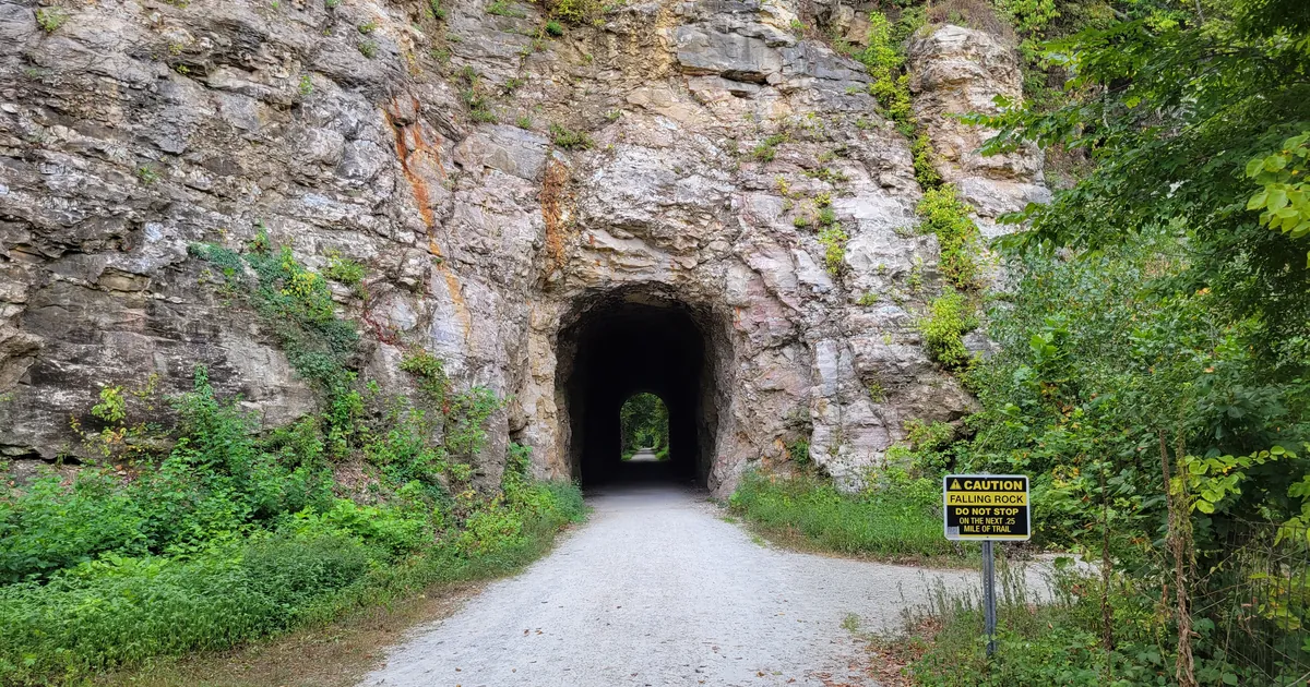
The water reaches Jefferson City last. At 7:45 p.m. Saturday the river there stood at 18.1 feet. St. Louis forecasts it to pass the 23-foot flood stage Sunday evening and crest at 24.8 feet early Monday afternoon. The warning's listed impact also changed. Friday's warning began its list with Route 179 at 26.3 feet. Saturday's warning names the Katy Trail near Rocheport, which floods at 24.5 feet. That puts the trail three tenths of a foot under the forecast crest.
Hermann is where the revision mattered most. Friday's forecast crest of 23.1 feet was above the 22.3-foot height where Old Rock Road and Twisters Road south of Rhineland begin to flood. Saturday's forecast crest is 22.0 feet, just under that height. Chamois is forecast to crest at 18.2 feet early Tuesday morning, down from 19.1 feet. Both gages are forecast to drop back below flood stage Tuesday afternoon.
The margins at Rocheport and Rhineland are a few tenths of a foot. Forecasts this week have moved by that much from one issuance to the next.
| Gage | Stage in the warning (CDT) | Flood stage | Forecast crest (Sat. evening issuance) | Earlier forecast | Listed impact near the crest |
|---|---|---|---|---|---|
| Missouri River at Glasgow, Mo. | 27.6 ft (7:30 p.m. Sat.) | 25.0 ft | 30.3 ft Sun. evening | 30.7 ft (Sat. a.m.), 31.1 ft (Fri.) | 27.0 ft: many agricultural levees overtopped; 32.0 ft: Highway 240 west of Glasgow, city park |
| Missouri River at Boonville, Mo. | 22.1 ft (7:04 p.m. Sat.) | 21.0 ft | 26.4 ft early Mon. morning | 26.8 ft (Sat. a.m.), 27.2 ft (Fri.) | 25.0 ft: farm levees overtopped, Perche Creek backwater floods McBaine |
| Missouri River at Jefferson City, Mo. | 18.1 ft (7:45 p.m. Sat.) | 23.0 ft | 24.8 ft early Mon. afternoon | 25.6 ft early Tue. (Fri.) | 24.5 ft: Katy Trail floods near Rocheport |
| Missouri River near Chamois, Mo. | 8.0 ft (7:00 a.m. Sat.) | 17.0 ft | 18.2 ft early Tue. morning | 19.1 ft (Fri.) | 17.0 ft: lower bottom land begins to flood |
| Missouri River at Hermann, Mo. | 13.8 ft (7:30 p.m. Sat.) | 21.0 ft | 22.0 ft early Tue. morning | 23.1 ft (Fri.) | 22.3 ft: Old Rock Road and Twisters Road south of Rhineland |
*Source: NWS Kansas City/Pleasant Hill Flood Warnings issued 7:52 p.m. CDT Oct. 3, 2026, and NWS St. Louis Flood Warnings issued 8:26 p.m. CDT Oct. 3, 2026. Earlier forecasts are from this desk's Oct. 3 stories, which quoted the Friday and Saturday-morning warnings. River forecasts change with each issuance, and newer ones may have replaced these by the time you read this.*
Central Iowa crests today, right at the line
NWS Des Moines issued its warnings at 3:30 a.m. CDT Sunday, and two of them describe rivers cresting almost exactly at flood stage. The Des Moines River at the SE 6th Street gage in Des Moines read 24.0 feet at 3:15 a.m., which is its flood stage. It is forecast to crest at 24.1 feet this morning and drop below flood stage late this morning. At 24 feet, the warning says, the bike trail east of Water Street is closed.
The South Skunk River at Colfax read 17.7 feet at 2:45 a.m. and was rising. It is forecast to pass its 18-foot flood stage this morning, crest at 18.1 feet this afternoon, and fall back below flood stage late this evening. The warning's first listed impact is at 19 feet, the earthen levee west of town, so the forecast crest is nine tenths of a foot under it.
| Gage | Stage in the warning (CDT) | Flood stage | Forecast crest | First listed impact |
|---|---|---|---|---|
| Des Moines River at Des Moines SE 6th St, Iowa | 24.0 ft (3:15 a.m. Sun.) | 24.0 ft | 24.1 ft this morning | 24.0 ft: bike trail closed east of Water St. |
| South Skunk River at Colfax, Iowa | 17.7 ft (2:45 a.m. Sun.) | 18.0 ft | 18.1 ft this afternoon | 19.0 ft: earthen levee west of town |
*Source: NWS Des Moines Flood Warnings issued 3:30 a.m. CDT Oct. 4, 2026.*
This is a morning summary, not emergency information. For live warnings see weather.gov and your local officials, and for river forecasts see water.noaa.gov.
The rock's live forecast for the places in this story
More from the Journal



Follow the Journal: RSS · get it by email