THE WEATHER BEAT · OCT 1
Fourteen tornado reports across central Kansas on Wednesday, and up to five inches of rain behind them
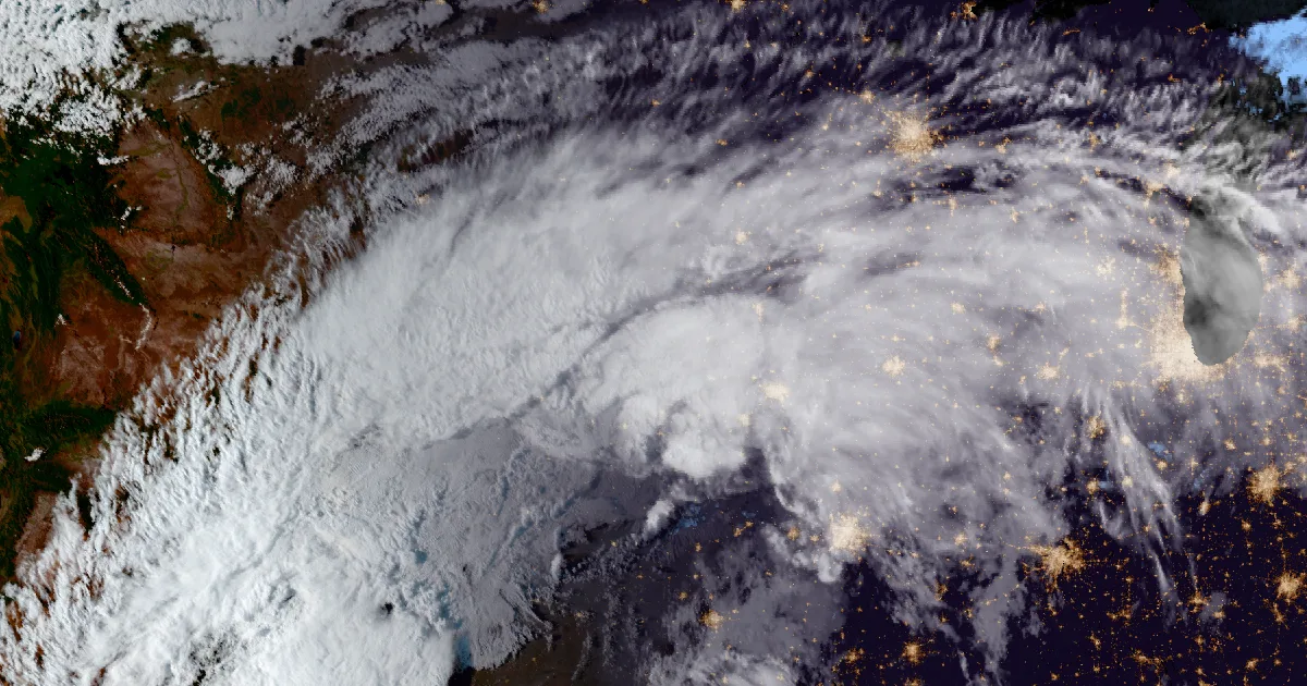
From Ash Valley at 3:49 p.m. to Ash Grove at 7:01 p.m., spotters reported tornadoes across five Kansas counties. Then came four to five inches of rain.

Key points
- Spotters, storm chasers and an emergency manager sent 14 preliminary tornado reports to the Dodge City and Wichita weather offices on Wednesday, Sept. 30. They came in between 3:49 p.m. and 7:01 p.m. CDT, from Pawnee County in the south to Lincoln County in the north.
- In those reports the only damage is "to some outbuildings" near Susank in Barton County. Every report is preliminary, and no damage survey had been published when this was written.
- Rain followed the storms. By about 11:50 p.m. CDT, mesonet gauges around Beloit, Luray and Smith Center had measured 4 to 5 and a quarter inches.
Yesterday: a long afternoon of tornadoes across central Kansas
The first tornado warning went up at 3:20 p.m. CDT for central Pawnee County. At 3:49, a storm chaser streaming live video reported a tornado 3 miles south-southwest of Ash Valley. Dodge City's warning text called it a "weak, brief tornado". That storm did not stay weak or brief for long. It, or storms right behind it, kept producing warnings northeast for the next five hours.
Between 4:52 and 5:10 p.m. the storms crossed northwest Barton County, and the reports came in close together. Chaser video showed a tornado north of Olmitz. A trained spotter reported "multiple tornadoes ongoing" east of Galatia. Chasers saw "several brief touchdowns" west of Susank. North-northwest of Susank, a spotter logged the only damage in the Wichita office's day summary: "Tornado damage to some outbuildings."
At 5:51 p.m. a spotter reported a rope tornado 3 miles west of Dorrance, north of Interstate 70. The warning at that hour put Interstate 70 between mile markers 189 and 203 in the storm's path. The storms then crossed Wilson Lake. At 6:24 a spotter reported a tornado 3 miles west of the Wilson Lake Dam. A member of the public reported an "elephant trunk" tornado east of Lucas at 6:39. The Lincoln County emergency manager reported one 5 miles north of Sylvan Grove at 6:53. At 7:01 a spotter reported a multi-vortex tornado 4 miles south of Ash Grove.
The Hastings office carried the warnings into Mitchell County after that, around Victor and later Asherville. Its last tornado warning was cancelled at 9:03 p.m. CDT. Through the evening the warnings said a Tornado Watch remained in effect until 11 p.m. CDT for central Kansas.
Then the rain came. At 7:19 p.m. a spotter reported water over Highway 181 in several places west of Ash Grove. Just before midnight, the Hastings office listed mesonet totals above four inches at eight gauges in Mitchell, Osborne and Smith counties.
| Time (CDT, Sept. 30) | Report | Place | County | Source |
|---|---|---|---|---|
| 3:49 p.m. | Tornado | 3 SSW Ash Valley | Pawnee | Storm chaser |
| 3:53 p.m. | Tornado | 1 SE Ash Valley | Pawnee | Storm chaser |
| 4:52 p.m. | Tornado | 4 NNE Olmitz | Barton | Storm chaser |
| 4:58 p.m. | Tornado (multiple) | 4 ESE Galatia | Barton | Trained spotter |
| 5:01 p.m. | Tornado (brief touchdowns) | 4 W Susank | Barton | Storm chaser |
| 5:06 p.m. | Tornado | 4 NW Susank | Barton | Trained spotter |
| 5:10 p.m. | Tornado, outbuildings damaged | 4 NNW Susank | Barton | Trained spotter |
| 5:51 p.m. | Tornado (rope) | 3 E Bunker Hill | Russell | Trained spotter |
| 6:24 p.m. | Tornado | 6 S Lucas | Russell | Trained spotter |
| 6:39 p.m. | Tornado | 3 E Lucas | Lincoln | Public |
| 6:43 p.m. | Tornado | 4 NW Sylvan Grove | Lincoln | Trained spotter |
| 6:45 p.m. | Tornado | 4 E Lucas | Lincoln | Trained spotter |
| 6:53 p.m. | Tornado | 5 N Sylvan Grove | Lincoln | Emergency manager |
| 7:01 p.m. | Tornado (multi-vortex) | 4 S Ash Grove | Lincoln | Trained spotter |
| 7:19 p.m. | Flood, water over Highway 181 | 3 WSW Ash Grove | Lincoln | Trained spotter |
| Rain gauge (mesonet) | County | Total |
|---|---|---|
| 4 S Beloit | Mitchell | 5.26 in |
| 7 NE Luray | Osborne | 5.21 in |
| 1 E Beloit | Mitchell | 5.01 in |
| 8 NW Victor | Mitchell | 4.61 in |
| Smith Center | Smith | 4.56 in |
| Glen Elder | Mitchell | 4.46 in |
| Cawker City | Mitchell | 4.28 in |
| 11 N Luray | Osborne | 4.15 in |
- Tornado warnings: 12 issued between 3:20 p.m. and 8:50 p.m. CDT. Dodge City issued 2, Wichita 7 and Hastings 3.
*Source: NWS Dodge City, Wichita and Hastings preliminary Local Storm Reports and tornado warning texts, Sept. 30, 2026. All reports are preliminary. Several reports may describe the same tornado, so 14 reports is not a count of tornadoes. The Storm Prediction Center's report file could not be reached for this brief. Hastings tornado reports, if any were filed, are not in this table. Rain totals are as listed between 11:41 p.m. and 11:53 p.m. CDT.*
Today, officially
The Storm Prediction Center's day 1 outlook, as carried on the wire at 6:50 a.m. CDT, reads: "Severe thunderstorm potential is low today, but some gusty winds could accompany thunderstorms from parts of Kansas to the eastern half of Texas." The early hours were wet farther south. Norman, Okla., issued a Flash Flood Warning at 6:08 a.m. CDT for Garvin, Johnston, Murray and Pontotoc counties until 7:45 a.m. San Angelo and Austin/San Antonio issued Flash Flood Warnings for Kimble, Mason and Sutton counties until 9:15 a.m. and for Edwards and Val Verde counties until 10 a.m. Nobody has said yet what Wednesday's tornadoes were rated. That waits on the National Weather Service's damage surveys, and this desk will report them when they are published.
This is a morning summary, not emergency information. For live warnings see weather.gov and your local officials.
The rock's live forecast for the places in this story
More from the Journal


Follow the Journal: RSS · get it by email