THE WEATHER BEAT · OCT 24
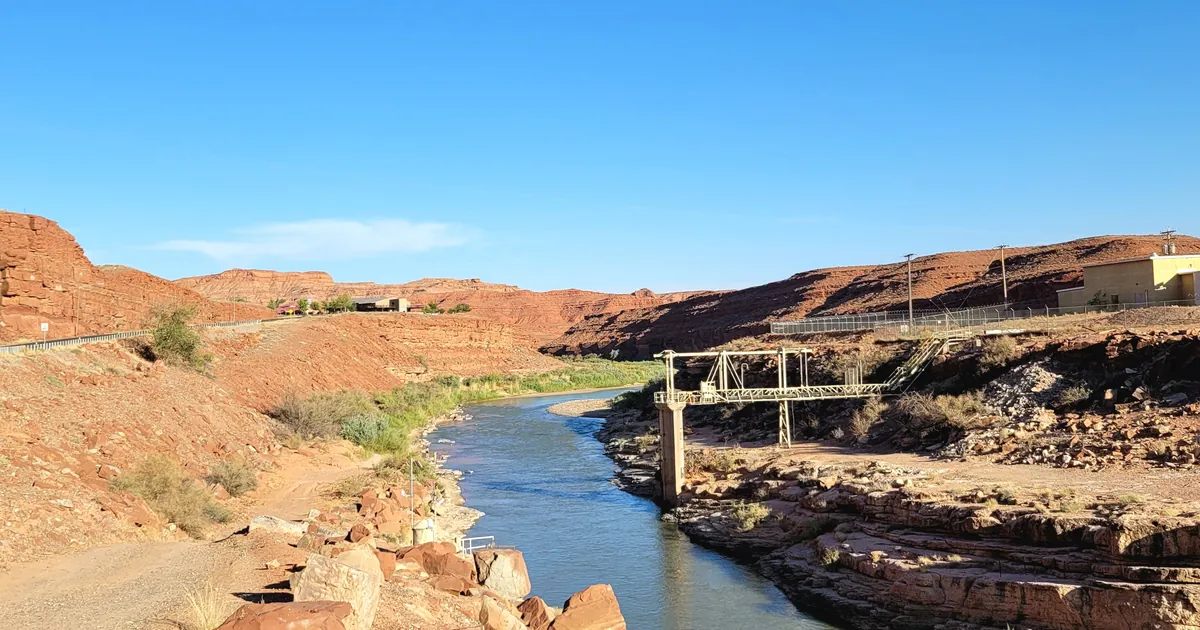
The San Juan River's flood crest heads into Utah, due near 31 feet at Mexican Hat Sunday, after a record stage at Shiprock
Grand Junction calls the San Juan crest headed for Bluff and Mexican Hat catastrophic, and Shiprock ran higher than forecast, the highest on record.


Key points
- The San Juan River's flood crest is moving into Utah. NWS Grand Junction's 7:28 p.m. MDT warning calls it "Catastrophic flooding" from the Four Corners to Mexican Hat and says "This is an emergency situation!" The office expects the river at Mexican Hat to peak near 31 feet around 7 p.m. Sunday, just below major flood stage.
- At Shiprock, New Mexico, NWS Albuquerque now calls the San Juan's stage "the highest river stage on record." The gauge read 21.2 feet before it stopped reporting, which is higher than the 20.7-foot crest forecast this morning. Upstream at Farmington, the San Juan and the Animas have crested and are falling.
- Thunderstorms brought new flash flooding to New Mexico this evening. Law enforcement reported up to 3.5 inches of rain near Laguna and Acoma pueblos, and Interstate 40 was closed between mile markers 102 and 108. Severe Thunderstorm Watch 697 runs until 10 p.m. MDT across 11 New Mexico and 3 Texas counties.
The river moves downstream
This morning's story ended with two crests to check. The first was due at Shiprock late Saturday morning, and it came in higher than forecast. Albuquerque's 4:11 p.m. MDT warning says the river at Shiprock reached 21.2 feet in the 24 hours ending 4 a.m., and that this was the last reading the gauge sent. The office thinks the river is "likely near crest around or just above 22 feet," calls it the highest stage on record, and says catastrophic flooding at and near Shiprock will go on through the evening. Flood stage there is 15.5 feet.
The second crest is still on its way. The water that passed Farmington and Shiprock is now headed for the canyon country of southeastern Utah. At 7:28 p.m. Grand Junction laid out the timing: a crest at the Four Corners around 1 a.m. Sunday, at Montezuma Creek around 6 a.m., between Bluff and Mexican Hat on Sunday afternoon, and at Mexican Hat near 31 feet by 7 p.m. Sunday. The office's words do not all match. The header says "Catastrophic flooding" and "an emergency situation," while the impacts line says "near major flooding forecast" and the details say the river will peak just below major flood stage. The Salt Lake City office, in a warning sent at 4:04 p.m. for the stretch from below Bluff to Lake Powell, puts the crest at Bluff near midnight Sunday night. That is several hours after Grand Junction's timing. Both offices say low-water crossings are under water and that no one should try to cross.
Upstream the water is going down. Albuquerque says the San Juan at Farmington has crested and should drop below flood stage around midnight. At its crest the flooding reached an extent "not observed since before the completion of Navajo Dam in 1962." The Animas at Farmington read 10.9 feet at 2:30 p.m. after a 24-hour high of 11.6 feet, and the office expects it below flood stage this evening.
| River point | Office | Latest in the product | Flood stage | What the product says next | Issued |
|---|---|---|---|---|---|
| San Juan River at Shiprock NM | Albuquerque | 24 h max 21.2 ft ending 4 a.m. Sat, last observation; likely near crest around or just above 22 ft | 15.5 ft | below flood stage Sunday afternoon; "highest river stage on record" | 4:11 p.m. MDT Sat |
| San Juan River at Farmington NM | Albuquerque | no current observed data; crested | 8.5 ft | below flood stage around midnight, falling to 3.5 ft early in the week | 4:01 p.m. MDT Sat |
| Animas River at Farmington NM | Albuquerque | 10.9 ft at 2:30 p.m. Sat, 24 h max 11.6 ft | 10.0 ft | below flood stage this evening; previous crest 11.0 ft, 05/14/1941 | 3:49 p.m. MDT Sat |
| San Juan River, Four Corners to Mexican Hat | Grand Junction | crest at Four Corners about 1 a.m. Sun, Montezuma Creek about 6 a.m. Sun | not given | Mexican Hat near 31 ft by 7 p.m. Sun, just below major | 7:28 p.m. MDT Sat |
| San Juan River, below Bluff to Lake Powell | Salt Lake City | rising | not given | crest near midnight Sunday night at Bluff; flooding to Lake Powell through Monday morning | 4:04 p.m. MDT Sat |
*Source: NWS river Flood Warnings on api.weather.gov, read at 01:30Z October 25. Every stage and time is the product's own figure. Where the two Utah products disagree on timing, both are shown with their issue times.*
Tonight, officially
The rain has not ended. At 6:53 p.m. Albuquerque extended a Flash Flood Warning for eastern Cibola and east central McKinley counties. Law enforcement reported up to 3.5 inches of rain there, and Interstate 40 was closed between mile markers 102 and 108. A separate warning for the Rio San Jose says radar estimates 3 to 8 inches have fallen over three days near Grants, Laguna and Cubero. At 7:04 p.m. emergency management reported flash flooding on Magado Creek near Capitan in Lincoln County. In Colorado, the Pueblo office reported 1 to 1.5 inches near Colorado City and several vehicles sliding off Interstate 25 between mile markers 68 and 80.
At the time of the house wire's 01:30Z pull, the Storm Prediction Center's highest category was Marginal. Its summary: "Isolated severe wind/hail and a tornado remain possible across portions of New Mexico and Far West Texas this evening." Severe Thunderstorm Watch 697 covers Albuquerque, Las Cruces, El Paso, Roswell, Carlsbad and Ruidoso until 10 p.m. MDT.
| Product | Office | Area | In force until |
|---|---|---|---|
| Flash Flood Warning | Albuquerque NM | eastern Cibola and east central McKinley counties, I-40 mile markers 92 to 114 | 9 p.m. MDT Sat |
| Flood Warning | Albuquerque NM | Rio San Jose, northeastern Cibola and northwestern Valencia counties | 3:30 p.m. MDT Sun |
| Flash Flood Warning | Albuquerque NM | Lincoln County near Capitan and Lincoln, Highway 380 | 9:15 p.m. MDT Sat |
| Flash Flood Warning | Pueblo CO | southwestern Pueblo County, Colorado City | 9:30 p.m. MDT Sat |
| Severe Thunderstorm Watch 697 | Albuquerque, El Paso, Midland | 11 New Mexico counties, El Paso, Hudspeth and Culberson in Texas | 10 p.m. MDT Sat |
*Source: NWS products on api.weather.gov, read at 01:30Z October 25. The watch number and the county lists come from the watch text that each office printed. One SPC watch appears there as three office rows, and it is counted once here.*
What the reader can check
The Shiprock forecast this morning was 20.7 feet, and the river went past it before the gauge stopped reporting. The next test is downstream. Grand Junction says the river reaches Mexican Hat near 31 feet by 7 p.m. Sunday, and Salt Lake City says the Bluff crest comes near midnight Sunday night. Monday's warnings will show which timing was right. The Weather School page on watches, warnings and advisories explains why the Four Corners can carry a river warning, a flash flood warning and a watch at the same time.
This is a morning summary, not emergency information. For live warnings see weather.gov and your local officials.
More from the Weather Beat
More from the Journal
 THE WEATHER BEAT
A rare Coastal Flood Warning for the San Diego and Orange County coasts, Sunday to Thursday, as the Upper Keys go to major
OCT 23
 THE WEATHER BEAT
The St. Johns River at Astor, Florida, reaches moderate flood stage on days of northeast wind, with stronger wind due this weekend
OCT 22
 EXPLAINERS
Why Is the Sky Blue?
AUG 20
Follow the Journal: RSS · get it by email