THE WEATHER BEAT · OCT 24
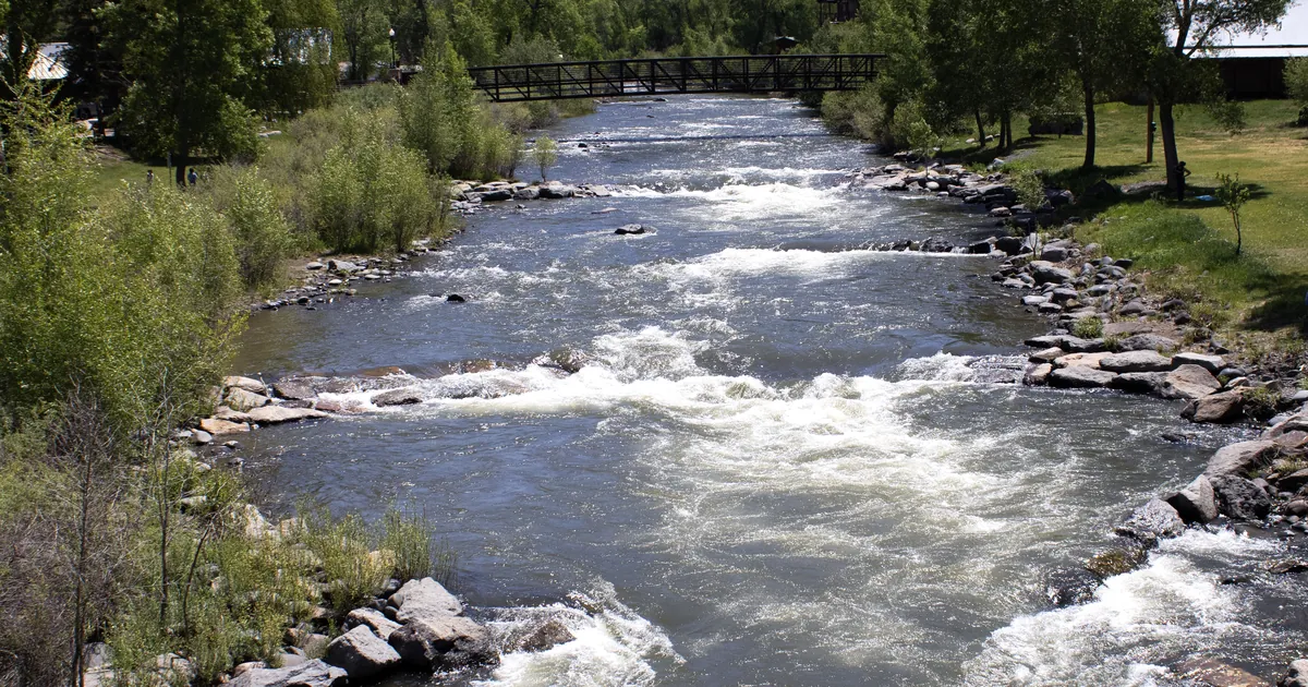
The San Juan River sets a flood of record at Farmington as the Animas and the Rio Grande run near their highest crests
NWS Albuquerque calls the San Juan at Farmington the flood of record; Colorado reports flooded structures and Rio Grande evacuations.


Key points
- NWS Albuquerque calls Friday's crest on the San Juan River at Farmington, New Mexico, "the flood of record." The previous record there was 12.3 feet on September 6, 1909. The office's warning says the river has likely crested and is expected to drop below flood stage Saturday afternoon.
- The Animas River at Farmington was likely near a 12-foot crest late Friday. Flood stage there is 10.0 feet, and the warning says water has not been this high since the flood of 1927. Upstream in Colorado, NWS Grand Junction reported several structures flooded in Archuleta and La Plata counties. NWS Pueblo reported housing areas evacuated along the Rio Grande from above South Fork to Monte Vista.
- As of the outlook on the wire at 12:00Z, the Storm Prediction Center has a Slight risk over parts of New Mexico and far west Texas. Flood Watches run through late Saturday night or Sunday morning from the Four Corners to Albuquerque, Santa Fe, the Sacramento Mountains and El Paso.
Overnight, the rain reached the rivers
All week this story was about watches, then about washes and canyons in Arizona and Utah. Overnight it moved downstream into the rivers that drain the San Juan Mountains, and several of them rose higher than anyone has measured.
The biggest was the San Juan at Farmington. The Albuquerque office's 11:31 p.m. MDT warning says major flooding continues and "This is the flood of record." It adds that there is no current observed data at the gauge, so the office gives no stage. It says the river has likely crested and will slowly fall. The Animas joins the San Juan at Farmington, and it was near the top of its own record. Upstream near Cedar Hill, the Animas read 11.9 feet at 5 p.m. Friday, above a previous crest of 11.5 feet in June 1949. At Farmington itself the office expected a crest near 12 feet and said the riverwalk is flooded and should be avoided. The La Plata River below Redmesa was forecast to crest at 10.5 feet just after midnight, close to its 1934 crest of 10.8. Downstream at Shiprock, the San Juan read 17.3 feet at 10 p.m. Friday and was forecast to reach 20.7 feet late Saturday morning.
In Colorado the reports came from people, not only from gauges. Grand Junction's warnings for Archuleta, La Plata and Hinsdale counties cite emergency management reports of "numerous reports of damage and flooding impacts," several flooded structures and many closed roads, from Pagosa Springs to Durango, Bayfield and Ignacio. The San Juan at Pagosa Springs hit 15.0 feet in the 24 hours ending 11 p.m. Friday, then fell to 11.4 feet. Grand Junction's product disagrees with itself on that point: its header says "Major flooding is forecast" and its WHAT line says minor flooding. Across the divide, the Pueblo office said several roads remain closed and housing areas were evacuated along the Rio Grande. It also said Highway 160 remains closed between South Fork and Wolf Creek Pass. The Rio Grande near Del Norte read 6.4 feet at 6:46 p.m., which matches its June 1927 crest.
Farther south, Albuquerque reported the Rio San Jose flooding near Laguna Pueblo along I-40. The Rio Chama below Chamita reached 8.0 feet in the 24 hours ending 7 p.m. Friday. In Utah, Grand Junction expects a second, higher crest on the San Juan at Mexican Hat on Sunday into Monday.
| River point | Office | Reading | Flood stage | Previous crest in the product | Issued |
|---|---|---|---|---|---|
| San Juan River at Farmington NM | Albuquerque | no observed data; "the flood of record", likely crested | 8.5 ft | 12.3 ft, 09/06/1909 | 11:31 p.m. MDT Fri |
| Animas River at Farmington NM | Albuquerque | stage unknown, likely near crest around 12 ft | 10.0 ft | 11.0 ft, 05/14/1941 | 11:18 p.m. MDT Fri |
| Animas River near Cedar Hill NM | Albuquerque | 11.9 ft at 5 p.m. Fri | 10.5 ft | 11.5 ft, 06/19/1949 | 6:18 p.m. MDT Fri |
| La Plata River below Redmesa NM | Albuquerque | crest 10.5 ft forecast just after midnight | 9.0 ft | 10.8 ft, 08/26/1934 | 11:27 p.m. MDT Fri |
| San Juan River at Shiprock NM | Albuquerque | 17.3 ft at 10 p.m. Fri, crest 20.7 ft forecast late Sat morning | 15.5 ft | none available | 10:16 p.m. MDT Fri |
| Rio Chama below Chamita NM | Albuquerque | 6.5 ft at 7 p.m. Fri, 24 h max 8.0 ft | 6.0 ft | 6.7 ft, 05/22/1995 | 7:24 p.m. MDT Fri |
| San Juan River at Pagosa Springs CO | Grand Junction | 11.4 ft at 11 p.m. Fri, 24 h max 15.0 ft | 10.5 ft | not given | 11:21 p.m. MDT Fri |
| Rio Grande near Del Norte CO | Pueblo | 6.4 ft at 6:46 p.m. Fri, 24 h max 6.6 ft | 5.5 ft | 6.4 ft, 06/29/1927 | 7:12 p.m. MDT Fri |
*Source: NWS river Flood Warnings on api.weather.gov, read at 12:00Z October 24. Every stage, flood stage and previous crest is the product's own figure. The previous crests are the ones each office printed in its "Flood History" line. They are not a complete record, and this brief adds none. Several of these warnings expire at midday Saturday.*
Today, officially
As of the Day 1 outlook on the house wire at 12:00Z (the wire printed no issue time), the Storm Prediction Center's highest category is Slight. Its summary reads: "Severe wind/hail and a tornado are possible across portions of New Mexico and far west Texas today." Albuquerque's Flood Watch, sent 10:45 p.m. MDT Friday, runs through late Saturday night. It covers the Albuquerque and Santa Fe metro areas, the Jemez and Sangre de Cristo mountains and the Upper Rio Grande Valley. El Paso's watch expects widespread rain of about 1 inch over the Sacramento Mountains, with 2 to 3 inches in spots. Grand Junction's watch for the Animas and San Juan river basins and southeast Utah runs through Sunday morning. The office warned that another 0.5 to 1 inch from thunderstorms would land on rivers that are "slow to recede."
| Product | Office | Area | In force until |
|---|---|---|---|
| Flood Watch | Albuquerque NM | central, north central and northeast New Mexico, incl. Albuquerque and Santa Fe | late Saturday night (ends 6 a.m. MDT Sun) |
| Flood Watch | El Paso TX | Sacramento Mountains, Otero County, El Paso and Hudspeth counties | late Saturday night (ends 6 a.m. MDT Sun) |
| Flood Watch | Grand Junction CO | Animas and San Juan basins, southwest San Juan Mountains, southeast Utah | Sunday morning (ends noon MDT Sun) |
| Flood Warning | Grand Junction CO | San Juan River, Montezuma CO and San Juan UT | 9 a.m. MDT Mon |
*Source: NWS Flood Watch products on api.weather.gov, read at 12:00Z October 24. The SPC line is the outlook summary as the house wire printed it.*
What the reader can check
A river warning is a scheduled forecast: a stage, a crest and a time. The Shiprock crest of 20.7 feet was due late Saturday morning, and the second rise at Mexican Hat is due Sunday into Monday. Tomorrow's gauge readings will show whether either one arrived on time. The Weather School page on watches, warnings and advisories explains why one river can carry a watch upstream and a warning downstream on the same day.
This is a morning summary, not emergency information. For live warnings see weather.gov and your local officials.
More from the Weather Beat
More from the Journal
 THE WEATHER BEAT
The St. Johns River at Astor, Florida, reaches moderate flood stage on days of northeast wind, with stronger wind due this weekend
OCT 22
 THE WEATHER BEAT
Coastal Flood Watches from Jacksonville to the Georgia beaches as Miami warns of the season's peak King Tide this weekend
OCT 22
 EXPLAINERS
Why Is the Sky Blue?
AUG 20
Follow the Journal: RSS · get it by email