THE WEATHER BEAT · OCT 23
A rare Coastal Flood Warning for the San Diego and Orange County coasts, Sunday to Thursday, as the Upper Keys go to major
NWS San Diego expects significant coastal flooding at high tide from Sunday to Thursday, with morning tides over 7.5 feet by Monday; the Upper Keys now.


Key points
- At 11:03 a.m. PDT Friday, NWS San Diego issued a Coastal Flood Warning for the San Diego County and Orange County coasts. It runs "from 5 AM Sunday to 1 PM PDT Thursday during high tides" and says "Significant coastal flooding expected."
- The office expects tides "1 to 1.7 feet above predicted," with the high tide each day in the morning. Its earlier discussion said morning high tides "are likely to exceed 7.5 feet by Monday morning."
- At 9:07 a.m. EDT, NWS Key West raised the Upper Keys from last night's advisory to a Coastal Flood Warning for "Major saltwater flooding" during times of high tide through Saturday morning.
High tides on the Southern California coast
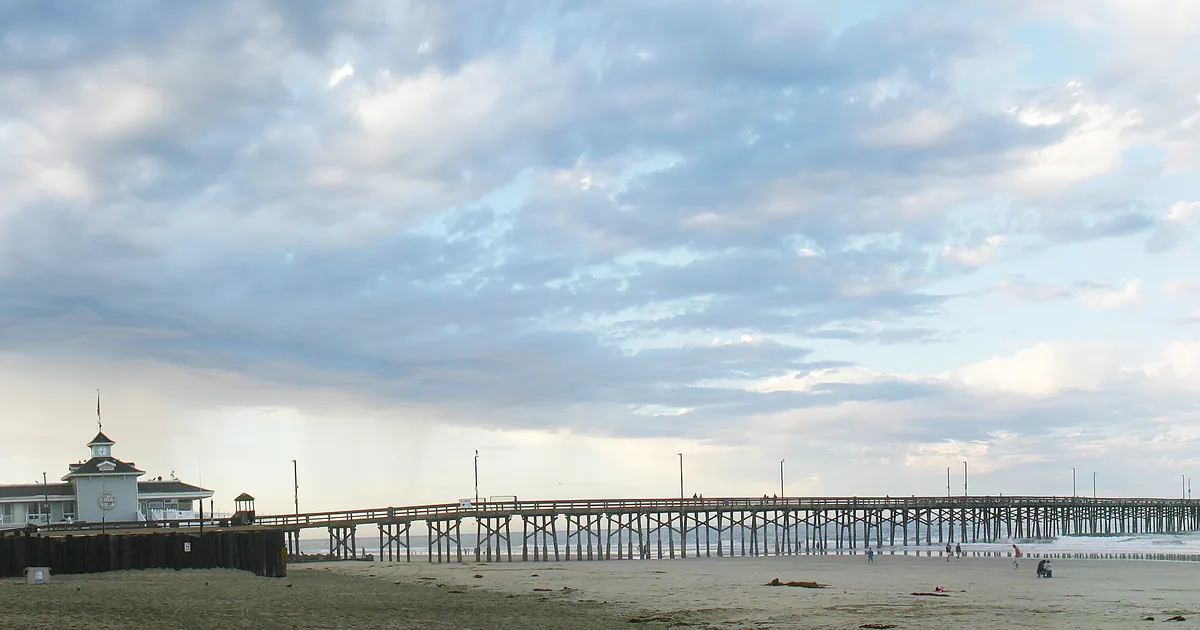
California does not often get a Coastal Flood Warning. On Friday morning, NWS San Diego issued one for the San Diego and Orange County coasts. It covers every high tide from Sunday morning to Thursday afternoon. The warning lists what it expects: "Numerous roads may be closed. Low lying property including homes, businesses, and some critical infrastructure will be inundated. Some shoreline erosion will occur in the morning hours." Those are the same impact words Jacksonville used for its watch last night. The difference is the verb: a watch says "may," and this warning says "will."
The office's 4:31 a.m. PDT discussion gives the cause in three words: "Astronomical high tides." Its beaches section expected minor to moderate coastal flooding "starting Saturday," with tides 1.4 to 1.6 feet above predictions. It said morning high tides could reach 7 feet on Saturday morning and "are likely to exceed 7.5 feet by Monday morning," with "Locally significant impacts expected from Monday to Wednesday." When that discussion went out, the office listed no watches, warnings or advisories. The warning came six and a half hours later. It starts Sunday rather than Saturday and gives a range of 1 to 1.7 feet above predicted. The two products disagree slightly on the start and the range, so this story prints both and quotes the warning for the window.
The weather itself is quiet next to the water. The same discussion expected showers to end from the northwest Friday night, then a dry, warmer weekend through Monday and a gradual cooling from Tuesday to Thursday. Its marine section expected "no hazardous marine conditions" through Tuesday. The flooding in this warning comes from the tide, not from a storm at sea.
| Product | Office | Where | What it says | Issued | Runs |
|---|---|---|---|---|---|
| Coastal Flood Warning | San Diego CA | San Diego County Coastal Areas, Orange County Coastal Areas | significant coastal flooding expected; tides 1 to 1.7 ft above predicted | 11:03 a.m. PDT Fri | 5 a.m. Sun to 1 p.m. PDT Thu, during high tides |
| Area Forecast Discussion, beaches | San Diego CA | the same coast | minor to moderate flooding from Saturday; tides 1.4 to 1.6 ft above predictions; about 7 ft Sat morning, over 7.5 ft by Mon morning; locally significant Mon to Wed | 4:31 a.m. PDT Fri | Saturday to Wednesday |
*Source: NWS San Diego Coastal Flood Warning and Area Forecast Discussion (AFDSGX 231131) on api.weather.gov, read at 18:15Z October 23. The warning's own "expires" field reads 8:15 a.m. PDT Sunday, earlier than the window in its WHEN line, so this table prints the WHEN line.*
The Keys, one rung higher
Last night's Florida story ended in the Keys, where NWS Key West expected saltwater flooding in the Upper Keys. On Friday morning the office moved the Upper Keys up a rung. It now has a Coastal Flood Warning for "Major saltwater flooding" during times of high tide through Saturday morning, with the same impact words as the California warning. The Middle Keys have an advisory for moderate saltwater flooding and the Lower Keys one for minor to moderate. Both say "some seawalls and docks will be overtopped" and remind drivers that puddles near high tide "are almost certain to contain a mix of saltwater."
| Product | Office | Where | What it says | Issued | Runs |
|---|---|---|---|---|---|
| Coastal Flood Warning | Key West FL | Upper Keys | major saltwater flooding | 9:07 a.m. EDT Fri | high tides through Saturday morning |
| Coastal Flood Advisory | Key West FL | Middle Keys | moderate saltwater flooding | 9:07 a.m. EDT Fri | high tides through Saturday morning |
| Coastal Flood Advisory | Key West FL | Lower Keys | minor to moderate saltwater flooding | 9:07 a.m. EDT Fri | high tides through Saturday morning |
*Source: NWS Key West products on api.weather.gov, read at 18:15Z October 23.*
What the reader can check
San Diego has put numbers on its forecast: about 7 feet on Saturday morning's high tide, more than 7.5 feet by Monday morning, and the worst of it from Monday to Wednesday. If you live near the San Diego or Orange County shore, watch the morning high tides. Did the water peak early in the week, as the discussion expects? Did the warning end on Thursday, or was it extended? The Weather School lesson on watches, warnings and advisories explains why one office calls the same words a watch and another calls them a warning.
This is a summary of official warnings, not emergency information. For live warnings see weather.gov and your local officials.
More from the Weather Beat
More from the Journal
 THE WEATHER BEAT
Tornado Watch for northern Arizona and a Flash Flood Warning on the Moenkopi Wash after an 8-foot gauge rise
OCT 21
 THE WEATHER BEAT
On this date in 1983, six Oklahoma and Texas Panhandle gauges recorded their wettest day, led by 10.6 inches at Shawnee
OCT 20
 EXPLAINERS
Why Is the Sky Blue?
AUG 20
Follow the Journal: RSS · get it by email