THE WEATHER BEAT · OCT 21
Tornado Watch for northern Arizona and a Flash Flood Warning on the Moenkopi Wash after an 8-foot gauge rise
Tornado Watch 688 covers Flagstaff, Sedona, Prescott and Kingman until 6 p.m. MST, and a Moenkopi Wash gauge rose about 8 feet by late morning.


Key points
- Northern Arizona is under Tornado Watch 688 until 6 p.m. MST on Wednesday. It covers Coconino, Navajo, Yavapai and Mohave counties, including Flagstaff, Sedona, Prescott, Winslow, Show Low and Kingman. NWS Flagstaff issued its part at 10:10 a.m. MST.
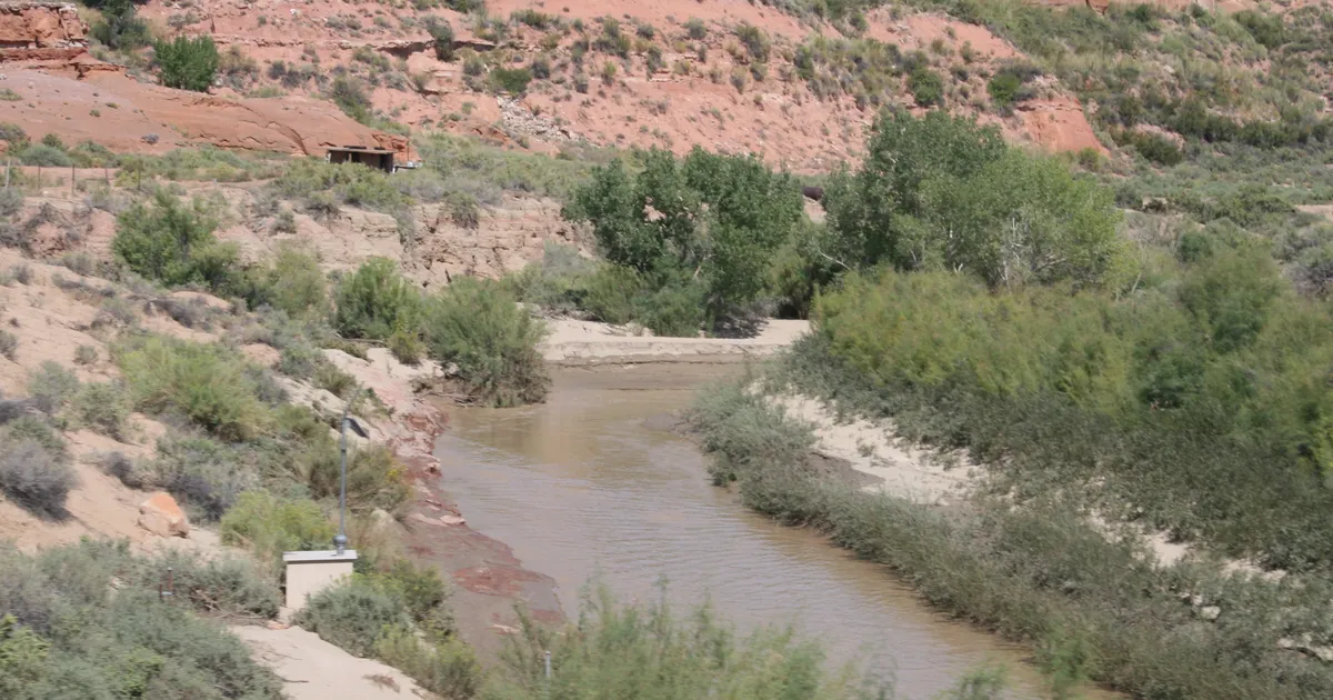
- At 11:02 a.m. MST, a river gauge on the Moenkopi Wash in Coconino County reported a rise of around 8 feet. NWS Flagstaff then issued a Flash Flood Warning there until 3 p.m. MST.
- Flagstaff's morning discussion calls the moisture in the air "highly anomalous for mid-October". It keeps a Flood Watch in force through 11 p.m. MST Thursday. Idaho has new Flash Flood Watches for three burn scar areas, starting Thursday evening.

From outlook to products
This morning's story ended on an outlook: the Storm Prediction Center had an Enhanced risk of severe storms along Arizona's Mogollon Rim. By late morning the outlook had turned into products. At 10:04 and 10:10 a.m., the Las Vegas and Flagstaff offices each issued their share of Tornado Watch 688. Together they cover four counties, from Kingman and Bullhead City in the northwest to Show Low and Whiteriver in the east.
A watch means the setup favors tornadoes. It does not say one has formed. Nothing in the products on the wire at 18:05Z reported a tornado, and this story does not cover one in progress.
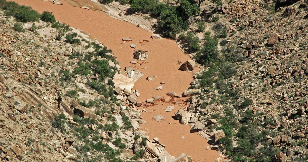
The first measured result came from water, not wind. At 11:02 a.m. MST, a river gauge on the Moenkopi Wash reported a rise of around 8 feet from thunderstorms with heavy rain. The Flagstaff warning names the village of Moenkopi and three road segments: Highway 160, U.S. 89 and State Route 264. It also lists the Little Colorado River and the Begashibito, Fivemile and Hamblin washes. In the National Weather Service's own words, the hazard is "life threatening flash flooding".
Flagstaff's 451 a.m. MST discussion explains why. A strong low off the California coast was moving inland, carrying "a deep moisture surge of tropical and subtropical origins". Precipitable water, the office's measure of how much moisture the air holds, would rise to 0.8 to 1.2 inches across most of its area, which it calls "highly anomalous for mid-October". The office adds that the ground in northern Arizona is already very saturated. It expects several rounds of heavy rain and possible flooding of normally dry washes. The flood threat ends Thursday evening, when a cold front brings much drier air.
| Product | Office | Area | Issued | In force until |
|---|---|---|---|---|
| Tornado Watch 688 | Flagstaff AZ | Coconino, Navajo, Yavapai | 10:10 a.m. MST Wed | 6 p.m. MST Wed |
| Tornado Watch 688 | Las Vegas NV | Mohave AZ | 10:04 a.m. Wed | 6 p.m. MST Wed |
| Flash Flood Warning | Flagstaff AZ | Moenkopi Wash, Coconino | 11:02 a.m. MST Wed | 3 p.m. MST Wed |
| Flood Watch | Flagstaff AZ | northern Arizona | 5 a.m. MST Wed | 11 p.m. MST Thu |
*Source: NWS alert products on api.weather.gov, read at 18:05Z October 21, and the NWS Flagstaff Area Forecast Discussion, 451 a.m. MST October 21. The gauge rise is the warning's own figure. Watch 688 cities: Camp Verde, Cottonwood, Flagstaff, Holbrook, Kayenta, Prescott, Sedona, Show Low, Snowflake, Whiteriver, Winslow, Bullhead City, Kingman, Mohave Valley.*
Next: Idaho's burn scars
The same moisture is forecast to reach Idaho later in the week. Around midday Wednesday, the NWS offices in Boise and Pocatello issued Flash Flood Watches for the Wapiti, Crooked, Big Rock and Ohio wildfire burn scars. Each watch runs from Thursday evening into Friday. Boise says up to 1.25 inches of rain is possible on its scars. Both offices warn of debris flows. The watches name Grandjean, Barber Flat Guard Station, Cape Horn, Banner Summit and Heise.
| Office | Burn scars | Starts | Ends |
|---|---|---|---|
| Boise ID | Crooked, Wapiti | Thu evening | noon MDT Fri |
| Pocatello ID | Wapiti (Sawtooth/Stanley Basin) | Thu evening | noon MDT Fri |
| Pocatello ID | Big Rock, Ohio | Thu evening | 6 p.m. MDT Fri |
*Source: NWS Flash Flood Watch products sent at 10:06 and 11:47 a.m. MDT October 21. The machine-readable expiry field on all three reads Thursday morning, earlier than each WHEN line. This table follows the WHEN lines and the products' end times.*
What the reader can check
This morning's story listed the Flood Watches from Santa Barbara County to the San Juan Mountains. This one adds the watch and the warning that followed. The Weather School page on the thunderstorm recipe explains how moisture, lift and instability combine. All three are named in Flagstaff's discussion.
This is a summary, not emergency information. For live warnings see weather.gov and your local officials.
More from the Weather Beat
More from the Journal
 THE WEATHER BEAT
Watch or warning? Interior Alaska's snowstorm splits: the mountains now under warnings, Fairbanks still on a watch
OCT 19
 THE WEATHER BEAT
Nor'easter stalls off North Carolina: Hatteras and Ocracoke flood warnings now run to Wednesday, Hampton Roads under advisories
OCT 19
 EXPLAINERS
Why Is the Sky Blue?
AUG 20
Follow the Journal: RSS · get it by email