THE WEATHER BEAT · OCT 20
Flood Watches across Arizona, southern Utah and southwest Colorado for Wednesday and Thursday as tropical moisture moves in
Six NWS offices have Flood Watches for Wednesday and Thursday, with local totals above 3 inches in southern Utah and rain rates of 1 to 2 inches an hour.


Key points
- Flood Watches now cover all of northern and central Arizona, the Phoenix area, southern and eastern Utah, southwest Colorado and the Arizona Strip. Most of them start Wednesday and run into Thursday.
- The Salt Lake City office expects local totals above 3 inches in southern Utah and above 2 inches in eastern Utah. The Arizona watches mention rain rates of 1 to 2 inches an hour in places.
- The offices name the same source for the rain: a late season surge of tropical moisture ahead of an upper-level trough.
Six offices, one watch pattern
Six National Weather Service offices put out Flood Watches this morning. Together they cover a long strip of the Southwest, from the Arizona Strip north of the Grand Canyon to the San Juan Mountains of Colorado, and from Zion to the Phoenix valley. These are watches. None of the offices has issued a flood or flash flood warning for the area.
Salt Lake City gave the clearest reason. Its 11:29 a.m. MDT watches say "a late season surge of tropical moisture will bring widespread moderate to at times heavy rainfall" to southern Utah, starting Wednesday morning and lasting through Thursday. The text expects local totals above 3 inches there and above 2 inches over Castle Country and the San Rafael Swell. Flagstaff, at 12:37 a.m. MST, describes the same setup as an upper-level trough bringing "a deep surge of subtropical and tropical moisture" into northern and central Arizona. Its watch covers all of that part of the state, including the Grand Canyon country and the Coconino Plateau.
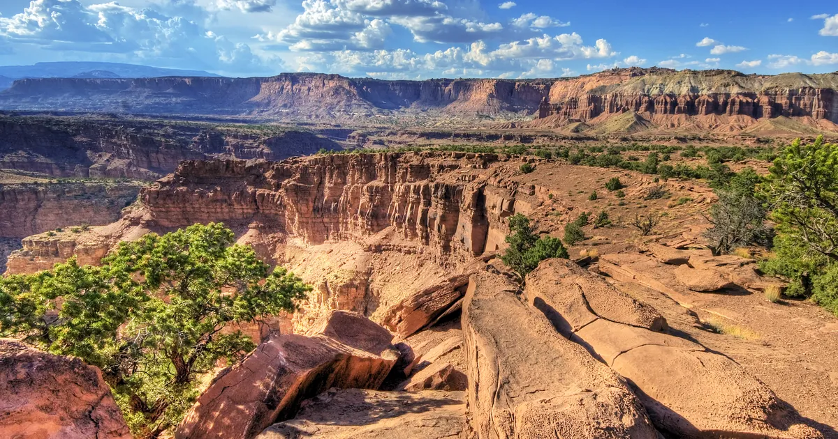
The watch texts also say what the water usually does in this country. Salt Lake City lists dry washes, slot canyons, slickrock areas and recent burn scars, and warns that backcountry roads may become impassable. That applies to places such as Capitol Reef National Park and Zion National Park, both inside the Utah watch area. Phoenix and Tucson say rain rates of 1 to 2 inches an hour are possible at times, and Tucson puts Thursday as the day with the higher chance for those rates.
| Office | Area | Watch starts | Watch runs | Totals or rates in the text |
|---|---|---|---|---|
| Salt Lake City | Southern Utah: Zion, Bryce Canyon, Capitol Reef, Lake Powell, Washington County | Wed morning | Thu evening | local totals above 3 in |
| Salt Lake City | Castle Country, San Rafael Swell | Wed afternoon | Thu evening | local totals above 2 in |
| Grand Junction | Southeast Utah, Four Corners, San Juan Mountains | Wed afternoon | Fri morning | heavy rain possible from Wed night through Fri morning |
| Las Vegas | Northwest Plateau, Arizona | late tonight | Thu afternoon | repeated rounds of storms Wed and Thu |
| Flagstaff | All of northern and central Arizona | late tonight | Thu evening | showers and storms from early Wed |
| Phoenix | Valley, Superstitions, Tonto Basin, Globe | Wed morning to Wed evening, by area | Thu afternoon or evening | rates of 1 to 2 in an hour at times |
| Tucson | Pinal County, Upper Gila, Pinaleno Mountains | Wed morning to Wed evening, by area | Thu afternoon or evening | rates of 1 to 2 in an hour, Thursday higher |
*Times are local to each office (Arizona stays on MST). Source: the NWS Flood Watch products sent between 12:04 a.m. MST and 11:29 a.m. MDT on Tuesday, October 20. One product conflict, reported as it reads: the Phoenix and Tucson products say Wednesday through Thursday in their WHEN lines, but their machine-readable expiry fields read Tuesday afternoon. This table follows the WHEN lines.*
What a watch means here
A Flood Watch says conditions favor flooding. It is not a statement that flooding has begun, and the offices have not said where the heaviest band will set up. The Las Vegas text puts it plainly: a flash flood threat "may develop in areas experiencing repeated rounds of storms." Grand Junction expects strong thunderstorms capable of heavy rain on Wednesday afternoon, followed by widespread moderate to heavy rain from Wednesday night through Friday morning. If your plans take you into a canyon, wash or burn scar region this week, the Weather School page on watches, warnings and advisories explains what each step up means.
This is a morning summary, not emergency information. For live warnings see weather.gov and your local officials.
The rock's live forecast for the places in this story
More from the Weather Beat
More from the Journal
 THE WEATHER BEAT
Winter Storm Watches for Interior Alaska: up to 30 inches possible in the Eastern Alaska Range, 4 to 8 in Fairbanks
OCT 18
 THE WEATHER BEAT
Hurricane Trudy runs along Mexico's west coast at 105 mph, with rapid weakening forecast from tonight
OCT 18
 EXPLAINERS
Why Is the Sky Blue?
AUG 20
Follow the Journal: RSS · get it by email