THE WEATHER BEAT · OCT 23
Jacksonville's Coastal Flood Watches become Warnings from the Georgia beaches to Flagler, Saturday through Monday
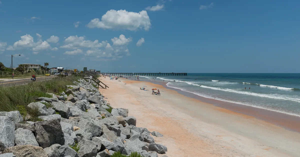
NWS Jacksonville upgraded to Coastal Flood Warnings Friday evening, with water forecast 2 to 3.5 feet above the high tide mark by Sunday.


Key points
- At 7:33 p.m. EDT Friday, NWS Jacksonville turned its Coastal Flood Watches into Coastal Flood Warnings. The warnings cover the northeast Florida coast, the St. Johns River basin and the southeast Georgia beaches, and they run from Saturday to 8 p.m. EDT Monday.
- The office's 8:01 p.m. discussion expects the water to peak 2.0 to 3.5 feet above the normal high tide mark by the Sunday high tides. Northeast wind, Sunday and Monday's full moon and the moon's close pass on October 28 all add to it.
- A Wind Advisory forecasts gusts up to 40 mph along the coast from noon Saturday. High Surf Advisories forecast breaking waves of 7 to 11 feet, and Gale Warnings cover the coastal waters through Monday evening.
Thursday evening's story covered watches. Friday evening they became warnings. NWS Jacksonville wrote in its tides discussion that "this evening's observations and the latest guidance" had prompted an upgrade of the Coastal Flood Advisory and Coastal Flood Watch to a Coastal Flood Warning. The warnings begin with Saturday morning's high tide in the St. Johns River and Saturday evening's along the coast.
Every warning uses the same impact language: "Numerous roads may be closed. Low lying property including homes, businesses, and some critical infrastructure will be inundated." The office expects minor flooding, about 1 to 2 feet above normally dry ground, through Friday night's high tide. Northeast winds then build on Saturday morning. According to the discussion, Sunday and Monday are "when the peak tidal flooding will occur." The cause is the wind together with the full moon on Sunday and Monday, October 25 and 26, and the moon's closest pass on October 28.
The beaches are part of the story too. The office expects more erosion than in the northeast wind event around October 17 and 18. It wrote that "the long duration of this event could produce significant erosion during each high tide cycle during the upcoming week." Inland on the river, the St. Johns at Astor was in moderate flood on Thursday, and NWS Melbourne's Flood Warning for Lake and Volusia counties was still in effect Friday evening.
| Product (NWS Jacksonville) | Where | When (EDT) | What the product says |
|---|---|---|---|
| Coastal Flood Warning | Coastal Duval | 5 a.m. Sat to 8 p.m. Mon | significant coastal flooding expected |
| Coastal Flood Warning | St Johns River Basin (Inland Flagler, Eastern Clay, Eastern Putnam, South Central Duval, Western St. Johns) | 5 a.m. Sat to 8 p.m. Mon | significant coastal flooding expected |
| Coastal Flood Warning | Coastal Flagler, Northeast and Southeast Coastal St. Johns | 5 p.m. Sat to 8 p.m. Mon | significant coastal flooding expected |
| Coastal Flood Warning | Trout River | 5 p.m. Sat to 8 p.m. Mon | significant coastal flooding expected |
| Coastal Flood Warning | Southeast Georgia Beaches (Coastal Nassau, Glynn, Camden) | 5 p.m. Sat to 8 p.m. Mon | significant coastal flooding expected |
| Coastal Flood Advisory | same zones, ahead of each warning | until 5 a.m. or 5 p.m. Sat | minor coastal flooding |
| High Surf Advisory | Duval, Flagler and St. Johns coasts, Georgia beaches | 8 a.m. Sat to 8 p.m. Mon | breaking waves of 7 to 11 ft |
| High Rip Current Risk | the same beaches | through Monday evening | dangerous rip currents |
| Wind Advisory | coastal Nassau to Flagler, inland St. Johns and Flagler, coastal Glynn and Camden | noon Sat to 1 a.m. Sun | northeast winds 15 to 25 mph, gusts up to 40 mph |
| Gale Warning | Altamaha Sound GA to Flagler Beach FL, out to 60 NM | through 8 p.m. Mon | gales |
| Area Forecast Discussion, NWS Jacksonville, 8:01 p.m. EDT Oct 23 | |
|---|---|
| Peak water level | 2.0 to 3.5 ft above MHHW by the Sunday high tide cycles |
| Tonight | minor flooding, about 1 to 2 ft above normally high ground |
| Astronomy | full moon Oct 25 to 26, lunar perigee Oct 28 |
| Surf peak (marine section) | breakers 8 to 10 ft northeast Florida, 6 to 7 ft southeast Georgia, Sunday and Monday |
Sources: NWS Jacksonville Coastal Flood Warnings, Advisories, High Surf Advisories, Rip Current Statements and Gale Warnings, all issued 7:33 p.m. or 7:10 p.m. EDT Oct 23; the Wind Advisory issued 7:01 p.m. EDT; the Area Forecast Discussion issued 8:01 p.m. EDT. The products conflict with the discussion: its key messages and short-term section still read "Coastal Flood Watch," but its tides section and the products say the warnings are in effect. The warning tier here comes from the products.
This is a summary, not emergency information. For live warnings see weather.gov and your local officials: https://www.weather.gov/jax/
The rock's live forecast for the places in this story
More from the Weather Beat
More from the Journal
 THE WEATHER BEAT
Tornado Watch for northern Arizona and a Flash Flood Warning on the Moenkopi Wash after an 8-foot gauge rise
OCT 21
 THE WEATHER BEAT
On this date in 1983, six Oklahoma and Texas Panhandle gauges recorded their wettest day, led by 10.6 inches at Shawnee
OCT 20
 EXPLAINERS
Why Is the Sky Blue?
AUG 20
Follow the Journal: RSS · get it by email