THE WEATHER BEAT · OCT 8
Isaias reaches 85 mph as Tropical Storm, High Wind and Flood Watches spread inland to Alabama, Georgia and Tennessee
Isaias reached 85 mph Thursday. By early afternoon, Tropical Storm, High Wind and Flood Watches reached central Alabama, Georgia and Tennessee.

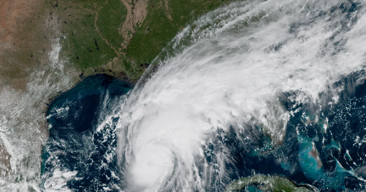
Key points
- At 1 p.m. CDT the National Hurricane Center had Hurricane Isaias at 85 mph and 975 millibars. That is up from 80 mph and 979 millibars at 4 a.m. The Center expects more strengthening through early Friday and still puts landfall inside the warning area late Friday or early Saturday.
- Isaias now reaches well inland in the official products. By early afternoon Thursday, Birmingham had Tropical Storm Watches up for 29 central Alabama counties and Peachtree City had them for 16 west-central Georgia counties. High Wind Watches with gusts up to 50 mph cover north Alabama, north Georgia, southeast Tennessee and two North Carolina counties for Saturday.
- The rain forecast went up. The Center's 10 a.m. advisory raised the localized total from 10 inches to 15, mainly in banding over the Florida Panhandle and Big Bend. Flood Watches for Isaias now run from Mobile and Tallahassee north to Birmingham, Huntsville, Nashville, Memphis, Morristown and Peachtree City.
Isaias Thursday: a little stronger, and a much wider reach
Isaias spent Thursday morning crawling east-northeast across the southern Gulf at about 10 mph. Air Force Hurricane Hunters stayed with it. At 10 a.m. CDT the Center raised the winds to 85 mph, with the pressure at 975 millibars. Its discussion said a microwave satellite image showed "a closed ring around the eye," which it called "typically a harbinger of rapid intensification." It then gave the other side: the shear is expected to rise sharply as Isaias nears the coast, so the forecast brings it to 110 mph early Friday and eases it to 100 mph by Friday evening, near 29.6N 87.4W, just off the Alabama coast. Its summary line was the same as this morning's: "Isaias is expected to remain a dangerous hurricane through landfall."
The 10 a.m. advisory made one change on the coast. It extended the Storm Surge Warning east from the Steinhatchee River to the Suwannee River in Florida, with 3 to 5 feet possible on that stretch. The 1 p.m. update changed nothing. The Hurricane Warning still runs from Ocean Springs, Mississippi, to the Bay/Gulf County Line in Florida.
The bigger change Thursday came from the inland offices. In the same 10 a.m. discussion, the Center wrote that damaging gusts were possible "over much of central and northern Alabama and portions of western and northern Georgia, especially in areas of higher terrain," and that more watches "will likely be required." The offices put them up within three hours.
- Peachtree City's 11:42 a.m. EDT statement issued a Tropical Storm Watch for 16 west-central Georgia counties, including Muscogee (Columbus), Troup and Harris, for gusts of 40 to 50 mph. Its reason was the same one Tallahassee gave this morning: the wind field "may be lopsided towards the east, which means impacts are likely well beyond the forecast cone."
- Peachtree City also explained why north Georgia got a different product. Strong high pressure over the Mid-Atlantic will set up "a strong easterly wind gradient even further off to the east of Isaias." The High Wind Watch covers metro Atlanta's counties and the north Georgia mountains, because those winds "will linger after Isaias falls below tropical storm strength."
- Birmingham's 1:07 p.m. CDT statement lists Tropical Storm Watches for 29 counties across central Alabama, Pickens being the latest. It calls for gusts of 40 to 50 mph Friday night through Saturday, isolated gusts to 60, and "the potential for numerous downed trees and power lines."
- Huntsville's High Wind Watch for north Alabama and southern middle Tennessee carries the biggest inland wind number on the wire: gusts up to 50 mph, with a "high end potential of 60-70 mph gusts, especially in higher terrain."
The Flood Watches follow the same northward path. Huntsville expects 2 to 4 inches, locally 5 to 7. Birmingham expects 2 to 4 inches, locally up to 5, and its watch covers all of central Alabama. Peachtree City expects 1 to 3 inches, locally 5. Morristown expects 1 to 3 inches for the Chattanooga area counties and far southwest North Carolina. Memphis says the eventual remnants of Isaias could bring local amounts up to 4 inches east of the Mississippi River. The Center added that river flooding "is also expected, some of which could be significant."
At 1 p.m. CDT, the Center put Isaias about 355 miles south of the mouth of the Mississippi River. Birmingham measured it as about 680 miles south-southwest of that city. Peachtree City, at 11 a.m. EDT, put it about 780 miles south-southwest of Atlanta.
| Item | 4 a.m. CDT (Adv 7) | 7 a.m. CDT (Adv 7A) | 10 a.m. CDT (Adv 8) | 1 p.m. CDT (Adv 8A) |
|---|---|---|---|---|
| Center | 23.3N 91.2W | 23.7N 90.6W | 23.7N 90.2W | 24.0N 89.8W |
| Distance | About 420 mi SSW of the mouth of the Mississippi | About 385 mi SSW | About 380 mi S | About 355 mi S |
| Max sustained winds | 80 mph | 80 mph | 85 mph | 85 mph |
| Pressure | 979 mb | 975 mb | 975 mb | 975 mb (28.80 in) |
| Movement | ENE, 9 mph | ENE, 9 mph | ENE, 10 mph | ENE, 10 mph |
| Localized rain ceiling, U.S. | 10 in | 10 in | 15 in | 15 in |
| Coastal change | none | none | Storm Surge Warning extended to the Suwannee River | none |
| NHC forecast point (Discussion 8, 10 a.m. CDT Thu) | Position | Max winds |
|---|---|---|
| Thu 7 p.m. CDT | 24.9N 89.0W | 105 mph |
| Fri 7 a.m. CDT | 27.1N 87.9W | 110 mph |
| Fri 7 p.m. CDT | 29.6N 87.4W | 100 mph |
| Sat 7 a.m. CDT | 32.3N 87.8W, inland | 40 mph |
| Sat 7 p.m. CDT | 34.6N 88.1W, post-tropical, inland | 35 mph |
| Sun 7 a.m. CDT | 36.5N 87.8W, post-tropical, inland | 30 mph |
| Inland office | Product, issue time | Gusts or rain | When |
|---|---|---|---|
| NWS Birmingham AL | Tropical Storm Watch, 29 counties (statement 1:07 p.m. CDT) | Gusts 40 to 50 mph, isolated 60 | Friday night through Saturday |
| NWS Birmingham AL | High Wind Watch, 10 north-central counties, 12:11 p.m. CDT | Gusts up to 50 mph | Late Friday night through late Saturday night |
| NWS Birmingham AL | Flood Watch, all of central Alabama, 11:26 a.m. CDT | 2 to 4 in, locally 5 | Friday evening through Sunday morning |
| NWS Peachtree City GA | Tropical Storm Watch, 16 counties, 11:42 a.m. EDT | Gusts 40 to 50 mph | Saturday |
| NWS Peachtree City GA | High Wind Watch, north and west-central Georgia, 11:20 a.m. EDT | Gusts up to 50 mph | Saturday morning through Sunday morning |
| NWS Peachtree City GA | Flood Watch, 11:58 a.m. EDT | 1 to 3 in, locally 5 (statement) | Weekend |
| NWS Huntsville AL | High Wind Watch, 12:04 p.m. CDT | Gusts up to 50 mph, high end 60 to 70 | Saturday morning through Sunday morning |
| NWS Huntsville AL | Flood Watch, 11:04 a.m. CDT | 2 to 4 in, locally 5 to 7 | Late Friday night through Sunday morning |
| NWS Morristown TN | High Wind Watch and Flood Watch, 1:24 and 12:43 p.m. EDT | Gusts up to 50 mph; 1 to 3 in | Saturday into Sunday morning |
| NWS Nashville TN | Flood Watch, 17 counties, 11:25 a.m. CDT | Not stated | Late Friday night through Sunday morning |
| NWS Memphis TN | Flood Watch, north Mississippi and west Tennessee, 12:13 p.m. CDT | Local amounts up to 4 in | Late Friday night through Sunday morning |
*Sources: National Hurricane Center Isaias Advisory 7 (4 a.m. CDT), Intermediate Advisory 7A (7 a.m.), Advisory 8 and Discussion 8 (10 a.m.), Intermediate Advisory 8A (1 p.m. CDT Thu); NWS Tropical Cyclone Local Statements from Birmingham (1:07 p.m. CDT) and Peachtree City (11:42 a.m. EDT); NWS High Wind Watches and Flood Watches as listed in the table. Forecast times are converted from UTC. These are forecasts, not measurements. The Flood Watch from Jacksonville, Florida, is for a separate Atlantic coast rain event and is not counted here.*
What the offices ask of people inland
The Center's key message for the inland area asks residents to "secure loose outdoor items, avoid driving high-profile vehicles, and prepare for power outages." Birmingham sees a tornado threat developing Saturday "along and east of Interstate 65," with confidence "low to medium at this time." Peachtree City expects conditions "favorable for several tornadoes across North and Central GA from Saturday into Sunday." On the coast, the 1 p.m. advisory still asks that preparations in the warning area "be rushed to completion today." The federal preparedness guide is at https://www.ready.gov/hurricanes. This morning's story on the coastal warnings is at /journal/beat/isaias-hurricane-warnings-mobile-pensacola-panama-city-2026-10-08/.
This is a summary of official warnings, not emergency information. For live warnings see weather.gov and your local officials. The National Hurricane Center: https://www.nhc.noaa.gov/
The rock's live forecast for the places in this story
More from the Journal
 THE WEATHER BEAT
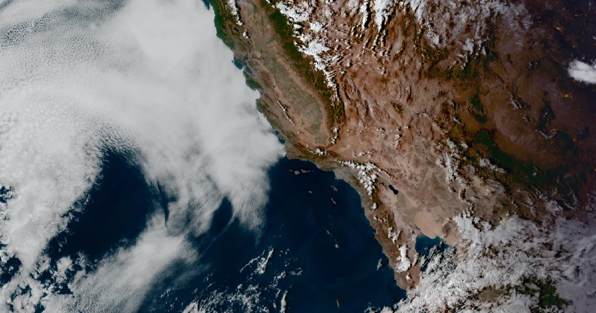
Downtown Los Angeles hits a record 104, its fourth straight 100-degree day, as heat watches reach the Coachella Valley
OCT 6
THE WEATHER BEAT
Downtown Los Angeles hits a record 104, its fourth straight 100-degree day, as heat watches reach the Coachella Valley
OCT 6
 THE WEATHER BEAT
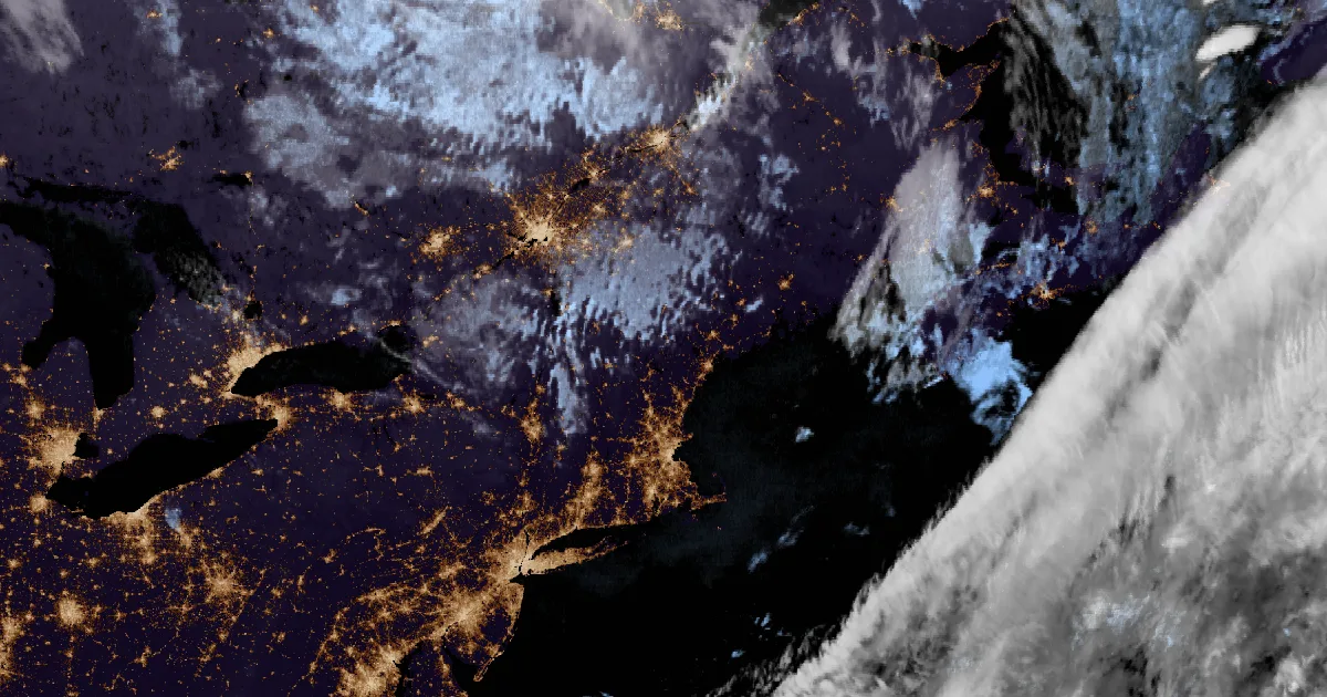
Frost Advisories from Pennsylvania to Maine and across inland Connecticut for the season's coldest night so far
OCT 6
THE WEATHER BEAT
Frost Advisories from Pennsylvania to Maine and across inland Connecticut for the season's coldest night so far
OCT 6
 EXPLAINERS
Why Is the Sky Blue?
AUG 20
EXPLAINERS
Why Is the Sky Blue?
AUG 20
Follow the Journal: RSS · get it by email