THE WEATHER BEAT · OCT 21
A Bering Sea storm due in western Alaska Friday: Coastal Flood Warning for Hooper Bay, Blizzard Warnings on the Seward Peninsula, gusts to 75 mph
A 960 mb Bering Sea low brings water 5 to 7.5 feet above the high tide line to Hooper Bay Friday, blizzards on the Seward Peninsula, gusts to 75 mph.


Key points
- NWS Fairbanks issued a Coastal Flood Warning for the Yukon Delta coast, in effect from 4 a.m. Friday to 10 p.m. AKDT Sunday. Water at Hooper Bay is expected 5 to 7.5 feet above the normal high tide line, and 2 to 4.5 feet elsewhere on that coast.
- Blizzard Warnings cover the Seward Peninsula from 4 a.m. Friday into Saturday, with gusts to 60 to 65 mph and up to 15 inches of snow inland. High Wind Warnings from two offices allow for gusts up to 75 mph on the Kuskokwim Delta and the northern Bristol Bay coast.
- Fairbanks forecasters describe a 960 mb low moving into the eastern Bering Sea Thursday night. They name coastal flooding and erosion as their main concern, and say another storm may follow Sunday night into Monday.
The Bering Sea gets a quiet day first. In its 3:44 p.m. AKDT Wednesday discussion, the Fairbanks office called the next 24 to 48 hours "relatively quiet," with some of the coldest air of the season over the Interior. The same discussion then describes a 960 mb low moving into the eastern Bering Sea Thursday night. Its warm front carries what the forecaster called "an anomalous atmospheric river," and it is running into cold air already over western Alaska. As a result, the coast is expected to get heavy, wet snow first, which turns to rain by Saturday morning.
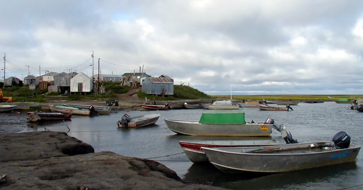
Hooper Bay faces the most serious risk. The Coastal Flood Warning issued at 3:09 p.m. says "beach property, and the lowest buildings will be inundated," and that the roads to the airstrip and to the larger parts of town will likely flood. According to the warning, water peaks with Friday's high tides and then falls slowly through the weekend. Wind is the other part of the forecast. The Fairbanks discussion expects gusts "widespread around 50 to 70 mph with the strongest being in the Yukon Delta and St. Lawrence Island."
To the south, the Anchorage office wrote at 4:32 p.m. that even inland Bethel "is on track to see winds gusting to 60 to 70 mph for Friday afternoon and Friday night." The same discussion says its Coastal Flood Watch was raised to an advisory for Kipnuk, Kwigillingok and Kongiganak, for water 2 to 3 feet above the normal highest tide line around the Friday high tides near 10 a.m. and 10 p.m. It also explains why that coast is not expecting more. Unlike earlier storms with southwesterly winds, this one blows from the south and south-southeast. Because of the shape of the coastline, that direction limits how much fetch is pointed at the Kuskokwim Delta coast. Cold Bay and King Cove are still on a watch rather than a warning. Forecasters put the chance of 75 mph gusts there at 40 to 60 percent, because it is not certain the wind will line up with the southeast to northwest gap that speeds it up.
The Fairbanks discussion's synopsis still refers to "watches," even though the office had already raised the products below to warnings when it was written. The table follows the products.
| Place | Product | Expected | When (AKDT) |
|---|---|---|---|
| Hooper Bay, Yukon Delta coast | Coastal Flood Warning | water 5 to 7.5 ft above normal high tide line at Hooper Bay, 2 to 4.5 ft elsewhere | 4 a.m. Fri to 10 p.m. Sun |
| Yukon Delta coast | High Wind Warning | SE 30 to 40 mph, gusts to 65 mph | 4 a.m. Fri to 4 p.m. Sat |
| St. Lawrence Island | High Wind Warning | SE 35 to 45 mph, gusts to 60 mph | 10 p.m. Thu to 4 p.m. Sat |
| Kuskokwim Delta, Platinum, Goodnews Bay, northern Bristol Bay coast | High Wind Warning | S to SE 35 to 50 mph, gusts to 75 mph | 7 a.m. Fri to 4 a.m. Sat |
| Kipnuk, Kwigillingok, Kongiganak | Coastal Flood Advisory (per the Anchorage discussion) | water 2 to 3 ft above normal highest tide line | 8 a.m. Fri to 1 a.m. Sat |
| Cold Bay, King Cove | High Wind Watch | SE 40 to 50 mph, gusts to 75 mph possible | Fri morning to Sat morning |
| Interior Seward Peninsula | Blizzard Warning | 8 to 15 in snow, gusts to 65 mph | 4 a.m. Fri to 10 a.m. Sat |
| Shishmaref, Bering Strait coast | Blizzard Warning | up to 3 in snow, gusts to 60 mph | 4 a.m. Fri to 1 a.m. Sat |
| Southern Seward Peninsula coast | Blizzard Warning | 2 to 6 in snow, gusts to 60 mph | 4 a.m. Fri to 1 a.m. Sat |
| Noatak Valley, Western Brooks Range south slopes | Winter Storm Warning | 10 to 20 in snow, gusts to 55 mph | 4 p.m. Fri to 4 p.m. Sun |
| Upper Kobuk Valleys | Winter Storm Warning | 4 to 10 in snow, gusts to 50 mph | 10 p.m. Fri to 4 p.m. Sun |
| Point Hope | Winter Storm Watch | up to 4 in snow, gusts to 65 mph | late Thu night to Sun afternoon |
| Bettles, Coldfoot, Wiseman | Winter Storm Watch | 6 to 10 in snow | Sat morning to Sun afternoon |
*Sources: NWS Fairbanks Coastal Flood Warning (3:09 p.m. AKDT), Blizzard and Winter Storm Warnings (3:06 p.m.), High Wind Warnings (2:50 p.m.), Winter Storm Watch for Bettles, Coldfoot and Wiseman (2:37 p.m.), all October 21; Winter Storm Watch for Point Hope (2:39 p.m. October 20); Area Forecast Discussion (3:44 p.m. October 21). NWS Anchorage High Wind Warning and High Wind Watch (1:14 p.m.) and Area Forecast Discussion (4:32 p.m.), October 21, 2026.*
The Fairbanks discussion looks past this weekend too. It says there is "increasing confidence for another round of coastal flooding, heavy rain, and strong southwest winds" with a second system arriving Sunday into Monday.
Elsewhere
On the Outer Banks, the Hatteras Island Coastal Flood Warning from NWS Newport/Morehead City now runs until 8 p.m. EDT Thursday. It calls for 2 to 4 feet of inundation in low-lying areas. Its 8:28 p.m. EDT update says NC-12 between the Basnight Bridge and Rodanthe "remains closed," and it repeats the possibility of being stranded on Hatteras Island for multiple days. NWS Wakefield has Coastal Flood Warnings for Virginia Beach until 9 a.m. EDT Thursday, and for Dorchester, Wicomico and Somerset counties in Maryland and Westmoreland and Northumberland counties in Virginia until 2 p.m. EDT Thursday.
This is a summary of official warnings, not emergency information. For live warnings see weather.gov and your local officials. Fairbanks forecast office: https://www.weather.gov/afg/ Anchorage forecast office: https://www.weather.gov/afc/
The rock's live forecast for the places in this story
More from the Weather Beat
More from the Journal
 THE WEATHER BEAT
A low of 34 and frost anyway: what West Virginia's advisory says, and the shirt for a clear cold night
OCT 20
 THE WEATHER BEAT
Nor'easter stalls off North Carolina: Hatteras and Ocracoke flood warnings now run to Wednesday, Hampton Roads under advisories
OCT 19
 EXPLAINERS
Why Is the Sky Blue?
AUG 20
Follow the Journal: RSS · get it by email