THE WEATHER BEAT · SEP 22
The coastal flood warnings reached three offices this afternoon, and the biggest number is on Hatteras and Ocracoke
Three weather offices now carry coastal flood warnings from Ocracoke Island to the Jersey shore, and the largest figure of the sixteen is on the Outer.

Key points
- Three National Weather Service offices were carrying coastal flood warnings as of this evening, sixteen zones in all, from Ocracoke Island to the New Jersey shore, and they are the only coastal flood warnings active in the country.
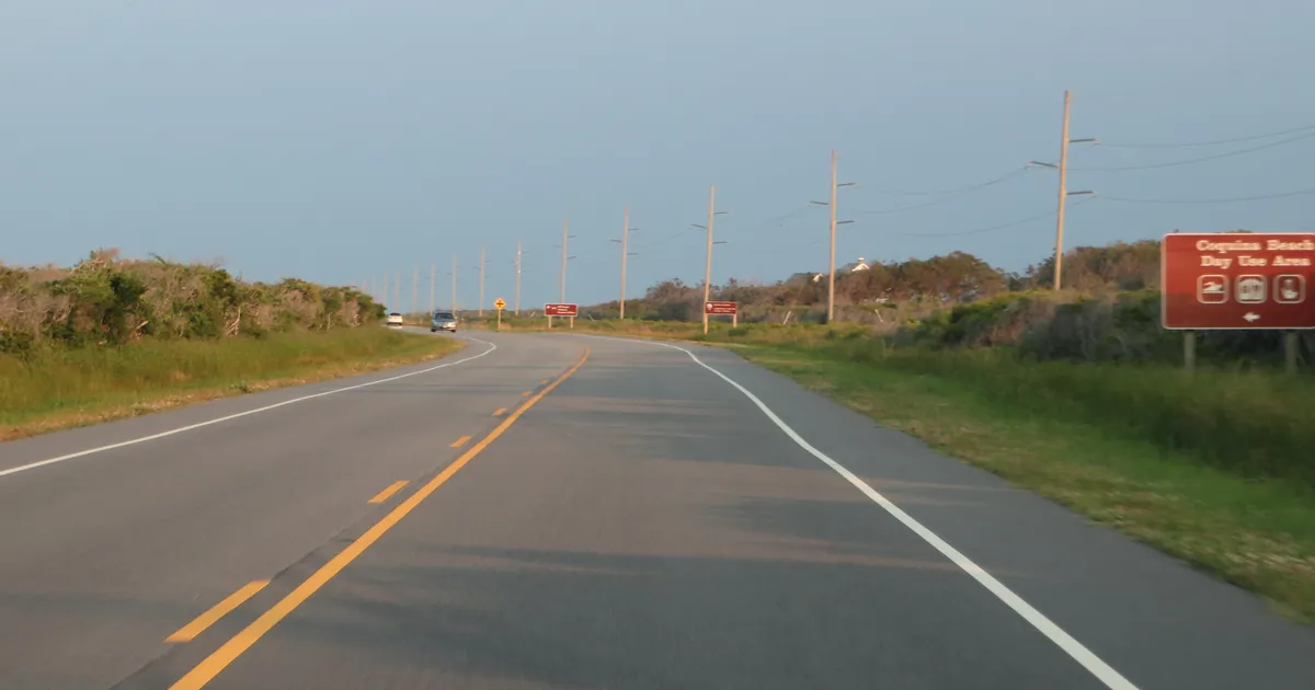
- The largest number on the wire belongs to the Outer Banks. NWS Newport/Morehead City's 4:42 p.m. EDT product puts 2 to 4 feet of inundation above ground level on Hatteras Island and Ocracoke Island, and says portions of Highway 12 will be inundated.
- None of it begins tonight. The earliest warning starts at 5 a.m. Wednesday and the last one runs to 11 p.m. Friday, because the forecasters expect several tide cycles of northeast wind rather than one bad high tide.

What changed this afternoon
This morning the story was marine. Six East Coast offices had turned gale watches into gale warnings before 7 a.m., for a low that had not formed yet. By late afternoon the same system had produced land products in three states, and the belt of coastal flood warnings had grown from one office to three.
NWS Wakefield went first, at 2:57 p.m. EDT, with ten warnings covering Hampton Roads, the Middle Peninsula, the Eastern Shore and the lower Maryland shore. Its own discussion, written at 3:49 p.m., says plainly what it did: all coastal flood watches have been upgraded to coastal flood warnings. NWS Mount Holly followed at 4:14 p.m. for the Delaware beaches, Kent and inland Sussex counties, Cape May, Atlantic and Ocean counties in New Jersey, and southeastern Burlington. NWS Newport/Morehead City came last, at 4:42 p.m., with two products for Hatteras Island and Ocracoke Island.
Coming last does not mean coming smallest. The Outer Banks products carry the highest figure of the sixteen, 2 to 4 feet of inundation above ground level expected, and the same office adds up to a foot of sound side flooding from Buxton southward late Thursday and Friday, when it expects the wind to turn more northerly.
There is one other difference worth reading closely, because it is the only place these otherwise identical products disagree about certainty. Wakefield and Mount Holly both write that low lying property including homes, businesses and some critical infrastructure may be inundated. Morehead City writes will.
The sixteen coastal flood warnings
| Office | Zones | Inundation expected | Warning window |
|---|---|---|---|
| Newport/Morehead City NC | Hatteras Island | 2 to 4 ft | to 11 p.m. Fri |
| Newport/Morehead City NC | Ocracoke Island | 2 to 4 ft | 2 p.m. Wed to 11 p.m. Fri |
| Wakefield VA | Virginia Beach | 2 to 3 ft | 2 p.m. Wed to 4 a.m. Fri |
| Wakefield VA | Surry, James City, Newport News, Isle of Wight | 2 to 3 ft | 6 a.m. Wed to 4 a.m. Fri |
| Wakefield VA | Chesapeake, Hampton and Poquoson, Suffolk, Norfolk, Portsmouth | 1 to 3 ft | 2 p.m. Wed to 4 a.m. Fri |
| Wakefield VA | New Kent, Gloucester, eastern King William, eastern King and Queen, York | 1 to 3 ft | 4 p.m. Wed to 4 a.m. Fri |
| Wakefield VA | Westmoreland, Richmond, Northumberland, Lancaster, Middlesex, Mathews, Essex | 1 to 3 ft | 5 a.m. Wed to 8 a.m. Fri |
| Wakefield VA | Eastern Currituck NC | 1 to 3 ft | 11 a.m. Wed to 4 a.m. Fri |
| Wakefield VA | Maryland beaches, Accomack, Northampton | 1 to 2 ft | 4 p.m. Wed to 4 a.m. Fri |
| Wakefield VA | Dorchester, Wicomico, Somerset | 1 to 2 ft | 6 p.m. Wed to 4 a.m. Fri |
| Wakefield VA | Inland Worcester | 1 to 2 ft | 4 p.m. Wed to 4 a.m. Fri |
| Wakefield VA | Prince George, including Hopewell and Petersburg, and Charles City | 1 to 2 ft | 6 a.m. Wed to 4 a.m. Fri |
| Mount Holly NJ | Delaware beaches | 1 to 2 ft | 4 p.m. Wed to 1 a.m. Fri |
| Mount Holly NJ | Kent, inland Sussex | 1 to 2 ft | 4 p.m. Wed to 1 a.m. Fri |
| Mount Holly NJ | Atlantic coastal Cape May, coastal Atlantic, coastal Ocean | 1 to 2 ft | 4 p.m. Wed to 1 a.m. Fri |
| Mount Holly NJ | Ocean, Atlantic, Cape May, southeastern Burlington | 1 to 2 ft | 4 p.m. Wed to 1 a.m. Fri |
Inundation is measured above ground level in low lying areas near shorelines and tidal waterways, which is the wording every one of these products uses. Sixteen coastal flood warnings, three offices, sent between 2:57 and 4:42 p.m. EDT today. All times Eastern. Source: NWS coastal flood warning products, read from the active alert feed at 23:21Z, which showed no other coastal flood warning anywhere in the United States.
Why it lasts into Friday
The offices do not describe a single flooding tide. They describe wind holding water against the coast for days.
Wakefield's third key message, written at 3:15 p.m. EDT, reads: "Widespread moderate to locally major tidal flooding (inundation of 2-3 feet AGL in vulnerable areas) is likely by the Wednesday afternoon/evening high tide due to strong northeast winds. Tidal flooding is expected to continue for several tide cycles given the persistent northeast winds."
That is the mechanism, and it is why the warnings do not share one start time. Water arrives at Newport News at 6 a.m. Wednesday and at Ocracoke at 2 p.m., and a single headline time for the whole coast would be a tidier sentence than the weather deserves.
The low itself is still being assembled. Morehead City's 4:20 p.m. EDT discussion expects a consolidation of surface lows off the East Coast over roughly the next day, then rapid deepening later Wednesday into Thursday, with the marine section putting the central pressure as low as around 990 millibars. The same office is candid about what it does not know: guidance has trended west and deeper, some of it slower, and the office writes that not all guidance shows the westward shift and it will keep watching. Mount Holly's 7:07 p.m. EDT discussion frames the whole week in one line, multiple rounds of significant tidal flooding expected, and adds that significant beach erosion is also likely at the Jersey shore and the Delaware beaches.
The wind has a land number too, which no coastal flood product carries. Wakefield added wind advisories for the immediate coast this afternoon because it expects gusts in excess of 50 mph from Wednesday afternoon into Thursday night.
Today, before the tide
The same office that spent the afternoon writing tidal flood warnings spent the earlier part of it on rain. Wakefield's 3:49 p.m. EDT discussion notes showers and storms developing along a stalled boundary across the southeastern part of its area, roughly along the Virginia and North Carolina border, producing locally heavy rainfall and flash flooding. Two kinds of water, the same streets, six hours apart, from two entirely different causes.
Elsewhere on the wire
The tropics are busy and none of it is pointed at the United States. The active alert list carried 539 National Weather Service products at 23:21Z and not one tropical storm or hurricane watch or warning among them.
| Storm | Position | Max sustained | Pressure |
|---|---|---|---|
| Hurricane Polo, eastern Pacific | 14.6 N, 101.5 W | 155 kt | 892 mb |
| Odalys, eastern Pacific | 15.1 N, 130.1 W | 60 kt | 994 mb |
| Fay, central Atlantic | 30.8 N, 35.3 W | 30 kt | 1011 mb |
Source: National Hurricane Center current storms file, advisories issued 21:00Z today. Polo is far off southwestern Mexico and Fay is closer to the Azores than to anything American.
The Storm Prediction Center's day one outlook, in text, put the highest risk category at marginal, for isolated severe wind gusts in Utah into southwest Wyoming and western Colorado and strong to locally severe gusts in parts of the Southeast. Yesterday's preliminary storm reports and the Weather Prediction Center's day one excessive rainfall page both returned an HTTP 403 error to our wire reader again today, the ninth day running, so this brief cannot tell you what yesterday's storm reports held. That is a gap in our reading, not a quiet day on record.
This is a summary of official warnings, not emergency information. For live warnings see weather.gov and your local officials. The coastal flood warning definitions are on the NWS page for flood watches and warnings.
The rock's live forecast for the places in this story
More from the Journal

.jpg)
.jpg)
Follow the Journal: RSS · get it by email