THE WEATHER BEAT · OCT 26
The Rio Puerco passes its forecast crest near Bernardo, New Mexico, and tops the old Highway 60 bridge, as Alamosa ties 1948
The Rio Puerco read 24.3 feet near Bernardo Monday, above its forecast crest, with 25.3 feet due after midnight; Alamosa tied its 1948 crest.

Key points
- The Rio Puerco near Bernardo, New Mexico, read 24.3 feet at 4 p.m. MDT Monday. That is above both crests Albuquerque forecast on Sunday (24.1 and 24.2 feet). The office says the old Highway 60 bridge goes under at 24.0 feet, and it now expects 25.3 feet just after midnight.
- Sunday's other number to check came in level with the old mark. The Rio Grande at Alamosa, Colorado, peaked at 9.9 feet in the 24 hours ending 8:30 a.m. MDT Monday, the same as the 9.9 feet of June 5, 1948 that its own product lists.
- On the San Juan the two offices still disagree. At 8:29 a.m. MDT Grand Junction raised the Bluff, Utah, crest to 31.0 feet for late afternoon. At 4:18 p.m. MDT Salt Lake City said the crest would come "near to slightly above moderate flood stage" and gave no figure.
The Rio Puerco, checked
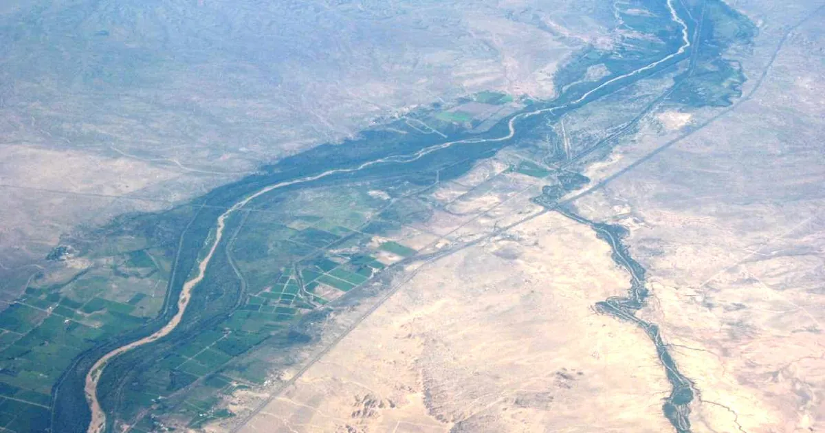
Last night's story left the reader two numbers to check. The first was the Rio Puerco near Bernardo, the wash that joins the Rio Grande south of Belen. At 2:46 p.m. Sunday Albuquerque expected it to crest at 24.1 feet just after midnight. At 7:44 p.m. the figure was 24.2 feet. The river went past both.
Albuquerque's warning, sent at 4:47 p.m. MDT Monday, put the river at 24.3 feet at 4 p.m. and moved the warning from minor to moderate. The warning lists its own impacts. At 23 feet, streets flood in the village of San Francisco, between Interstate 25 and the Rio Grande just south of Bernardo. At 24 feet the old Highway 60 bridge is overtopped. The railroad bridge nearby may also flood, and the warning says "further rises will impact Interstate 25 traffic." The office repeats the line from Sunday: "Water levels in the Lower Rio Puerco have not been this high since July of 1944."
The office expects one more step up before the river falls: 25.3 feet just after midnight, about 20.2 feet early Wednesday afternoon, a second rise to 21.6 feet Thursday morning, and below flood stage early Thursday afternoon. The product shows "No available flood history" for this gauge, so the 1944 line is the only comparison it gives.
The second check was Alamosa, where Sunday's forecast was 9.6 feet and the 2:48 a.m. Monday forecast was 10.0 feet. Pueblo's 9:33 a.m. warning gives the answer. The river read 9.8 feet at 8:30 a.m., after a 24-hour high of 9.9 feet. That ties the previous crest the product lists, 9.9 feet on June 5, 1948, and the river is expected to fall below flood stage late tonight. Upstream, Pueblo said at 5:15 p.m. that the Conejos River "has crested at most locations."
| River point | Office | Latest in the product | 24 h max | Flood stage | Forecast | Previous crest in the product | Issued |
|---|---|---|---|---|---|---|---|
| Rio Puerco near Bernardo NM | Albuquerque | 24.3 ft at 4 p.m. Mon | 24.3 ft | 19.5 ft | 25.3 ft just after midnight; 21.6 ft Thu morning; below flood stage early Thu afternoon | none available; "not been this high since July of 1944" | 4:47 p.m. MDT Mon |
| Rio Grande at Alamosa CO | Pueblo | 9.8 ft at 8:30 a.m. Mon | 9.9 ft | 9.0 ft | below flood stage late tonight | 9.9 ft, 06/05/1948 | 9:33 a.m. MDT Mon |
| Rio Chama below Chamita NM | Albuquerque | 6.7 ft at 11 a.m. Mon | 7.1 ft | 6.0 ft | below flood stage Monday afternoon | 6.7 ft, 05/22/1995 | 11:52 a.m. MDT Mon |
| San Juan River near Bluff UT | Grand Junction | 24.6 ft at 7:30 a.m. Mon | 24.6 ft | 23.0 ft | crest 31.0 ft late afternoon; below flood stage late Tuesday morning | 32.0 ft, 09/10/1927 | 8:29 a.m. MDT Mon |
| San Juan River below Bluff UT | Salt Lake City | crest "near to slightly above moderate flood stage" this evening | not given | not given | flooding to Lake Powell through at least Tuesday morning | not given | 4:18 p.m. MDT Mon |
| Rio Grande below Rio Conchos near Presidio TX | Midland/Odessa | 9.0 ft at 1:15 p.m. CDT Mon | 9.0 ft | 9.0 ft | crest 9.9 ft late afternoon; below flood stage this evening | 9.9 ft, 08/31/2016 | 1:59 p.m. CDT Mon |
*Source: NWS river Flood Warnings on api.weather.gov, read at 00:50Z October 27. Every stage, time and previous crest is the product's own figure, as of its issue time. The Chamita product listed a previous crest of 7.3 feet (06/18/1984) on Sunday and lists 6.7 feet (05/22/1995) on Monday. Both are quoted as each product gave them.*
The San Juan crest, still two numbers
On Sunday afternoon Grand Junction had cut the Bluff crest to 29.5 feet. Monday's 8:29 a.m. product raised it again to 31.0 feet late in the afternoon, a foot under the 32.0 feet of September 10, 1927. The header still reads "Catastrophic flooding" and "This is an emergency situation!" It names Mexican Hat, Tselakai Dezza, Bluff, Halchita, Montezuma Creek and Aneth. Salt Lake City's 4:18 p.m. warning for the river below Bluff gives no stage. It calls the crest "near to slightly above moderate flood stage" and says flooding continues to Lake Powell through at least Tuesday morning. Neither product printed a measured crest by the time of this brief.
This evening, officially
The rain this evening fell farther south and east. Albuquerque extended a Flash Flood Warning for west central Chaves County, New Mexico, until 8 p.m. MDT. Radar estimated 1.5 to 3 inches had fallen, heaviest toward the Otero County line, with flash flooding expected first in Whitetail and Lincoln canyons. Midland/Odessa issued a Flash Flood Warning for Glasscock County, Texas, including Garden City, until 9 p.m. CDT, with 2 to 3 inches estimated by radar. In Colorado, Pueblo's Flood Watch for the Purgatoire River near Las Animas began this evening and runs to Wednesday afternoon: the river read 2.5 feet at 11:15 a.m., against a 9.0 foot flood stage that "may be reached late this evening." The Storm Prediction Center's day one summary, as the house wire printed it at 00:49Z, said "organized severe thunderstorm potential should remain fairly low."
| Product | Office | Area | Radar or gauge | In force until |
|---|---|---|---|---|
| Flash Flood Warning | Albuquerque NM | west central Chaves County | radar, 1.5 to 3 in | 8 p.m. MDT Mon |
| Flash Flood Warning | Midland/Odessa TX | Glasscock County, Garden City | radar, 2 to 3 in | 9 p.m. CDT Mon |
| Flood Watch | Pueblo CO | Purgatoire River near Las Animas | 2.5 ft at 11:15 a.m.; flood stage 9.0 ft | 5 p.m. MDT Wed |
*Source: NWS products on api.weather.gov and the SPC Day 1 summary as printed by the house wire, read at 00:49Z to 00:52Z October 27.*
What the reader can check
Albuquerque says the Rio Puerco reaches 25.3 feet just after midnight and falls by Wednesday afternoon. Grand Junction says Bluff crests at 31.0 feet and Salt Lake City says moderate. Tuesday's products will show which was closer. The Weather School page on watches, warnings and advisories explains why one evening can carry a river warning, a flash flood warning and a river watch in the same state.
This is a summary, not emergency information. For live warnings see weather.gov and your local officials.
More from the Weather Beat
More from the Journal


Follow the Journal: RSS · get it by email