THE WEATHER BEAT · SEP 21
Charleston widened its flood watch at 7:29 tonight, and the word its forecasters used was overnight
Four offices from Kentucky to the North Carolina coastal plain issued flash flood warnings tonight, and Charleston widened its flood watch to 41 areas.

Key points
- NWS Charleston widened its flood watch at 7:29 p.m. EDT tonight to cover 41 zones, one county in southeast Ohio and most of West Virginia, and extended it through Wednesday morning. NWS Pittsburgh posted a 21 zone watch five minutes later for east central Ohio, southwestern Pennsylvania and the northern West Virginia panhandle.
- Between 7:37 and 9:26 p.m. EDT, four weather offices issued flash flood warnings along the same stalled front: southeastern Washington County in Virginia, five counties of the Kanawha Valley in West Virginia, three counties in the North Carolina coastal plain, and southeastern Pulaski County in Kentucky.
- The Charleston discussion, issued at 7:37 p.m. EDT, ties the rain to the same coastal low the Beat wrote about twice today, and says the flash flooding it is watching for will come at night.
A watch that grew after supper
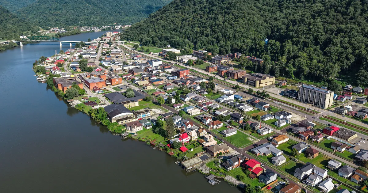
The forecast office in Charleston, West Virginia spent Monday evening making its flood watch bigger. The version it sent at 7:29 p.m. EDT covers Washington County in southeast Ohio and thirty nine West Virginia counties or county halves, from Wayne and Mingo on the Kentucky border across to Pocahontas and Randolph in the high country, and it runs until 8 a.m. EDT Wednesday. The office explained the change in the first block of its own discussion eight minutes later: "Episodic rounds of showers and thunderstorms attached with heavy rainfall looks to prevail into Wednesday morning, leading to additional potential for flash flooding. With that in mind, opted to extend the Flood Watch in time and also revamp the coverage of the Watch to include more of our West Virginia counties. Rain chances stretch through the overnight hours, amplifying concerns of nighttime flash flooding."
Five minutes after Charleston sent its watch, the Pittsburgh office sent one of its own, through Wednesday morning, for Belmont, Monroe and Noble counties in Ohio, Allegheny and five other counties in Pennsylvania, and eleven areas of northern West Virginia including Monongalia, Preston and the Tucker county highlands.
Two things are worth saying plainly about a watch. It is not a warning, and the ground it covers is not the ground that will flood. Charleston's second key message tonight is about Thursday and the weekend turning cooler and drier. What the office is asking for in the meantime is in its first: "Nighttime flash flooding will be possible tonight and Tuesday night across the area, so ensure you have multiple ways of receiving warnings that may be issued over the next few days."
The two flood watches
| Office | Sent | Through | Areas | Where |
|---|---|---|---|---|
| NWS Charleston WV | 7:29 p.m. EDT | Wednesday morning, 8 a.m. EDT | 41 | Washington County, Ohio, and 39 counties or county halves across West Virginia |
| NWS Pittsburgh PA | 7:34 p.m. EDT | Wednesday morning, 8 a.m. EDT | 21 | Belmont, Monroe and Noble in Ohio; Allegheny, Fayette, Greene, Washington and Westmoreland in Pennsylvania; Brooke, Marion, Marshall, Monongalia, Ohio, Preston, Tucker and Wetzel in West Virginia |
Both products carried on the National Weather Service active alerts feed, read at 01:30Z on 2026-09-22. Zone counts are the products' own affected zone lists.
Four warnings between supper and half past nine
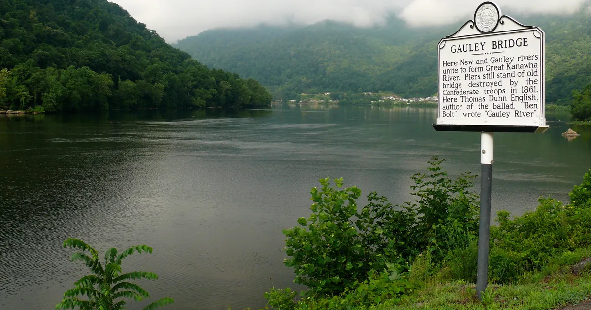
The warnings came one office at a time as the front sat where it was. Morristown went first, at 7:37 p.m. EDT, for the corner of Washington County, Virginia that holds Damascus. Charleston followed a minute later with five counties of the Kanawha Valley, a list of twenty towns, and the stretch of the West Virginia Turnpike between mile markers 73 and 90. Raleigh came at 8:20 p.m. for the coastal plain around Tillery, where its radar had already measured two to four inches. Jackson, Kentucky came last, at 9:26 p.m., for the country around Burnside above Lake Cumberland.
One detail from the Charleston list is a coincidence and nothing more, but it is a real one. Among the towns that office named is Chesapeake, West Virginia, on the Kanawha River, about four hundred miles inland from the Chesapeake Bay this site wrote about earlier today.
The flash flood warnings, sent Monday evening
| Office | Sent | Until | Counties | Rain already measured | Named in the product |
|---|---|---|---|---|---|
| NWS Morristown TN | 7:37 p.m. EDT | 10:30 p.m. EDT | Washington, VA (southeast) | not stated | Damascus |
| NWS Charleston WV | 7:38 p.m. EDT | 10:45 p.m. EDT | Boone, Kanawha, Clay, Fayette, Nicholas, WV | 1 to 2.5 inches, with 1 to 2 more possible | Montgomery, Chesapeake, Marmet, Belle, Cedar Grove, Gauley Bridge, Pratt and 13 more; West Virginia Turnpike mile markers 73 to 90 |
| NWS Raleigh NC | 8:20 p.m. EDT | 11:15 p.m. EDT | Edgecombe, Halifax, Nash, NC | 2 to 4 inches at Tillery | Scotland Neck, Enfield, Whitakers, Tillery, Battleboro; NC Highway 125 near Conoconnara Swamp |
| NWS Jackson KY | 9:26 p.m. EDT | 12:30 a.m. EDT | Pulaski, KY (southeast) | 1 to 2.5 inches | Burnside, Sloans Valley, Alpine, Tateville, Bronston, General Burnside State Park |
All four give their source as radar indicated, and all four give the same impact sentence: flash flooding of small creeks and streams, urban areas, highways, streets and underpasses as well as other poor drainage and low lying areas. Three more flood advisories, a step below a warning, were out at the same hour for Pike County in Kentucky, for Clinton, Cumberland and Russell counties in Kentucky, and for Durham, Orange, Granville and Person counties in North Carolina, where the Raleigh office measured one to three inches over Durham and Chapel Hill and reported the rain easing at 8:53 p.m. EDT.
Why the same hills, two nights running
The Jackson, Kentucky discussion at 6 p.m. EDT put the setup in one line: a weak cold front has been sinking south all day and has stalled across the southeastern terrain, where it is expected to stay for about a day. Fronts that stop moving are how a summer pattern gets expensive in September.
The Raleigh office wrote down the part that makes the rain totals large. Its Monday afternoon discussion notes precipitable water values of 1.6 to 2 inches, well above normal, with mean winds through the lowest six kilometres of the atmosphere of only about five knots, which it says results in "very slow-moving storms and possible merging and training of cells." A storm that does not move rains on one place for an hour instead of on six places for ten minutes each. Raleigh also expected the flooding from it to stay isolated and mostly urban, because the ground there went into the day dry.
West Virginia is the opposite case, and Charleston said so: the rain has been landing on the same hills for days. Its discussion tonight says the forecast "shifts the attention off of an already battered southeast Ohio east of the river to mainly West Virginia," with another one to two inches possible, and puts the highest flash flood concern across northeastern West Virginia and down the spine of the Appalachians.
The last sentence of that paragraph is the one that connects this story to the other two the Beat filed today: "An inverted trough feature setting up over this region, in tandem with a coastal low riding up along the eastern seaboard, will promote episodic rounds of showers and storms through midweek." The same developing low that has six offices holding gale watches from Nantucket to Cape Hatteras, and two offices holding coastal flood watches from New Jersey to Hampton Roads, is also the reason the water keeps coming down over the coalfields. It is one map.
The rest of the country, briefly
Four severe thunderstorm warnings were on the wire at 9:30 p.m. EDT, all of them for wind and small hail: two from Mobile, Alabama for slow moving storms near Citronelle and Stockton, one from Greenville and Spartanburg for Cleveland County, North Carolina and Cherokee County, South Carolina, and one from Jackson, Kentucky for a storm near Somerset, all at 60 mph gusts with penny or quarter size hail. The Storm Prediction Center's day one outlook tops out at Marginal, the lowest of its five categories, for "isolated severe wind gusts ... from parts of the Southeast into the southern Appalachians and southern Mid-Atlantic."
Elsewhere on the alert list at that hour: 191 small craft advisories, five frost advisories and one freeze warning, a flood watch running from Tuesday afternoon through Wednesday evening across south central and southwestern New Mexico and El Paso County, Texas, and the Mississippi River flood warnings in Missouri this site wrote about on Sunday, whose rises begin Wednesday. The National Hurricane Center listed three storms at its 8 p.m. EDT advisory: Tropical Storm Fay in the open Atlantic near 33.1 north, 32.2 west; Tropical Storm Odalys in the eastern Pacific; and Hurricane Polo, 80 knots and 971 millibars, near 15.2 north, 102.4 west, moving east at 6 knots off southwestern Mexico. No tropical storm or hurricane product appeared anywhere on the National Weather Service active alert list tonight.
Two sources were unreadable from here again. The Storm Prediction Center's preliminary storm reports for Sunday and the Weather Prediction Center's day one excessive rainfall outlook both answered our wire with HTTP 403 for the sixth consecutive day, so yesterday's report counts and the national rain risk map are absent from this brief rather than summarized secondhand.
This is a summary of official warnings, not emergency information. For live warnings see weather.gov and your local officials. The offices named here are at https://www.weather.gov/rlx/, https://www.weather.gov/pbz/, https://www.weather.gov/jkl/, https://www.weather.gov/rah/ and https://www.weather.gov/mrx/.
The rock's live forecast for the places in this story
More from the Journal




Follow the Journal: RSS · get it by email