THE WEATHER BEAT · OCT 28
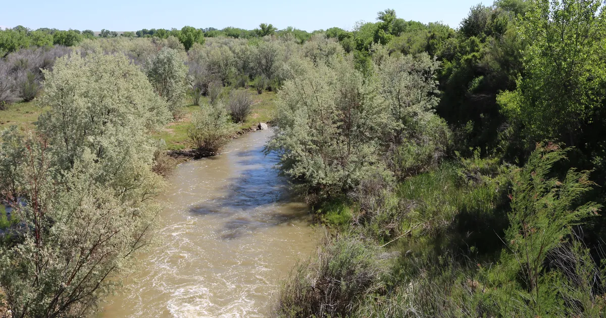
The Purgatoire and the Rio Chama come in under their old marks, as the Rio Puerco makes a second rise near Bernardo
The Rio Chama topped out at 6.7 feet, not 6.9; the Purgatoire crest forecast fell from 10.2 to 9.7 feet; the Rio Puerco heads for 21.8 feet Wednesday.


Key points
- Both rivers that Tuesday evening's story asked readers to check stayed below their old marks. The Rio Chama below Chamita, New Mexico, topped out at 6.7 feet, not the 6.9 feet forecast. The Purgatoire near Las Animas, Colorado, now has a forecast crest of 9.7 feet, down from 10.2.
- When the forecasts changed, so did the old crests the products compare them with. The Purgatoire is now set beside 9.8 feet on June 6, 1949, and the Rio Chama beside 6.4 feet on July 21, 2009.
- The Rio Puerco near Bernardo, New Mexico, is on its second rise. Albuquerque's 6:54 p.m. MDT warning on Tuesday expects a crest of 21.8 feet Wednesday morning and a drop below flood stage Thursday.
The two checks, answered
Tuesday evening's story ended with two forecasts that matched old crests exactly. The Purgatoire was forecast to reach 10.2 feet, the same as May 31, 1995. The Rio Chama was forecast to reach 6.9 feet, the same as June 13, 1991. Both have now come in lower, which is how the Rio Puerco and the San Juan went earlier in the week.
The Rio Chama answer is already in. Albuquerque's 6:50 p.m. MDT warning on Tuesday gives the highest stage in the 24 hours ending at 6 p.m. as 6.7 feet. The river read 6.4 feet at 6 p.m., and the office expects it "to oscillate around 6.4 to 6.5 feet through Wednesday." That is still above the 6.0 foot flood stage. At that level the product says properties in the flood plain along the Rio Chama and near where the Rio Ojo Caliente comes in "will see water in their yards." The old crest it now cites is 6.4 feet on July 21, 2009. This week the same gauge has been compared with five different years.
The Purgatoire answer is a smaller forecast, not a crest yet. Pueblo's 8:52 p.m. MDT warning on Tuesday put the river near Las Animas, in Bent County, at 9.2 feet at 8:15 p.m. The highest reading in the previous 24 hours was 9.3 feet. Flood stage is 9.0 feet. The office now expects a crest of 9.7 feet Wednesday morning, half a foot under Tuesday morning's 10.2, with the river back below flood stage early Wednesday afternoon. The product's explanation is that "High flow is traveling down the Upper Purgatoire from recent rains." At 9.0 feet it describes "minor agricultural flooding" in low-lying areas along the river.
| River point | Office | Forecast the reader was given | What the latest product shows | Flood stage | Previous crest, then and now | Issued |
|---|---|---|---|---|---|---|
| Rio Chama below Chamita NM | Albuquerque | crest 6.9 ft Tue afternoon (11:53 a.m. MDT Tue) | 24 h max 6.7 ft ending 6 p.m. Tue; 6.4 ft at 6 p.m.; 6.4 to 6.5 ft through Wed | 6.0 ft | 6.9 ft, 06/13/1991 (Tue morning); 6.4 ft, 07/21/2009 (Tue evening) | 6:50 p.m. MDT Tue |
| Purgatoire River near Las Animas CO | Pueblo | crest 10.2 ft Wed morning (9:07 a.m. MDT Tue) | 9.2 ft at 8:15 p.m. Tue; 24 h max 9.3 ft; crest 9.7 ft Wed morning; below flood stage early Wed afternoon | 9.0 ft | 10.2 ft, 05/31/1995 (Tue morning); 9.8 ft, 06/06/1949 (Tue evening) | 8:52 p.m. MDT Tue |
*Source: NWS river Flood Warnings on api.weather.gov, read at 12:40Z to 12:55Z October 28. Every stage, time and previous crest is the product's own figure at its issue time.*
The Rio Puerco's second rise
On Monday afternoon the Rio Puerco near Bernardo reached 24.3 feet, and on Tuesday it fell back. Albuquerque's 6:54 p.m. MDT update put the river at 19.3 feet at 6 p.m., just below the 19.5 foot flood stage. It expected the river to go back above flood stage Tuesday evening and crest at 21.8 feet Wednesday morning. Tuesday's 11:47 a.m. product had forecast 21.4 feet. The river is expected to fall below flood stage Thursday, and the warning now runs until Thursday evening.
The product's highest impact level is 23.0 feet, a bit above this crest. At that height it says "streets in the village of San Francisco between interstate 25 and the Rio Grande just south of Bernardo are being flooded," and that "the nearby railroad bridge may also be flooded." Once again the flood-history line has changed. Tuesday morning it listed 19.5 feet on August 10, 2006. Tuesday evening it reads "No available flood history."
In the San Luis Valley of Colorado, Pueblo cancelled its warning for the Rio Grande and Conejos River areas at 10:30 p.m. MDT Tuesday.
| River point | Office | Latest in the product | Flood stage | Forecast | Issued |
|---|---|---|---|---|---|
| Rio Puerco near Bernardo NM | Albuquerque | 19.3 ft at 6 p.m. Tue | 19.5 ft | crest 21.8 ft Wed morning; below flood stage Thu | 6:54 p.m. MDT Tue |
| Rio Grande and Conejos River, San Luis Valley CO | Pueblo | warning cancelled | not given | none | 10:30 p.m. MDT Tue |
*Source: NWS products on api.weather.gov, read at 12:45Z October 28.*
What the reader can check
All four rivers this house checked this week came in at or under their highest forecast: the Rio Puerco, the San Juan at Bluff, the Rio Chama, and so far the Purgatoire. Two numbers are still open. The first is whether the Purgatoire near Las Animas crests at 9.7 feet Wednesday morning or lower. The second is whether the Rio Puerco reaches 21.8 feet. Wednesday's products will print each one in their "maximum river stage in the 24 hours" line. The Weather School page on why forecasts go wrong explains why a crest forecast can drop half a foot between a morning issue and an evening one.
This is a summary, not emergency information. For live warnings see weather.gov and your local officials.
The rock's live forecast for the places in this story
More from the Weather Beat
More from the Journal
 THE WEATHER BEAT
Hurricane force with no hurricane: what Monday's Bering Sea warning means, and the gale and storm bands under it
OCT 26
 THE WEATHER BEAT
The San Juan River sets a flood of record at Farmington as the Animas and the Rio Grande run near their highest crests
OCT 24
 EXPLAINERS
Why Is the Sky Blue?
AUG 20
Follow the Journal: RSS · get it by email