THE WEATHER BEAT · OCT 27
The Rio Puerco and the San Juan crest below their highest forecasts, as the Purgatoire at Las Animas heads for its 1995 mark
The Rio Puerco topped out at 24.3 feet, not 25.3, and Bluff at 26.2 feet, not 31.0; the Purgatoire near Las Animas is forecast to tie 1995 Wednesday.

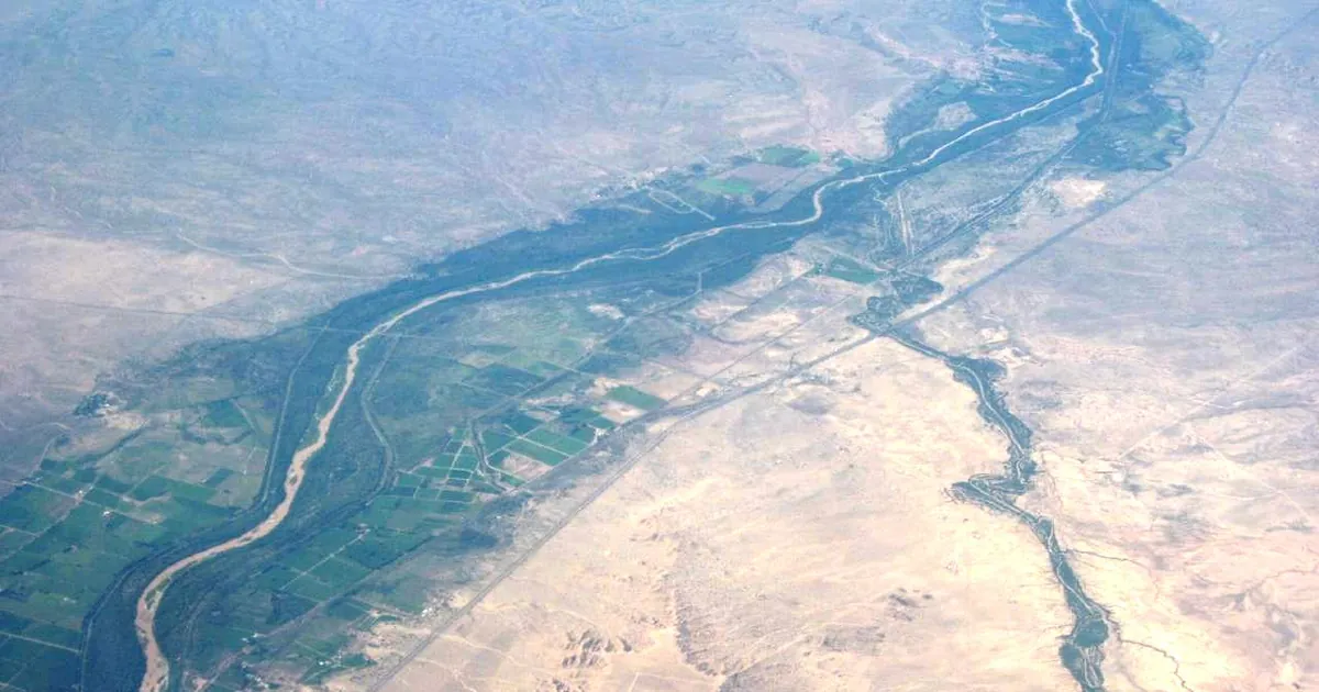
The Weather Beat, Tuesday, October 27, 2026.
Key points
- The Rio Puerco near Bernardo, New Mexico, never reached the 25.3 feet forecast for just after midnight. Its highest reading was the 24.3 feet from Monday afternoon. By 11 a.m. MDT Tuesday it was down to 20.4 feet, and Albuquerque expects a smaller second rise Wednesday morning.
- On the San Juan, Salt Lake City's wording came closer than Grand Junction's number. Bluff, Utah, peaked at 26.2 feet, not the 31.0 feet forecast, and Grand Junction cancelled its warning at 6:01 a.m. MDT Tuesday.
- Two rivers are still rising toward old marks. The Purgatoire near Las Animas, Colorado, is forecast to crest at 10.2 feet Wednesday morning, level with May 31, 1995. The Rio Chama below Chamita, New Mexico, was forecast Tuesday to reach 6.9 feet, level with June 13, 1991.
The two crests, checked
Last night's story ended with two numbers for the reader to check. The answers came in overnight, and in both cases the river did less than the biggest forecast said.
The first was the Rio Puerco, the wash that joins the Rio Grande south of Belen. At 4:47 p.m. MDT Monday, Albuquerque expected 25.3 feet just after midnight. Two and a half hours later, the 7:14 p.m. product had dropped that figure. It said the river read 24.1 feet at 6 p.m. and would "gradually fall into minor flood stage early Tuesday morning." Tuesday's 11:47 a.m. product closes the question: the highest stage in the 24 hours ending at 11 a.m. was 24.3 feet, the same reading as Monday afternoon. The river read 20.4 feet at 11 a.m., and the warning was lowered from moderate to minor. A second rise is still coming, to 21.4 feet Wednesday morning, before the river drops below flood stage Thursday morning. At 19.5 feet the warning says the water "will begin to threaten several homes and structures in the village of San Francisco between Interstate 25 and the Rio Grande."
The products do not agree on how this compares with the past. On Monday the gauge showed "No available flood history." On Tuesday it lists a previous crest of 19.5 feet on August 10, 2006 and "a similar crest on 10/03 of this current month." Both are quoted here as each product gave them.
The second check was the San Juan at Bluff. Grand Junction had raised its crest forecast to 31.0 feet on Monday morning, while Salt Lake City said only "near to slightly above moderate flood stage." Grand Junction's 11:07 p.m. product settled it: the highest stage in the 24 hours ending at 10:30 p.m. was 26.2 feet, and the river was down to 23.9 feet and falling. Salt Lake City's 3:55 a.m. update said the river near Bluff "showed a crest near moderate flood stage late Monday night into early Tuesday morning." Grand Junction cancelled its warning at 6:01 a.m. The mark that never came into play is still the one the product listed all week, 32.0 feet on September 10, 1927.
| River point | Office | Forecast the reader was given | What the product later showed | Latest in the product | Flood stage | Previous crest in the product | Issued |
|---|---|---|---|---|---|---|---|
| Rio Puerco near Bernardo NM | Albuquerque | 25.3 ft just after midnight (4:47 p.m. MDT Mon) | 24 h max 24.3 ft ending 11 a.m. Tue | 20.4 ft at 11 a.m. Tue; 21.4 ft Wed morning; below flood stage Thu morning | 19.5 ft | 19.5 ft, 08/10/2006, and "a similar crest on 10/03" (Tue); "No available flood history" (Mon) | 11:47 a.m. MDT Tue |
| San Juan River near Bluff UT | Grand Junction | 31.0 ft late afternoon (8:29 a.m. MDT Mon) | 24 h max 26.2 ft ending 10:30 p.m. Mon | 23.9 ft at 10:30 p.m. Mon; warning cancelled 6:01 a.m. Tue | not quoted | 32.0 ft, 09/10/1927 | 11:07 p.m. MDT Mon |
| San Juan River below Bluff UT | Salt Lake City | "near to slightly above moderate flood stage" (4:18 p.m. MDT Mon) | "a crest near moderate flood stage late Monday night into early Tuesday morning" | threat to Lake Powell through late Tuesday morning | not given | not given | 3:55 a.m. MDT Tue |
*Source: NWS river Flood Warnings on api.weather.gov, active and cancelled issues, read at 00:10Z to 00:15Z October 28. Every stage, time and previous crest is the product's own figure as of its issue time.*
Still rising
In southeastern Colorado, Pueblo's warning for the Purgatoire River near Las Animas, issued at 9:07 a.m. MDT Tuesday, put the river at 8.6 feet at 8:15 a.m. Flood stage is 9.0 feet. The warning expects the river to go above flood stage Tuesday afternoon and crest at 10.2 feet Wednesday morning. That is level with the previous crest the product lists, 10.2 feet on May 31, 1995. At 9.0 feet, the product says, "Minor agricultural flooding occurs into low lying areas along the river." The comparison has moved before. Pueblo's 6:50 a.m. product forecast 10.5 feet and listed a previous crest of 10.5 feet on August 19, 2004.
In northern New Mexico, Albuquerque's 11:53 a.m. warning for the Rio Chama below Chamita put the river at 6.6 feet at 11 a.m., with a crest of 6.9 feet expected Tuesday afternoon. That matches the 6.9 feet of June 13, 1991 that this product lists. Monday's issues compared the Chamita gauge with 7.3 feet in 1984, 6.7 feet in 1995 and 6.5 feet in 2006. In the San Luis Valley, Pueblo's 5:27 p.m. warning said water levels stayed high on the Conejos River near Manassa, with "widespread inundation of agriculture fields, wetlands, and other low-lying areas." The Rio Grande at Alamosa, last night's tie with 1948, dropped out of the warnings when Pueblo cancelled that product at 10:02 a.m. Tuesday.
| River point | Office | Latest in the product | Flood stage | Forecast | Previous crest in the product | Issued |
|---|---|---|---|---|---|---|
| Purgatoire River near Las Animas CO | Pueblo | 8.6 ft at 8:15 a.m. Tue | 9.0 ft | crest 10.2 ft Wed morning; below flood stage Wed afternoon | 10.2 ft, 05/31/1995 | 9:07 a.m. MDT Tue |
| Rio Chama below Chamita NM | Albuquerque | 6.6 ft at 11 a.m. Tue; 24 h max 6.7 ft | 6.0 ft | crest 6.9 ft Tue afternoon | 6.9 ft, 06/13/1991 | 11:53 a.m. MDT Tue |
| Conejos River and Rio Grande, San Luis Valley CO | Pueblo | "Flooding was still occurring" at 5:26 p.m. | not given | until 7:45 p.m. MDT Tue | not given | 5:27 p.m. MDT Tue |
*Source: NWS products on api.weather.gov, read at 00:10Z October 28.*
This evening, officially
The rain fell in the south again. At 5:25 p.m. MDT, Albuquerque issued a Flash Flood Warning for southeastern Lincoln and western Chaves counties, New Mexico, in force until 7:15 p.m. MDT. Radar estimated 1 to 3.75 inches had fallen, mainly over rural areas. Earlier that afternoon, the Storm Prediction Center's Day 1 outlook had a Marginal risk of isolated severe thunderstorms over a small part of southeast New Mexico and Far West Texas.
*Source: NWS Albuquerque Flash Flood Warning and the SPC Day 1 summary as printed by the house wire, read at 00:06Z October 28.*
What the reader can check
Two rivers have forecasts that match their old marks to the tenth of a foot: the Purgatoire at 10.2 feet against 1995, and the Rio Chama at 6.9 feet against 1991. This week the Rio Puerco and the San Juan both came in under their highest forecasts. Wednesday's products will show whether these two do the same. The Weather School page on why forecasts go wrong explains why a crest forecast can move a foot or more between issues.
This is a summary, not emergency information. For live warnings see weather.gov and your local officials.
The rock's live forecast for the places in this story
More from the Weather Beat
More from the Journal


Follow the Journal: RSS · get it by email