THE WEATHER BEAT · OCT 27
Florida's coastal flood watches become warnings from Nassau to Miami-Dade, and the Keys get major saltwater flooding
NWS Key West upgraded to a Coastal Flood Warning for major saltwater flooding at 3:33 p.m. EDT; warnings now cover the whole Atlantic coast, through.


Key points
- Every Coastal Flood Watch and Advisory along Florida's Atlantic coast is now a Coastal Flood Warning, from Coastal Nassau County at the Georgia line down to Coastal Miami-Dade.
- At 3:33 p.m. EDT, NWS Key West issued a Coastal Flood Warning for the Upper, Middle and Lower Keys calling for "Major saltwater flooding" through Wednesday.
- The northeast coast warnings run until 2 a.m. EDT Friday. The Miami warnings run until 8 p.m. EDT Wednesday.
Yesterday into today
Five days ago, Florida's Atlantic coast had a range of products: watches near Jacksonville, advisories from Palm Beach to Miami-Dade, and an advisory for the Upper and Middle Keys. The northeast wind those products were built around has kept blowing. Overnight and through this afternoon, each office raised its product one level.
NWS Miami went first, at 1:22 a.m. EDT. It put Coastal Palm Beach, Coastal Broward and Coastal Miami-Dade under a Coastal Flood Warning that says "significant coastal flooding expected." Its 3:41 p.m. discussion put it more plainly: "Major coastal flooding is expected with each high tide cycle over the next couple of days. Inundated roadways will be likely for coastal areas."
NWS Melbourne followed at 2:26 a.m. with a warning from Coastal Volusia through Brevard, Indian River and St. Lucie to Coastal Martin. NWS Jacksonville issued its warnings at 3:33 a.m. for the beaches from Nassau to St. Johns and for the St. Johns River basin inland. Jacksonville's discussion expects "Extended Duration of Moderate Tidal Flooding within the St. Johns River Basin."
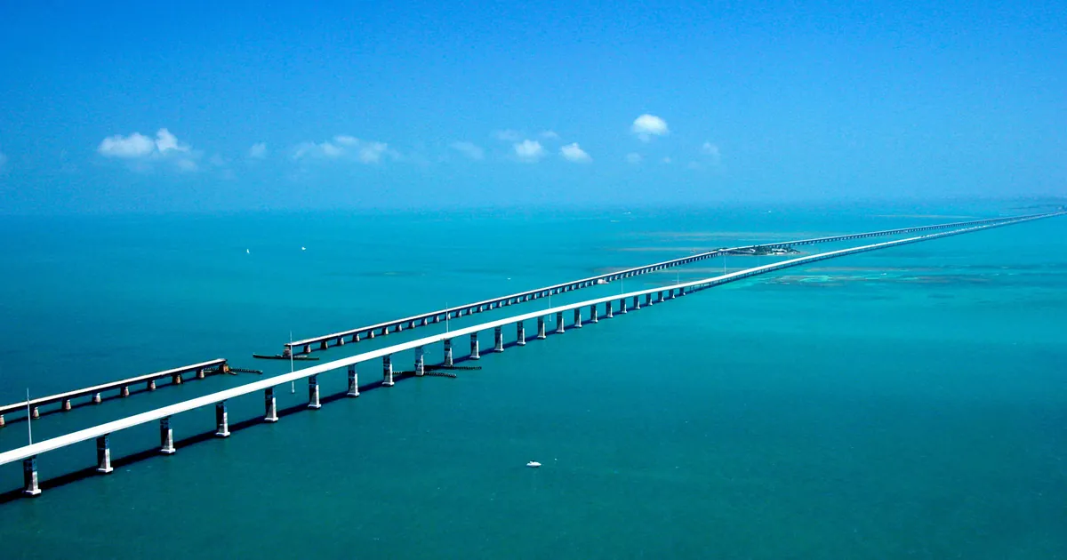
The Keys came last and highest. At 3:33 p.m., NWS Key West upgraded to a Coastal Flood Warning for "Major saltwater flooding," with relief mostly at low tide in the Lower and Middle Keys and "little relief outside of high tide in the Upper Keys." In its 2:02 p.m. discussion, the office expected the flooding to "gradually decrease later this week, but receding rates may be slow, especially in the Upper Keys." The Keys are strung together by one road, the Overseas Highway. Its Seven Mile Bridge west of Marathon is the longest stretch of open water on it.
The products do not all use the same word for the same coast. Melbourne's warning says "significant coastal flooding," while its own 2:50 p.m. discussion says "minor to moderate coastal flooding." Both are printed below as issued.
| Product | Office | Area | Wording | Issued | Until |
|---|---|---|---|---|---|
| Coastal Flood Warning | Key West | Upper, Middle and Lower Keys | Major saltwater flooding | 3:33 p.m. EDT Tue | through Wednesday (product valid to 5 a.m. EDT Wed) |
| Coastal Flood Warning | Miami | Coastal Palm Beach | significant coastal flooding; surf 8 to 13 ft | 1:22 a.m. EDT Tue | 8 p.m. EDT Wed |
| Coastal Flood Warning | Miami | Coastal Broward, Coastal Miami-Dade | significant coastal flooding | 1:22 a.m. EDT Tue | 8 p.m. EDT Wed |
| Coastal Flood Warning | Melbourne | Coastal Volusia, Brevard (mainland and barrier islands), Coastal Indian River, Coastal St. Lucie, Coastal Martin | significant coastal flooding; surf 7 to 11 ft | 2:26 a.m. EDT Tue | 2 a.m. EDT Fri |
| Coastal Flood Warning | Jacksonville | Coastal Nassau, Coastal Duval, Coastal Flagler, Coastal St. Johns | moderate flooding at high tide; surf 7 to 10 ft | 3:33 a.m. EDT Tue | 2 a.m. EDT Fri |
| Coastal Flood Warning | Jacksonville | St. Johns River basin: Inland Flagler, Eastern Clay, Eastern Putnam, Trout River, South Central Duval, Western St. Johns | moderate flooding at high tide | 3:33 a.m. EDT Tue | 2 a.m. EDT Fri |
| Flood Warning | Melbourne | St. Johns River near Astor and near Deland (Lake, Volusia) | moderate at Astor, minor forecast at Deland | 10:04 a.m. EDT Tue | Astor until further notice; Deland 8 p.m. EDT Wed |
*Source: NWS alerts at api.weather.gov as of 3:50 p.m. EDT October 27; Area Forecast Discussions from NWS Key West (2:02 p.m. EDT), Miami (key messages 3:41 p.m. EDT), Melbourne (2:50 p.m. EDT) and Jacksonville (12:25 p.m. EDT).*
Today, officially
Each discussion links the high water to the same pattern. NWS Key West describes "a tight pressure gradient between high pressure over the Eastern Seaboard and a low pressure system near the Bahamas." The office expects breezes to "abruptly slacken" from east to west on Wednesday as the low slides toward the Keys, then into the central Gulf, where it weakens later this week. Miami expects gusts over 35 mph possible through Tuesday night and Atlantic seas of 10 to 14 feet. Melbourne expects rain bands with locally heavy rain near the coast tonight and Wednesday. Jacksonville's discussion keeps a high risk of rip currents at its beaches through the weekend.
All four offices give the same advice: "If travel is required, do not drive around barricades or through water of unknown depth."
What the reader can check
The warnings come with their own end times, so you can check them against what happens. If Key West is right, the wind should drop off across the Keys on Wednesday, while the water in the Upper Keys stays high longer. On Friday morning, check whether the Jacksonville and Melbourne warnings ended at 2 a.m. as written, or were extended. Our Weather School lesson on watches, warnings and advisories covers the step this coast took overnight, from a watch to a warning.
This is a summary of official warnings, not emergency information. For live warnings see weather.gov and your local officials.
The rock's live forecast for the places in this story
More from the Weather Beat
More from the Journal
 THE WEATHER BEAT
The Rio Puerco heads for its highest level since 1944 near Bernardo, New Mexico, as the San Juan crest reaches Bluff
OCT 25
 THE WEATHER BEAT
Five years ago this week, the Sierra took 10.4 inches of rain in a day at Blue Canyon, one of 25 wettest-day records
OCT 23
 EXPLAINERS
Why Is the Sky Blue?
AUG 20
Follow the Journal: RSS · get it by email