THE WEATHER BEAT · SEP 22
The tidal flooding went up the bay Tuesday afternoon, and Annapolis is on the list at 3.5 feet
NWS Baltimore Washington posted five coastal flood advisories and three watches at 2:53 p.m. Tuesday, from Annapolis to the Potomac at Dahlgren.

Key points
- At 2:53 p.m. EDT Tuesday, NWS Baltimore MD/Washington DC posted five coastal flood advisories and three coastal flood watches, its first of this event, for Anne Arundel, Calvert, Charles, King George, St. Marys, Arlington and the City of Alexandria.
- The office states the water in feet of inundation above ground level: up to one foot on the Calvert shoreline, around one and a half feet at Anne Arundel and Alexandria, two to two and a half feet in St. Marys, and two to three feet along the Charles and King George shore until 2 a.m. EDT Friday.
- Its 7:36 p.m. EDT discussion gives the reason as persistent onshore flow and high astronomical tides near a full moon, and says the office expects some of those watches to become warnings later tonight or early Wednesday.

Yesterday and today: the water went up the bay
For two days this desk has written about the same coastal low from the ocean side, where the gale warnings and the coastal flood warnings are. Tuesday afternoon the story moved inland, up the Chesapeake and up the Potomac, and it arrived at the towns that keep their tide tables on the wall.
NWS Baltimore MD/Washington DC sent eight coastal products in one package at 2:53 p.m. EDT. That office had none of either earlier in the day. The numbers it wrote are small next to the two to four feet the Outer Banks products carry, and they are aimed at places where a foot and a half of water is a known quantity with a known address.
What makes these products worth reading is that they do not talk about a hazard class. They talk about a stage and what is under water at that stage. At 3.5 feet, the office writes, water reaches the floor of the Maritime Museum in Annapolis, begins to cover Bowyer Road on the Naval Academy campus, and floods numerous businesses on Dock Street along with the City Dock parking lot. At 3.0 feet it expects water in backyards near 9th Street in North Beach. At 3.5 feet in St. Marys it puts water over roads on Saint George Island and into marinas. In Alexandria it says water is expected to approach the curb near King Street and Strand Street. The stage numbers are printed without a datum, so they are copied here exactly as the office wrote them.
The timing is not one high tide. The advisories run to different hours by county, the longest to 2 a.m. EDT Friday at Charles and King George, and the watches that follow them run into Friday morning and Friday midday. The office explains why in its evening discussion: "Water levels will continue to rise through at least Thursday due to persistent onshore flow and high astronomical tides from a near Full Moon cycle." It adds that the watches have been extended in time and one is new for the City of Alexandria, "due to the expected long duration event of coastal flooding," and then the sentence a reader should keep: "Expect some watches to be converted to warnings later tonight or early Wednesday morning."
Away from the water, the same office's first key message is about a different kind of week. "Damp and dreary conditions continue through Wednesday afternoon with drier weather returning Thursday," it reads, with a stalled boundary on the Virginia and North Carolina border sending showers north in ripples. One storm, two ordinary things.
The upper bay and the Potomac, as issued
All eight products sent 2:53 p.m. EDT 22 September 2026 by NWS Baltimore MD/Washington DC.
| Zone | Product | Inundation above ground level | Through |
|---|---|---|---|
| Anne Arundel | Advisory | around 1.5 ft | midnight EDT Wednesday night |
| Anne Arundel | Watch | 2 to 2.5 ft possible | late Wednesday night to late Thursday night |
| Calvert | Advisory | up to 1 ft | 2 p.m. EDT Thursday |
| Charles, King George | Advisory | 2 to 3 ft | 2 a.m. EDT Friday |
| St. Marys | Advisory | 2 to 2.5 ft expected | 8 p.m. Tuesday to 8 p.m. EDT Wednesday |
| St. Marys | Watch | 2 to 2.5 ft possible | Wednesday evening to Friday morning |
| Arlington, Falls Church, Alexandria | Advisory | up to 1.5 ft expected | 2 p.m. EDT Thursday |
| Arlington, Falls Church, Alexandria | Watch | up to 0.5 ft possible | Thursday afternoon to Friday morning |
Tides two to two and a half feet above normal across the package, and up to three feet above normal in St. Marys.
Next high tides, by station, as printed in the products
| Station | Next high tides |
|---|---|
| Annapolis U.S. Naval Academy | 3:31 a.m. and 3:33 p.m. |
| Alexandria | 6:25 p.m. and 6:38 a.m. |
| Solomons Island | 12:22 a.m. and 12:30 p.m. |
| Chesapeake Beach | 2:08 a.m. and 2:24 p.m. |
| Coltons Point | 1:02 a.m. and 1:31 p.m. |
| Piney Point | 12:26 a.m. and 12:55 p.m. |
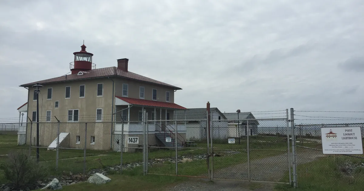
| Point Lookout | 11:27 p.m. and 11:43 a.m. |
| Goose Bay | 2:12 a.m. and 2:41 p.m. |
| Indian Head | 5:53 p.m. and 6:06 a.m. |
| Dahlgren | 12:57 a.m. and 1:19 p.m. |
Times as stated in the coastal flood products, Eastern Daylight Time.
The rest of the country, officially
As of the wire run at 1:37 a.m. UTC Wednesday, 449 alerts were active nationwide. Sixteen coastal flood warnings were in force, all of them on the mid-Atlantic and Outer Banks coast from three offices, and they have not grown since last evening. Twenty-four coastal flood advisories were active from four offices, of which five are the new Baltimore Washington set. Four coastal flood watches were active from two offices, three of them Baltimore Washington and one Anchorage.
The Storm Prediction Center's day one outlook states that no severe threat is forecast across the continental United States through daybreak Wednesday. Four flash flood warnings were active, in Colorado, Arizona and New Mexico, none of them connected to this storm. The National Hurricane Center carried three systems, Fay in the open Atlantic at 30 knots, Odalys at 60 knots and Polo at 150 knots in the eastern Pacific, and none of the three carries a United States watch or warning.
Two products this desk normally reads were unavailable again. The Storm Prediction Center's preliminary storm reports for yesterday and the Weather Prediction Center's day one excessive rainfall page both returned HTTP 403 to our wire tool, the tenth day running. That silence is a tool problem on this end and should not be read as a quiet night anywhere.
This is a summary of official warnings, not emergency information. For live warnings see weather.gov and your local officials.
The rock's live forecast for the places in this story
More from the Journal



Follow the Journal: RSS · get it by email